 Metadata catalogue
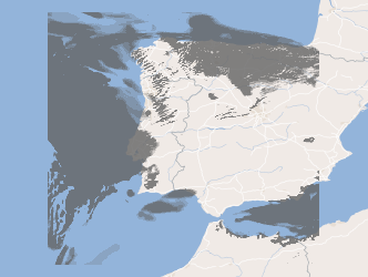
service-view
Type of resources
Available actions
INSPIRE themes
Keywords
Contact for the resource
Provided by
Years
Formats
Update frequencies
status
Service types
-

INSPIRE View Service provides access to mapped landslides in the Czech Republic.
-
Geoportal - Tiled view service (WMTS)
-

Three-hourly forecast maps of accumulated precipitation in mm/3h in the Iberian Peninsula, generated with the AROME model at 00UTC for the next 48 hours. This visualization service includes the individual layers and also a multidimensional layer that brings all of them together.
-
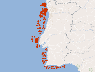
Web Map Visualization, INSPIRE (ISO19128-WMS 1.3.0) compliance, from monitoring campaigns that IPMA conducts regularly since 1996, of bivalve molluscs banks that occur in the oceanic coast of the South West zone, in order to assess their condition. These campaigns allow the adjustment of the fishing effort and fishing quotas to the state of resources in order to not compromise its sustainability. This resource shows the geographic distribution biomass The present resource presents the geographic distribution of the biomass index of White Clam (Spisula solida) in June 2014, European Hake (Merluccius merluccius) in September 2010 and Norway lobster (Nephrops norvegicus) in June 2010.
-

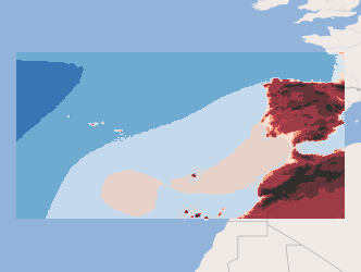
Three-hourly forecast maps of mean sea level pressure in Pascal in the Iberian Peninsula, generated with the AROME model at 12UTC for the next 48 hours. This visualization service includes the individual layers and also a multidimensional layer that brings all of them together.
-
WMS Three-hourly forecast of the surface pressure in the Atlantic region for the next 5 days (ECMWF)
Three-hourly forecast maps of surface pressure in Pascal in the Atlantic region, generated daily from ECMWF data, with forecasts every 3 hours of the current day from 00h to the next 120 hours. This visualization service includes the individual layers and also a multidimensional layer that brings all of them together.
-

Notifications concerning marine casualties and marine incidents occurring in the Portuguese territorial waters and in internal waters and with Portuguese flaged vessels in any part of the world.
-
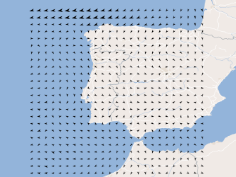
Three-hourly forecast maps of wind direction and intensity at 10 meters in the Iberian Peninsula, generated with the AROME model at 12UTC for the next 48 hours. This visualization service includes the individual layers and also a multidimensional layer that brings all of them together.
-
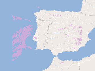
Three-hourly forecast maps of medium cloud cover in percentage in the Iberian Peninsula, generated with the AROME model at 12UTC for the next 48 hours. This visualization service includes the individual layers and also a multidimensional layer that brings all of them together.
-
Three-hourly forecast maps of total cloud cover in percentage in the Iberian Peninsula, generated with the AROME model at 00UTC for the next 48 hours. This visualization service includes the individual layers and also a multidimensional layer that brings all of them together.