 Metadata catalogue
irregular
Type of resources
Available actions
Topics
INSPIRE themes
Keywords
Contact for the resource
Provided by
Years
Formats
Representation types
Update frequencies
status
Service types
Scale
Resolution
-
The data comprise unprocessed raw data (level 0 data) containing image and spectral data acquired by scanning of drillcores at SGU. Level 0 is typically the level at which raw hyperspectral data is captured during the scanning campaign and the data has not been processed i.e. no data correction, normalization or band subsetting has been performed on this data. The cameras in the scanner cover the visible-near infrared and short-wave infrared (VNIR-SWIR) and the long-wave infrared (LWIR). The combination of different infrared wavelength ranges increases the mineral detection capability. Objective information about the mineralogical composition of the drillcores is fundamental basics for interpretation and modeling of the rock and the geological evolution.
-
The data comprise image and spectral data acquired by scanning of drillcores at SGU. The cameras in the scanner cover the visible, short wavelength and long wavelength parts of the infrared spectrum. The combination of different infrared wavelength ranges increases the mineral detection capability. Objective information about the mineralogical composition of the drillcores is fundamental basics for interpretation and modeling of the rock and the geological evolution. Level 2 is a processing level where data has been prepared for further spectral processing and product generation. Note that mineral identification is not included in level 2. This requires further processing and interpretation of the data.
-
WFS provides access to information related to the mineral occurrences, reserves and resources, associated commodities, geology, mines, mining activities, wastes and areas with mining potential of Portugal mainland. Moreover, this information is the result, improvement and adaptation of Portuguese data structure and vocabulary used in former European projects, Eurogeosource and Promine. This service was created in the framework of the Minerals4EU and ProSUM projects and it is harmonised according to the INSPIRE requirements.
-
World Heritage Sites are designated to meet the UK's commitments under the World Heritage Convention. The UK's ratification also extends to its Overseas Territories and Crown Dependencies. These sites are designated for their globally important cultural or natural interest and require appropriate management and protection measures. Natural properties may be terrestrial or marine areas.
-
Marine Consultation Areas are identified by Scottish Natural Heritage as deserving particular distinction in respect of the quality and sensitivity of the marine environment within them. Their selection encourages coastal communities and management bodies to be aware of marine conservation issues in the area.
-
LNRs are established in a variety of locations with very varied habitats and species. They must lie wholly within the area of jurisdiction of the local authority which declares them to be reserves. Prior to such declaration, the local authority must own or lease the site or obtain an agreement from the owner. LNRs are generally smaller than NNRs and closer to centres of population. They are frequently provided for the enjoyment and education of local people whose involvement in site management is encouraged.
-
Boundary of all Deer Management Groups in Scotland. For more information go to https://www.nature.scot/professional-advice/land-and-sea-management/managing-wildlife/managing-deer
-
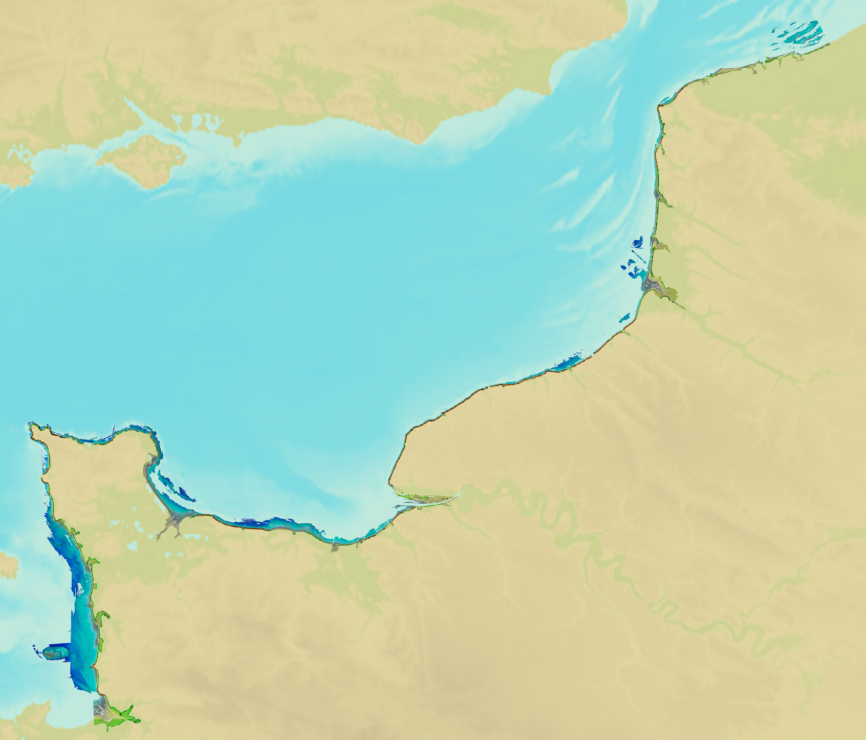
Litto3D® marine part is a unique and continuous land-sea database which can provide 3D models of the shape and location of french coastal terrain. Surveys are carried out by airborne lidar bathymetry over the sea side and airborne lidar topography over the land side up to 400m inland. Litto3D® marine part digital models are available in two formats: a set of 3D points and a qualified terrain mesh.
-
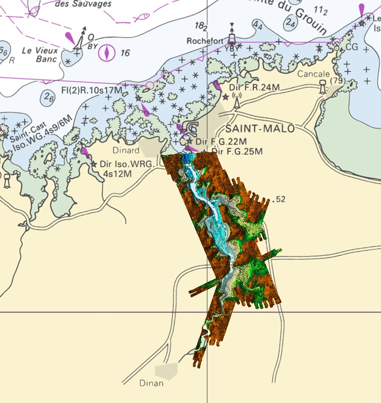
Lidar marine product is a unique and continuous land-sea database which can provide 3D models of the shape and location of french coastal terrain. Surveys are carried out by airborne lidar bathymetry over the sea side and airborne lidar topography over the land side up to 400m inland. This marine product is available in two formats: a set of 3D points and a qualified terrain mesh.
-
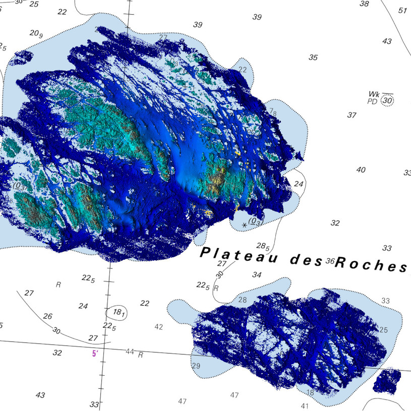
Lidar marine product is a unique and continuous land-sea database which can provide 3D models of the shape and location of french coastal terrain. Surveys are carried out by airborne lidar bathymetry over the sea side and airborne lidar topography over the land side up to 400m inland. This marine product is available in two formats: a set of 3D points and a qualified terrain mesh.