 Metadata catalogue
NetCDF
Type of resources
Available actions
Topics
INSPIRE themes
Keywords
Contact for the resource
Provided by
Years
Formats
Representation types
Update frequencies
status
Scale
Resolution
-
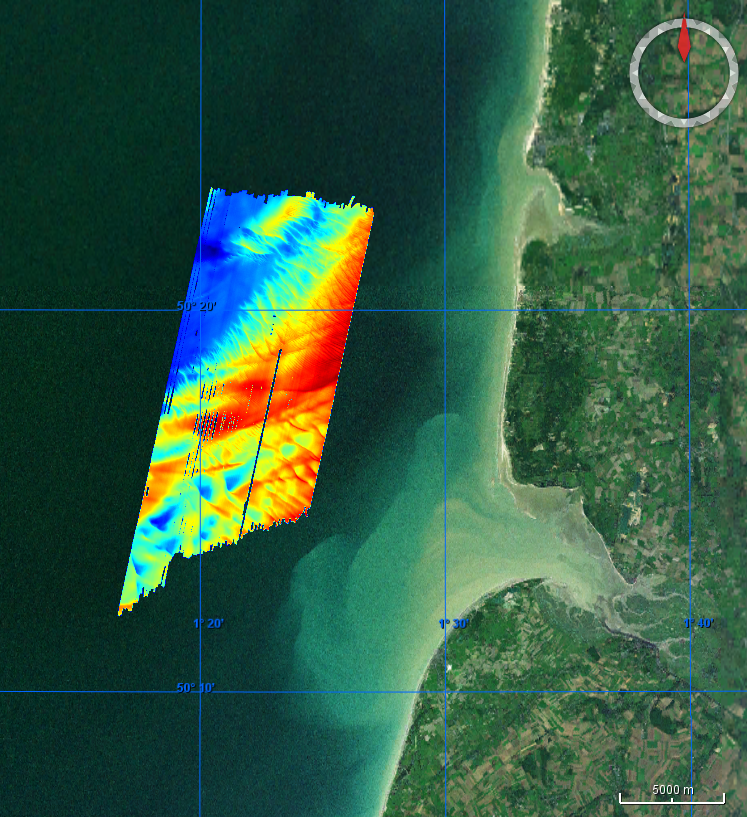
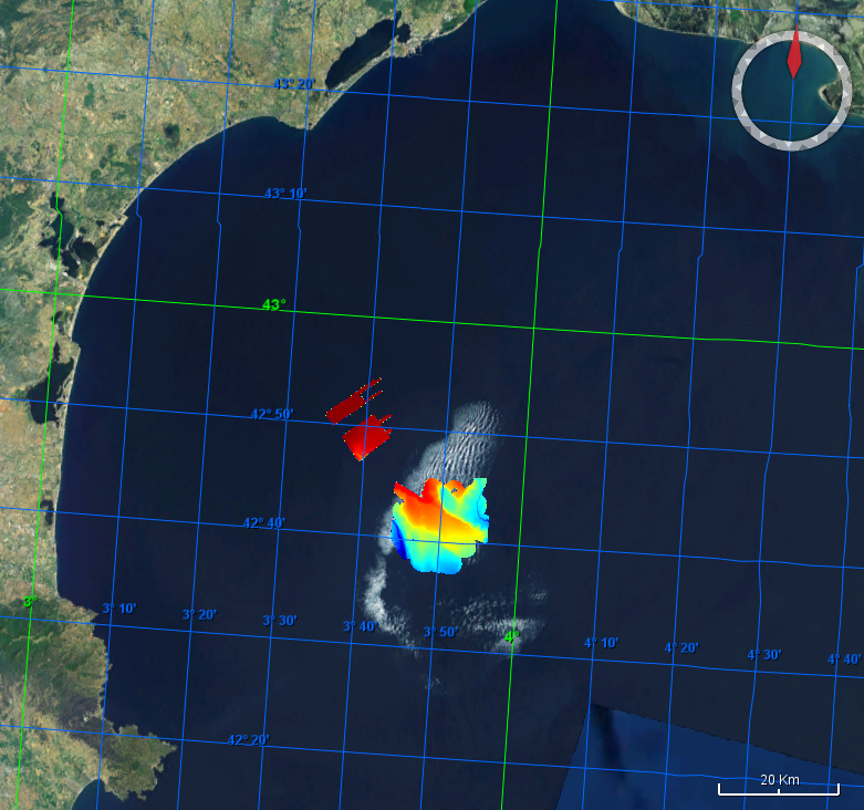
Multibeam data acquired during the RECOSOM survey. R/V Thalia, 2010, EM1000 multibeam system.
-
Grid processed for the purpose of the HR DTMs layer of EMODnet Bathymetry HRSM, October 2020
-
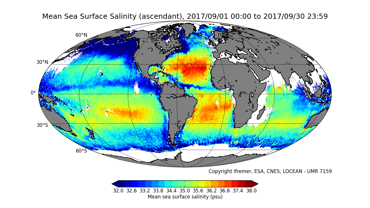
This product contains average 10 days & monthly salinity field based on L2P products, mixing ascending and descending orbits. ** This product is no longer available, see below **
-
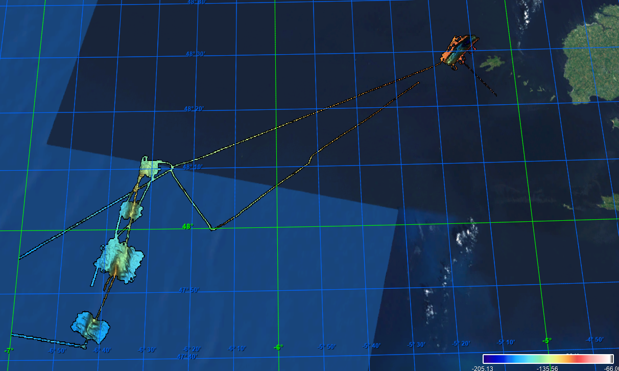
This dataset was collected during a survey within GEOSED Project by means of the MBES system Reson SeaBat8111 in the area named Punta Licosa in the Tyrrhenian Sea, Central Mediterranean. The dataset was acquired on the continental shelf in the depth range 10-150 meters.The Multibeam has 101 beams 1°x1° and an operational frequency of 100 kHz. A LandStar 12 channel DGPS system was used for ship positioning and a motion sensor TSS-DMS02-05 was used to provide corrections for attitude data. A Sound Velocity Sensor was installed near the transducers thus providing realtime sound speed for beam steering. A sound velocity profiler Reson SVP20 was lowered through the water column every 6–8 h to get the velocity profile required for the depth computation. The bathymetric data were processed using the PDS2000 software. Data de-spiking was carried out without the application of automatic filters in order to preserve data accuracy and resolution
-

The bathymetry data were collected from the online data source Norge Digitalt (http://www.norgedigitalt.no) established by the Norwegian Mapping Authority, the Hydrographic service (Statens Kartverk Sjø). The original resolution is about 50m on an irregular grid. IMR has interpolated the bathymetry to four 50m x 50m UTM-grids, and simple extrapolation is applied towards a high-resolution coast line, also provided by the Norwegian Mapping Authority.
-
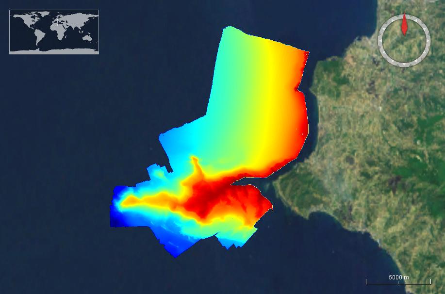
Multibeam data acquired during the Calimero 2 survey. R/V Le Suroit, 2005, EM300 multibeam system.
-
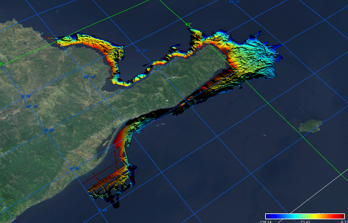
Grid processed in the framework of EMODnet Bathymetry HRSM, October 2020
-
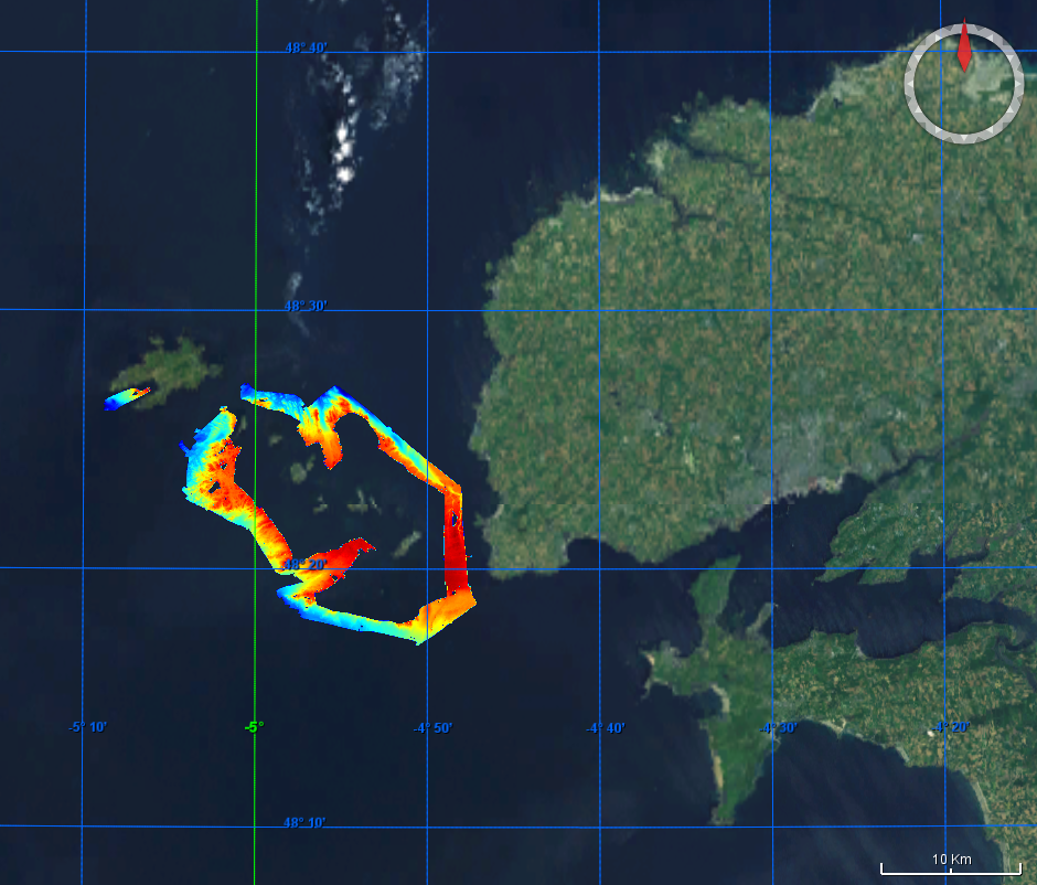
Multibeam data acquired during the Thalamacou survey. R/V Thalia, 2011, EM1000 multibeam system.
-
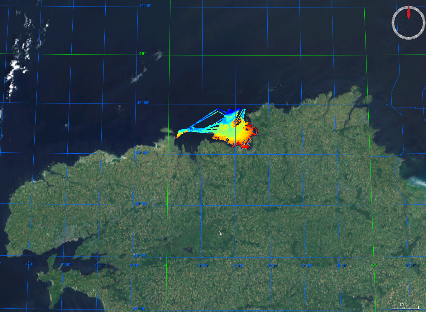
Multibeam data acquired during the Carbala and Carbala2 surveys, 2005 and 2006, multibeam acquisition.
-

Satellite-derived intertidal bathymetry for the Danish Wadden on the West coast of Denmark