 Metadata catalogue
2022
Type of resources
Available actions
Topics
INSPIRE themes
Keywords
Contact for the resource
Provided by
Years
Formats
Representation types
Update frequencies
status
Service types
Scale
Resolution
-
Harmonised WFS Download service for Maltese Agglomeration Maltese Zone and PAHs Zone According to the requirements of Directives 2008/50/EC and 2004/107/EC with respect to the minimum number of sampling points and the assessment regimes, the data set consists of two zones in the Maltese territory, the Air Monitoring Agglomeration and the Air Quality Monitoring Zone in which all main pollutants are being monitored. A third zone covering the monitoring of Polycyclic Aromatic Hydrocarbons (PAHs) is also included in the data set.
-
-
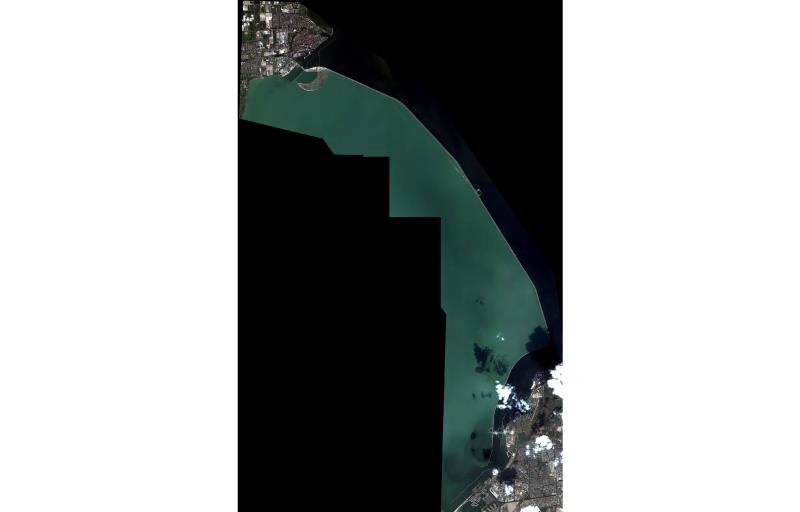
High resolution composite DTM based on multi beam surveys. All data acquired in the years 2014-2018.
-

Quaternary –age This web map service shows the chronostratigraphic age of geological units of the seafloor originated in the Quaternary period (i.e. 2,588 Ma from now until today). The data were compiled by BGR from the EMODnet geology partner organisations in the EMODnet Geology project phases II and III between 2009 and 2019. The scale varies between 20 000 and 2 500 000. Quaternary -lithology This web map service shows the rock type (lithology) of geological units of the seafloor originated in the Quaternary period (i.e. 2,588 Ma from now until today). The data were compiled by BGR from the EMODnet geology partner organisations in the EMODnet Geology project phases I, II and III between 2009 and 2019.
-
This composite Digital Terrain Model (cDTM) is a high resolution bathymetry dataset highlighting measurement of depth of water in the ocean. This cDTM covers the Celtic Sea off the coast of South West County Cork in Ireland. The EMODnet high resolution DTM covers bathymetry surveys completed between 2021 and 2022. Bathymetric data collected on board research vessels using multi-beam and single-beam echosounder instrumentation. Raw bathymetry processed within CARIS software to produce bathymetry products subsequently converted to NetCDF cDTM for EMODnet. Acquisition, processing and product delivery follows IHO standard s44 Edition 5. cDTM is composed of two (2) images “merged simply” using GLOBE software. INFOMAR (Integrated Mapping for the Sustainable Development of Ireland’s Marine Resource) is a twenty year programme to map the physical, chemical and biological features of Ireland’s seabed established in 2006. INFOMAR is funded by the Department of Communications, Climate Action and Environment (DCCAE), and delivered by joint management partners Geological Survey Ireland and the Marine Institute. The programme is the successor to the Irish National Seabed Survey (INSS) which ran between 1999 and 2005. INFOMAR concentrates on creating integrated mapping products related to the seabed.
-

Pre-Quaternary -age This web map service shows the chronostratigraphic age of geological units of the seafloor originated earlier than 2,588 Ma from now (pre-Quaternary). International Geological Map of Europe and Adjacent Areas (Asch, 2005). The scale varies between 25,000 and 5 000 000. The data were compiled by BGR from the EMODnet geology partner organisations in the EMODnet Geology project phases I, II and III between 2009 and 2019. Pre-Quaternary -lithology This web map service shows the rock type (lithology) of geological units of the seafloor originated earlier than 2,588 Ma from now (pre-Quaternary). International Geological Map of Europe and Adjacent Areas (Asch, 2005). The scale varies between 25 000 and 5 000 000. The data were compiled by BGR from the EMODnet geology partner organisations in the EMODnet Geology project phases I, II and III between 2009 and 2019. The scale varies between 25 000 and 5 000 000.
-
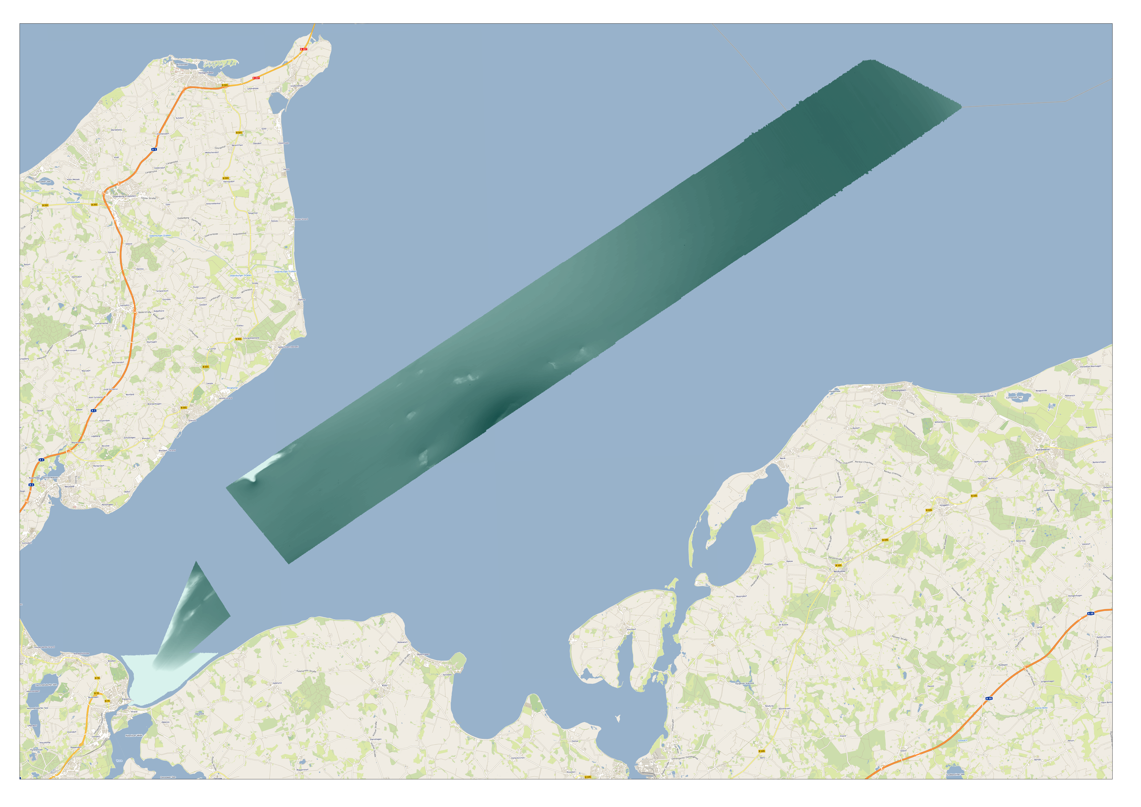
High resolution composite DTM based on multi beam surveys. All data acquired in the years 2013-2020.
-

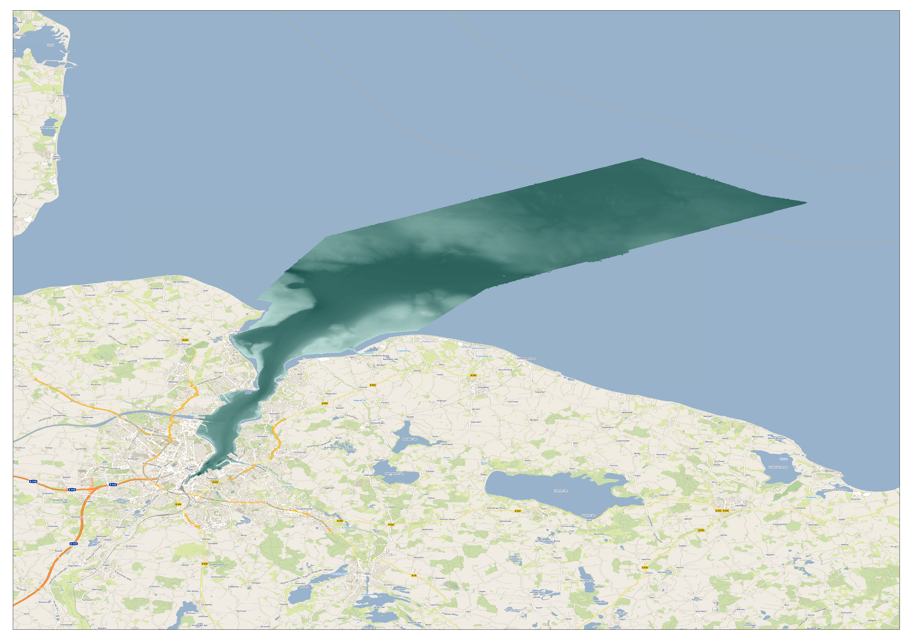
High resolution composite DTM based on multi beam surveys. All data acquired in the years 2017-2018.
-
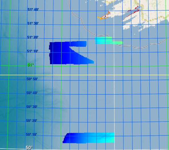
DTM based on multi beam surveys. All data acquired in the years 2014-2018.
-

DTM based on multi beam surveys. All data acquired in the years 2017-2018.