 Metadata catalogue
25000
Type of resources
Available actions
Topics
INSPIRE themes
Keywords
Contact for the resource
Provided by
Years
Formats
Representation types
Update frequencies
status
Scale
Resolution
-
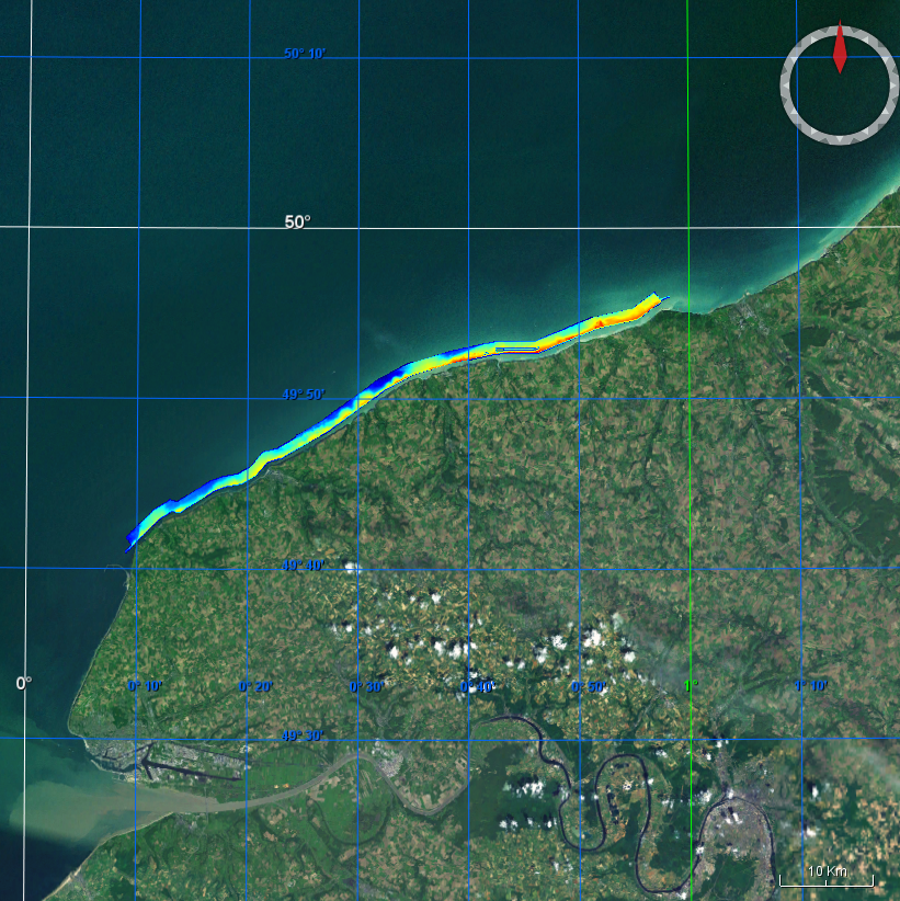
Database contains data from gamma-spectrometry survey. Gamma-ray spectrometry survey means measurement of natural radioactive isotopes concentration i.e. potassium 40K [%], uranium 328U and 235U [ppm], thorium 232Th [ppm]; simultaneously, total gamma-ray activity was registered. This survey started in 1976 and covered about 60 % of the territory.
-

Management plan of the Tejo Estuary Natural Reserve published by the RCM nº177/2008 of 24 November. Represents one of the map produced in the space planning third phase of the Plan, published at 1:25000 scale. Delimits space classes, depending on the dominant use and establishing operative units of planning and management. The use of this resource does not exempt the consultation of the official documents.
-
-

-

-

Qs - Modern beach sands (HOLOCENE).Qv - Valley fill (LATE PLEISTOCENE-HOLOCENE, TYRRHENIAN): Low angle subaerial fanglomerate cones, terra rossas, local clays and alluvium. Fanglomerates frequently are dominated by subangular carbonate lithoclast breccias and interpenetrative channels. Intercalated terra rossa palaeosols often contain rhizoid (root) fabrics and nodular caliche of varying ages but all post date valley cutting.Thickness 0-7m. Qb - Dunes and raised beach deposits (LATE PLEISTOCENE-HOLOCENE, TYRRHENIAN): Wind blown foraminiferal, marine mollusc and quartzarenitic grainstones. In Malta, the Marfa Point deposit contains rhizoid fabrics, and pulmonate gastropods of undiagnostic age. Terra rossa palaeosols are intercalated in some sections. The main deposits in Gozo are at Ramla Bay. Thickness 0-3m. Qt - Tufa and travertine deposits (? EARLY PLEISTOCENE): Friable, cream coloured lime mudstones, and wackestones with abundant plant remains, pulmonate and hydrobid gastropods. All deposits developed before termination of valley incision. The Fiddien Valley deposit near Rabat (Malta) pre-dates the terra rossa palaeosols but molluscan faunas are undiagnostic of age. Thickness 0-16m.
-

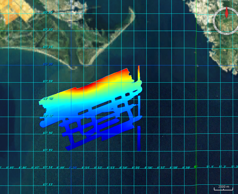
Systematic survey performed by ITS ARETUSA with Multibeam EchoSounder Simrad EM2040C
-
Multibeam data acquired during the PLA-HANO survey. R/V Thalia, 2006, EM1000 multibeam system.
-
Multibeam data acquired during the Rhosos survey. R/V Le Suroit, 2008, EM300 multibeam system.
-

The Fault theme contains information on faults and fault controlled synclines divided into threeclasses as follows:Fault Obs - Observed faults are indicated by solid lines. Downthrow direction indicated by bars and sense of relative movement indicated by arrows;Fault Inf - Inferred faults are indicated by dashed lines. Downthrow direction indicated by bars and sense of relative movement indicated by arrows;Fold Syncline - Fault controlled syncline axial trace.