Metadata catalogue
Deltares
Type of resources
Available actions
Topics
INSPIRE themes
Keywords
Contact for the resource
Provided by
Years
Formats
Representation types
Scale
Resolution
-
This product is a workflow and an example of how data from EMODnet Biology can be verified, checked and used for time series analyses in R. All zooplankton data from the Villefranche permanent zooplankton station were selected and analysed.
-
The use of ballast water is increasingly subjected to regulations because they are vectors for the spreading of invasive species. OSPAR and HELCOM have been working on a decision support tool and a harbour database to reduce unnecessary ballast water checks. In this analysis, we explore what EMODNET could offer to the efforts devoted to this decision support tool. This workflow demonstrates the use of the EMODnet Biology/EurOBIS database as a tool to check for false negatives in the harbour dataset. This is a workflow, rather than an end product. We hope that the workflow, documented at code level in this product, can be taken up and further extended by the authorities responsible for invasive species management.
-
This data product is an R Shiny application that discloses the data collected by the Institute of Oceanography and Fisheries (IZOR) in Croatia, in the Middle Adriatic (Skejic et al., 2015). A time series has been built of observations on the species composition of the plankton. The application shows the evolution over time of abundance of major groups of species, as well as the most frequent species (or other taxonomic units) in the dataset. There is also a multivariate representation based on a PCA of abundances of the most frequent species, which shows the seasonal (monthly) fluctuations and the long-term (yearly) trend, and the contribution of each individual species to the temporal evolution of the community.
-
A national scale map that shows yearly LTA potential recharge values (mm/year) calculated over the Netherlands. Values are averaged over the period 1981 to 2010
-

Satellite-derived intertidal bathymetry for the Danish Wadden on the West coast of Denmark
-

Satellite-derived intertidal bathymetry for the Tagus estuary near Lisbon Portugal
-
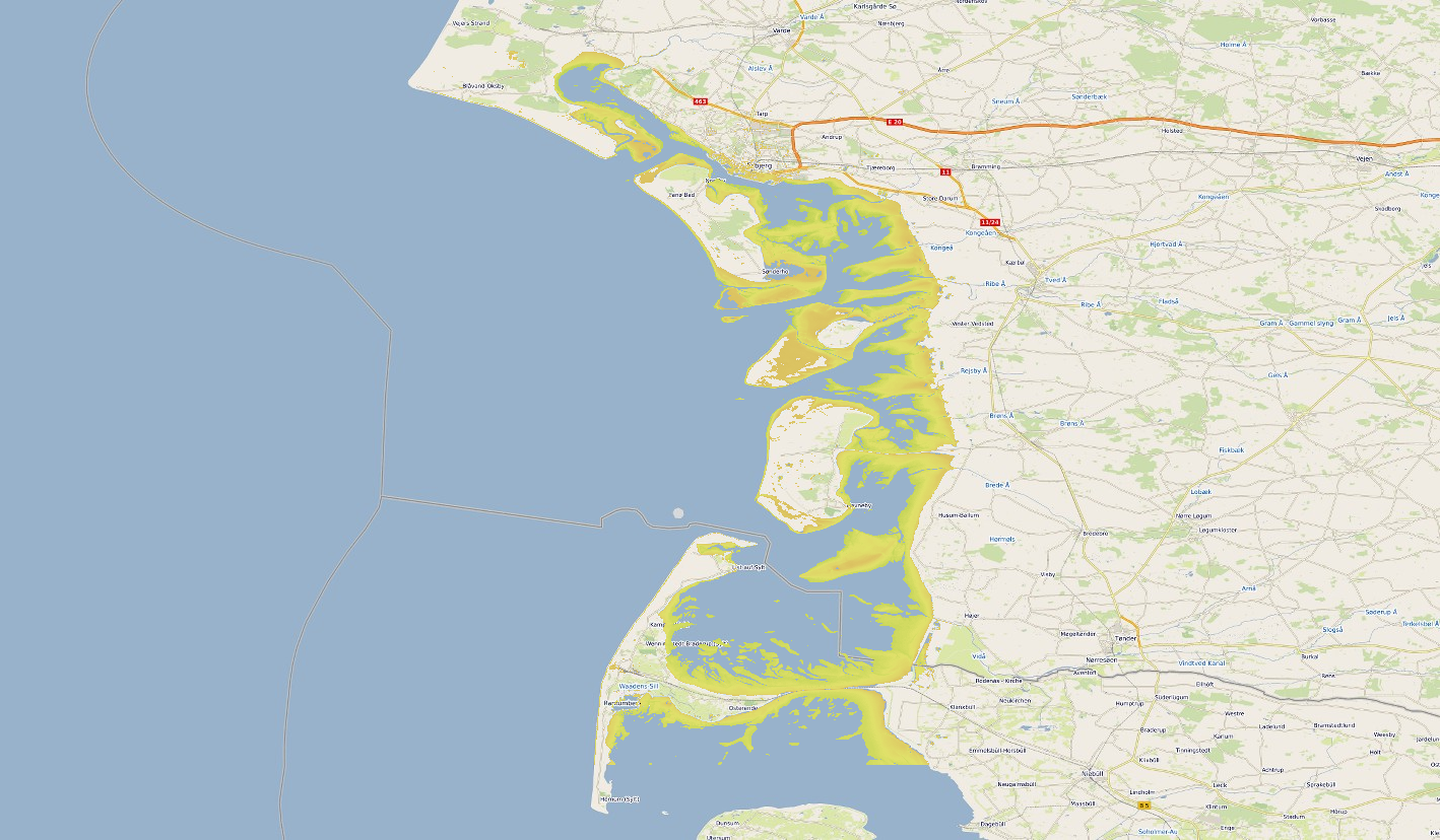
Satellite-derived intertidal bathymetry for the Danish Wadden on the West coast of Denmark
-
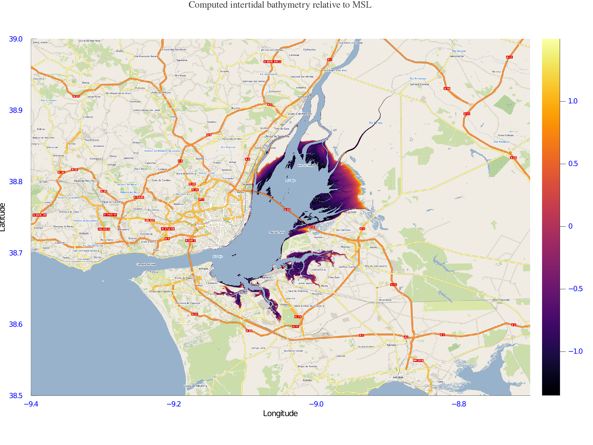
Satellite-derived intertidal bathymetry for the Tagus estuary near Lisbon Portugal
-

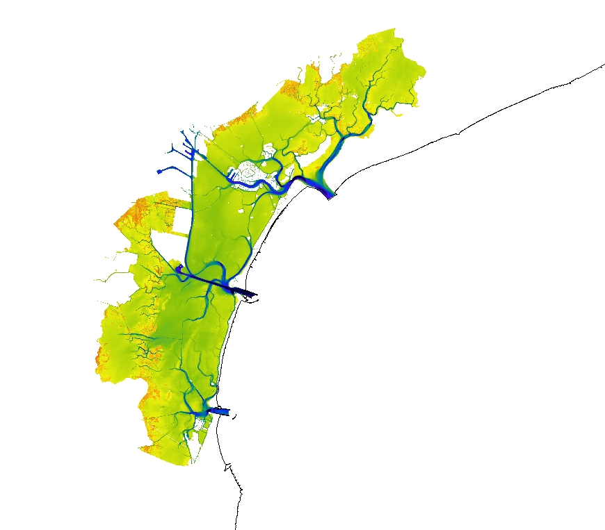
Satellite-derived bathymetry for the Venice Lagoon
-