 Metadata catalogue
50000
Type of resources
Available actions
Topics
INSPIRE themes
Keywords
Contact for the resource
Provided by
Years
Formats
Representation types
Update frequencies
status
Scale
Resolution
-
Dataset contains hydrogeological zones with attached basic informations to the extent given to edict of Ministry of Agriculture Decree no.391/2004 Coll., i.e. information about zone name, numerical identifier, river basin managers and territorial identification, additional data on natural characteristics. The basic natural characteristics of zone include geological unit, group of zones, lithology, stratigraphy of Cretaceous group of zones, type of Quarternary sediment in laden layer of zones, type of aquifer-saturation, the character of the collector, the average power of the collector, the character of the groundwater level, the type of permeability, the predominant mineralization of groundwater and predominant chemical type of groundwater.
-
The database contains selected mining engineering and operational data from the annual state statistical report Hor(MPO)1-01. Areas affected by mining, mining technically locked area, areas of remediation and reclamation where reclamation has been completed. Furthermore, the financial reserves for remediation, reclamation and mining damages. Hor(MPO)1-01 belongs to Individual data, it is possible to obtain data only in the summaries.
-
Location of polling places to be used for elections in PKC from 2017 onwards
-

Data extracted from the Hydrographic Office of the Polish Navy (HO) database. Cells in a 200m grid has been populated.
-
The approach to the affection of the submarine noise in the North Atlantic Marine Subdivision has been made for a 5' x 5' grid, being the noise source navigation. To do this, a semi-quantitative index has been developed that integrates the analysis of AIS data (merchant vessels) and VMS data (fishing ships). For both, cells have been selected according to the intensity of traffic effects based on the density of AIS and VMS signals in a month. In both cases, different intensity intervals have been established, and each case has been given a different weight. In addition, adjacent cells have been selected (classified into four ranges), giving them another way of importance depending on the proximity. The zero range coincides with the cells in which the signal density was recorded, while the first range corresponds to those cells limiting with the zero level, and so on. In Table 10 and Table 11 of the aforementioned document the applied values are indicated. The final result is the addition of all the weights in each cell, taking into account the maximum value for the bordering cells. The values range between 0 and 3.1, with the following levels of classification: Very High: > 2 / High: 1.71 - 2 / Medium: 0.41 - 1.7 / Low: 0.1 - 0, 4 / Very Low < 0.1
-

The Biologically Sensitive Area sets out the criteria and procedures for a system relating to the management of fishing effort in waters around Ireland that are considered biologically sensitive. A specific effort regime shall apply to the area enclosed by the coast of Ireland to the south of 53° 30' N and to the west of 07° 00' W and straight lines sequentially joining the following geographical coordinates: - a point on the coast of Ireland at latitude 53° 30; N, latitude 53° 30 N, longitude 12° 00 W, latitude 53° 00 N, longitude 12° 00 W, latitude 51° 00 N, longitude 11° 00 W, latitude 49° 30 N, longitude 11° 00 W and latitude 49° 30 N, longitude 07° 00 W. A point on the coast of Ireland at longitude 07° 00 W. An area to the South and West of Ireland has been identified as an area of high concentration of juvenile hake. This area has been made subject to special restrictions on the use of demersal gear. For the same conservation purpose it should also be subject to specific effort limitation requirements within the general system described above. A review of these requirements by December 2008 would allow the Council to reassess the situation. Council Regulation (EC) No 1954/2003 of 4 November 2003 on the management of the fishing effort relating to certain Community fishing areas and resources and modifying Regulation (EC) No 2847/93 and repealing Regulations (EC) No 685/95 and (EC) No 2027/95. The area covered by this designation includes the south coast of Ireland in the Celtic Sea from Waterford to Mizen Head and the south-west coast of Ireland in the North Atlantic Ocean from Mizen Head to Galway Bay. In 2003 the EU Commission established a Biologically Sensitive Area (BSA); off the south west of Ireland. Area designated via fisheries science research information. Area has been designated as a protected site for fishing effort monitoring. The Biologically Sensitive Area has been created by the European Council directive. Area 100% designated a protected site for biological sensitivity.
-
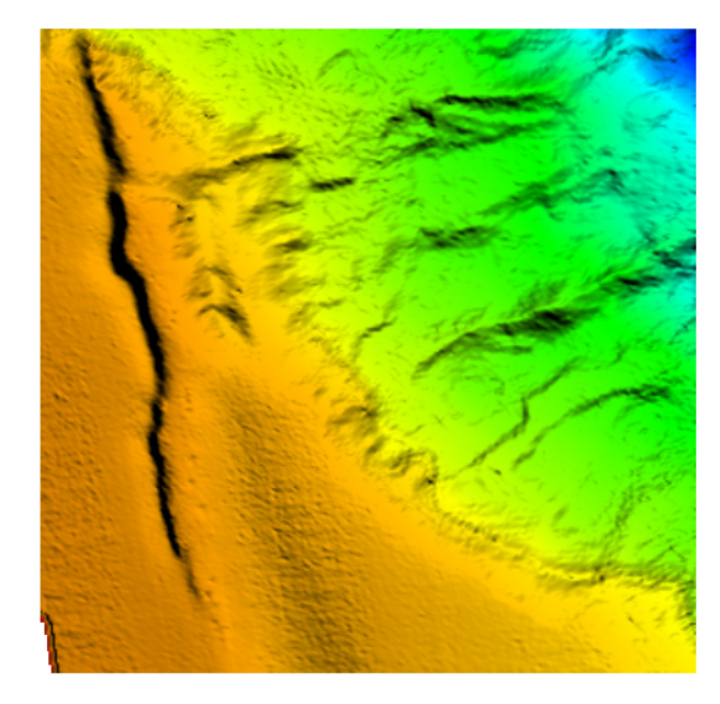
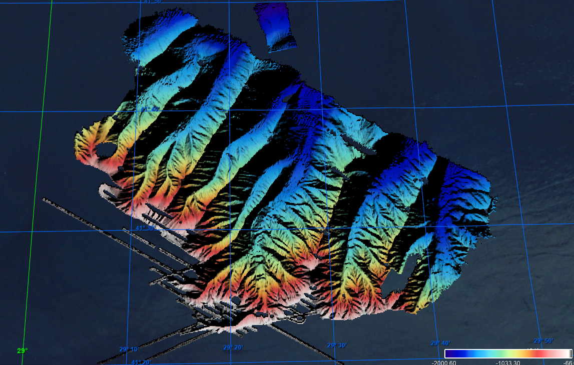
The data were acquired with a Simrad EM710 Multi Beam echosounder onboard the R/V Urania in order to cover the outer Malta Plateau and upper Malta Escarpment for a geological survey in the framework of EU FP7 project EUROFLEETS. The data were published in: Micallef, A., Georgiopoulou, A., Le Bas, T., Mountjoy, J.J., Huvenne, V., Lo Iacono, C., 2013. The Malta-Sicily Escarpment: Mass Movement dynamics in a sediment-undersupplied margin, in: Krastel, S., Berhmann, J.H., Volker, D., Stipp, M., Berndt, C., Urgeles, R., Chaytor, J.D., Huhn, K., Strasser, M., Harbitz, C.B. (Eds.), Submarine Mass Movements and Their Consequences. Springer International Publishing, Switzerland, pp. 317-328.
-
Grid processed for the purpose of the HR DTMs layer of EMODnet Bathymetry HRSM, October 2020
-
-