 Metadata catalogue
GML
Type of resources
Available actions
Topics
INSPIRE themes
Keywords
Contact for the resource
Provided by
Years
Formats
Representation types
Update frequencies
status
Service types
Scale
Resolution
-
The 1:500k lithostratigraphic map covering the whole of the Netherlands is available in this OGC WMS service for all uses - including commercial use subject to the conditions in the Access Constraints section. It is being served as a contribution to the OneGeology initiative (www.onegeology.org). Layers available for superficial geology are age and lithology. In this service these are attributed and coloured according to INSPIRE standards for age and lithology.
-
Harmonized geo-energy, mineral resource and area management data coming from various countries based on key economic and geological parameters
-
Location of properties based on the adress identifiers, usually the street name, house number and postcode.
-
Hydrographic elements, including river basins and sub-basins.
-

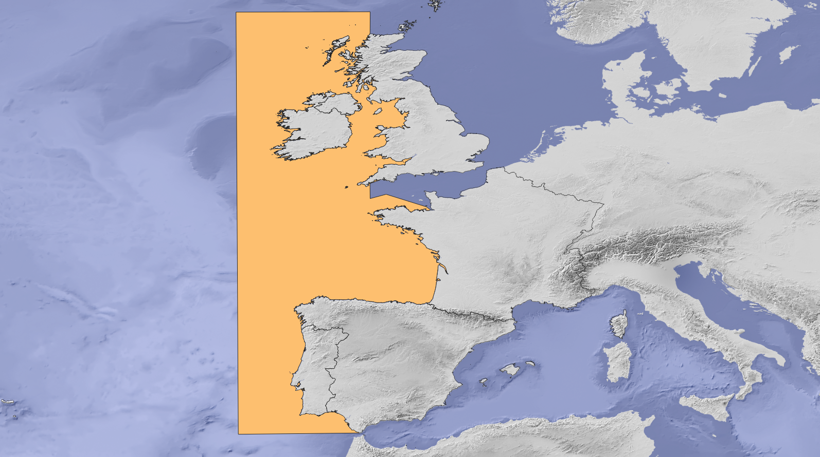
Study area of SIMCelt Project, composed of OSPAR zone 3 with an extension to Western Channel
-
Geographical location of buildings. Buildings are any structure permanently constructed or erected on its site, covered facilities, usable for the protection of humans, animals, things or the production of economic goods.
-
The study area of SIMAtlantic Project composed by Ospar III and IV regions
-
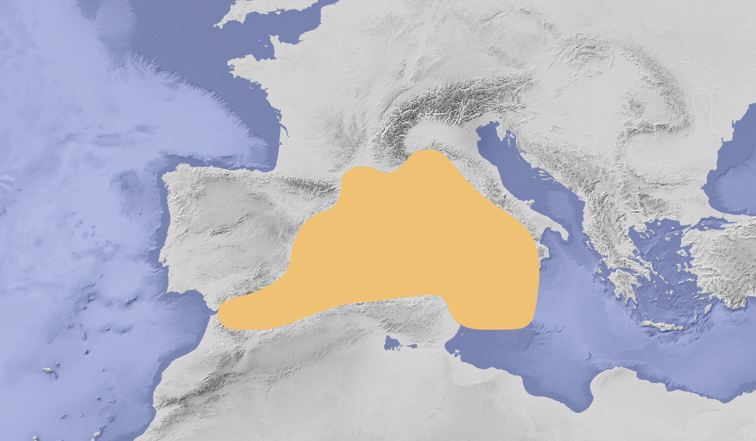
Study area of SIMWESTMED Project composed by FAO sub-area 37 including Malta waters
-

Serviço de Descarregamento (WFS 2.0) do tema Hidrografia - Águas Físicas conforme as especificações técnicas exigidas pela diretiva INSPIRE. Dados e serviço da responsabilidade da Direção Regional do Ambiente/Secretaria Regional da Energia, Ambiente e Turismo/Governo dos Açores. Fazem parte deste serviço as lagoas, linhas de água, bacias hidrográficas e açudes.
-

Serviço de Descarregamento (WFS 2.0) do tema Habitats e Biótopos da Região Autónoma dos Açores (RAA), conforme as especificações técnicas exigidas pela diretiva INSPIRE. Dados e serviço da responsabilidade da Direção Regional do Ambiente/Secretaria Regional da Energia, Ambiente e Turismo/Governo dos Açores.