 Metadata catalogue
GeoTIFF
Type of resources
Available actions
Topics
INSPIRE themes
Keywords
Contact for the resource
Provided by
Years
Formats
Representation types
Update frequencies
status
Service types
Scale
Resolution
-
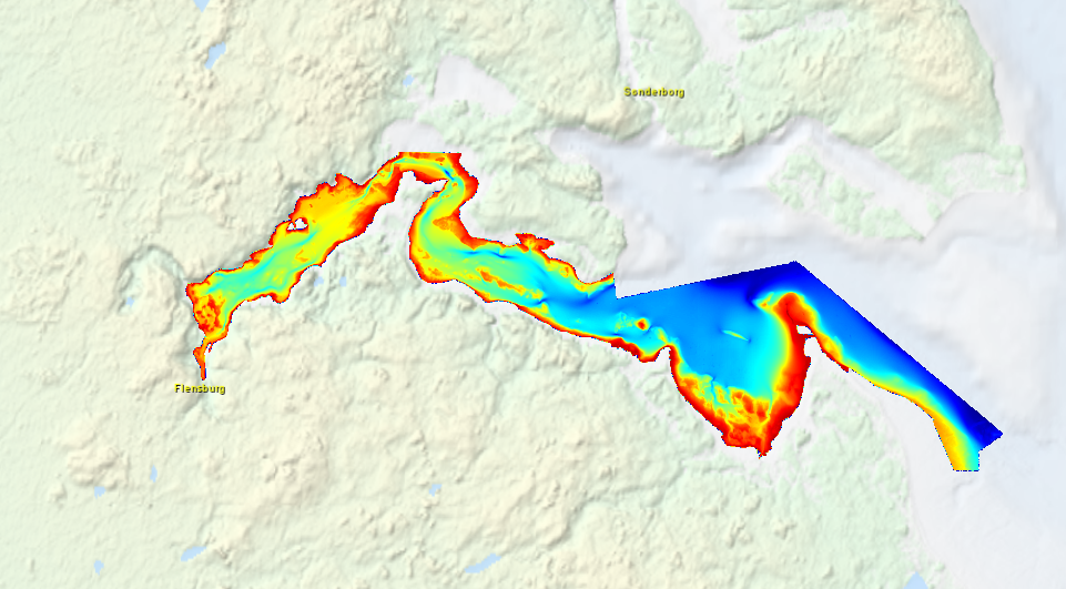
High resolution composite DTM based on multi beam surveys in Flensburg Bay. All data acquired in the years 2012-2013.
-
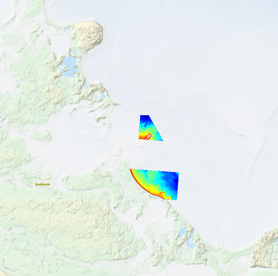
High resolution composite DTM based on multi beam surveys in German Bodden waters. All data acquired in 2016.
-

Subset of the Pléiades image that covers the northern part of the experimental station Paracou in French Guiana.
-

Subset of the image that covers the area around Saint Georges in French Guiana.
-

Subset of the image that covers the area around Saint Georges in French Guiana.
-

The image covers the site Rivière Grand Inini in the center of French Guiana.
-

Subset of the image that covers the experimental site Nouragues in French Guiana.
-

The image covers the experimental sites Counami, Paracou, Piste Saint Elii, Crique Passoura, Crique Plomb and Montagne Plomb in French Guiana.
-

Subset of the image that covers the experimental site Paracou in French Guiana.
-

Subset of the image that covers the experimental site Paracou in French Guiana.