 Metadata catalogue
tectonics
Type of resources
Available actions
Topics
INSPIRE themes
Keywords
Contact for the resource
Provided by
Years
Formats
Representation types
Update frequencies
status
Service types
Scale
-
Faults in Slovenia displayed in the HIKE European fault database.
-
Faults and nappe boundaries in Ukraine at scale 1:1.000.000
-
French Structural Map at national (1:1.000.000) and regional (1:50.000) scales
-
Inventory of principal faults, shear zones, etc. in Bavaria (w/o Alpine domain)
-
Faults, fault systems, lineaments and tectonic domains in Italy at scale 1.1.000.000; locally faults mapped at more detailed scale (up to 1:25.000) are added.
-
Faults, shearzones and nappe boundaries in Austria as they appear in the GeoERA HIKE European fault data base
-
Inventory of faults and tectonic boundaries in Denmark at various regional scales
-
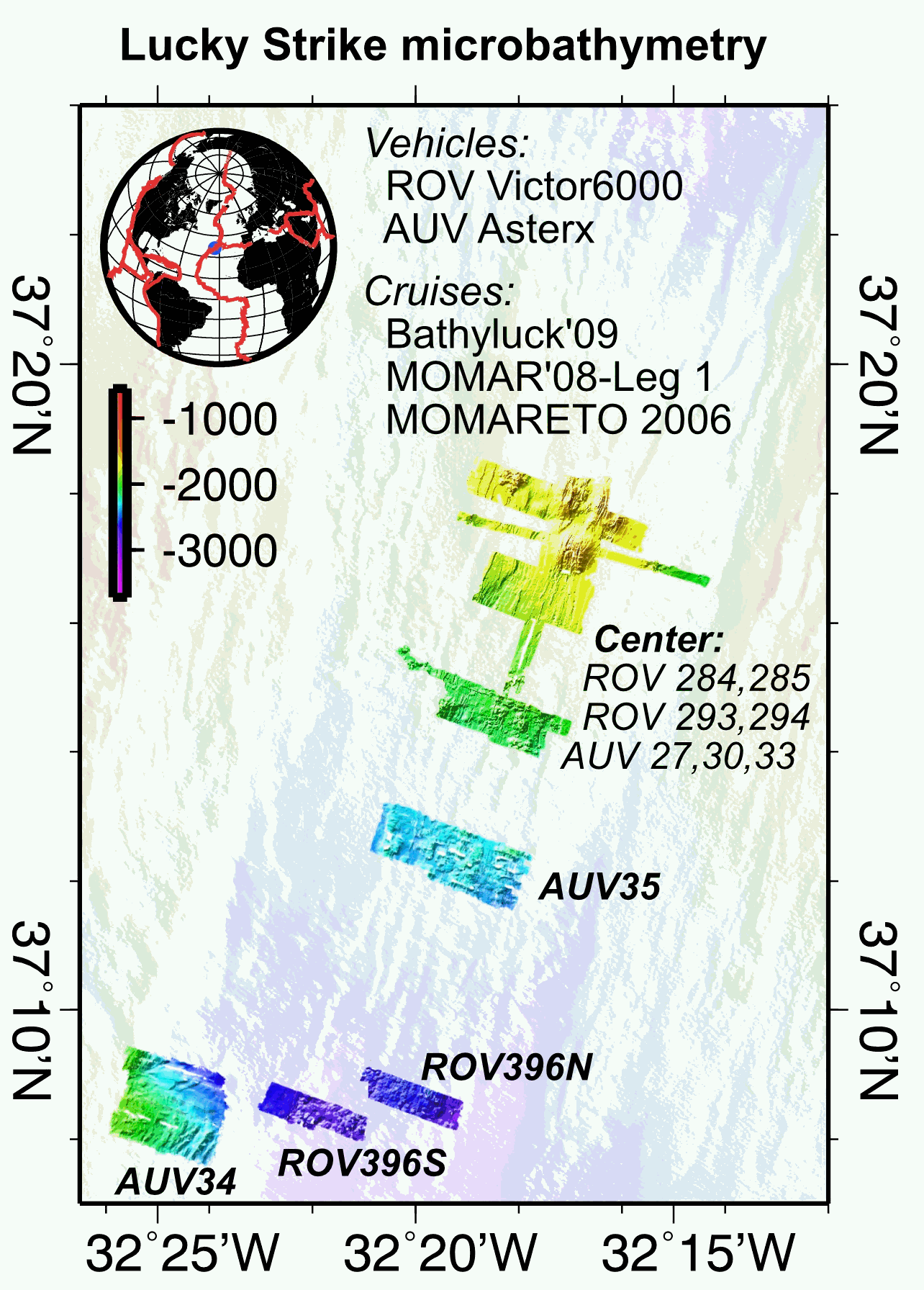
Multibeam near-bottom bathymetry from the Lucky Strike ridge segment along the Mid-Atlantic Ridge. The bathymetry data were acquired during AUV Asterx and ROV Victor6000 surveys during three different cruises (MOMARETO 2006, MOMAR'08-Leg1, & BATHYLUCK'09). The dataset includes a central grid (LuckyStrike_microbathymetry_Centre) that combines data from several AUV and ROV dives, and where original bathymetry grids for each dive have been manually shifted and combined into a single grid, using other datasets (shipboard bathymetry, acoustic sonar data from the Lustre'96 data) for geographical reference. The rest of the grids are from individual ROV or AUV dives. All grids are provided in NETCDF GMT .grd format, and with two associated GEOTIFFS with both the bathymetry DEM and the hillside (illumination) file. All grids are given in WGS84 (WGS 84 - WGS84 - EPSG:4326).
-
Faults represented in the Geological Map of Portugal, at 1:1 000 000 scale
-
Inventory of faults and tectonic boundaries in Brandenburg at regional scale (approx. 1:200.000 - 1:1.000.000)