 Metadata catalogue
fault
Type of resources
Available actions
Topics
INSPIRE themes
Keywords
Contact for the resource
Provided by
Years
Formats
Representation types
Update frequencies
Service types
Scale
-
ODEMAR cruise: ROV Victor photomosaics - French Antilles - GEOTIFFS (blended & renavigated, UTM 20N)
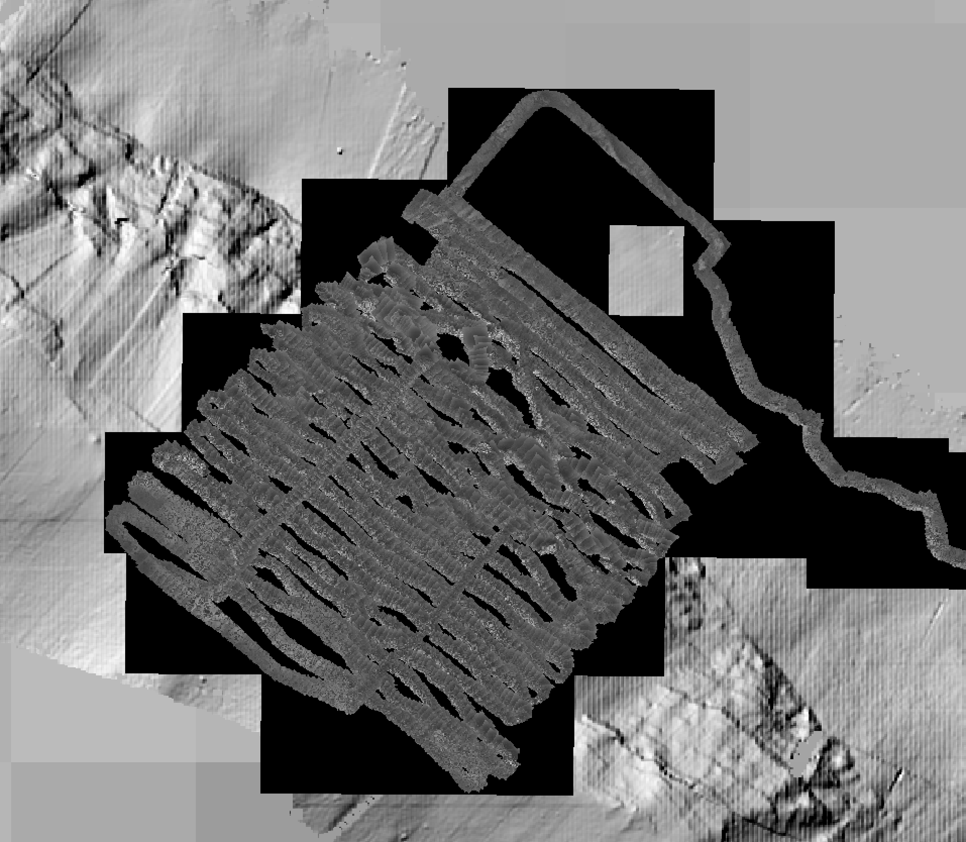
Photomosaics acquired by ROV Victor during ODEMAR cruise, Dive #563, with OTUS camera (B&W) vertically mounted. Track follows the Roseau Fault (French Antilles, off Les Saintes islands). GEOTIFFS projected in WGS84 UTM Zone 20N.
-
Inventory of faults and tectonic boundaries in Brandenburg at regional scale (approx. 1:200.000 - 1:1.000.000)
-
Inventory of faults and tectonic boundaries in Denmark at various regional scales
-
Faults, shearzones and nappe boundaries in Austria as they appear in the GeoERA HIKE European fault data base
-
The dataset contains the main faults and fault zones in Poland. The detail of the data corresponds to a scale of approximately 1: 500 000.
-
Faults in Albania, visualized in the Geological Map, at a scale of 1: 200 000. Explanatory text of the Geological Map at a scale of 1: 200 000.
-
Inventory of faults and tectonic boundaries in Saxony-Anhalt at various regional scales
-
Faults in Slovenia displayed in the HIKE European fault database.
-
Faults and nappe boundaries in Ukraine at scale 1:1.000.000
-
Faults in the Netherlands at national scale