 Metadata catalogue
100.0 m
Type of resources
Available actions
Topics
INSPIRE themes
Provided by
Years
Formats
Representation types
Update frequencies
status
Scale
Resolution
-
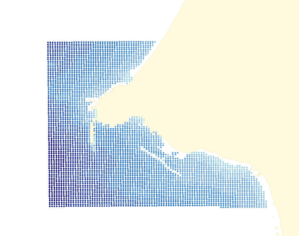
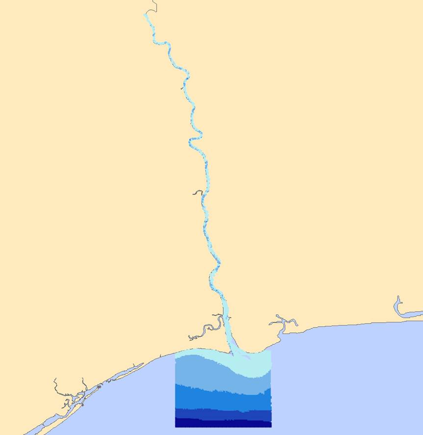
This dataset contains a depth grid with 100 meters spacing, built on sounding information from the hydrographic surveys in the Douro estuary. The depth values are referred to the Hydrographical Zero (ZH).
-
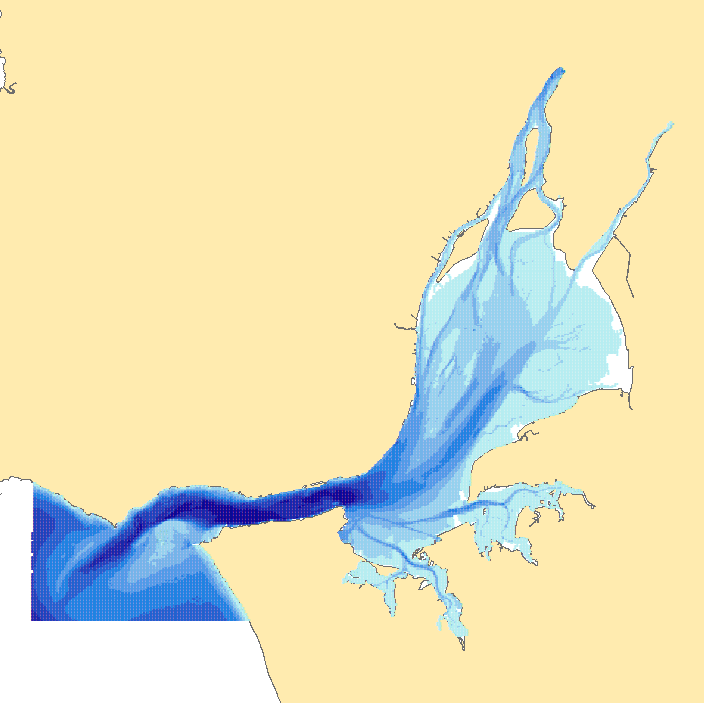
This dataset contains a depth grid with 100 meters spacing, built on sounding information from the hydrographic surveys in the estuary of Tagus river. The depth values are referred to the Hydrographic Zero (ZH).
-
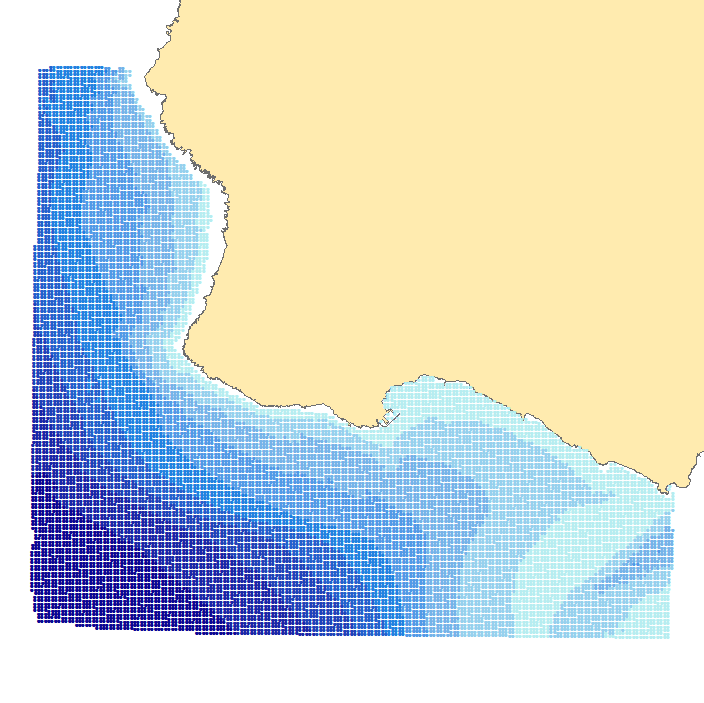
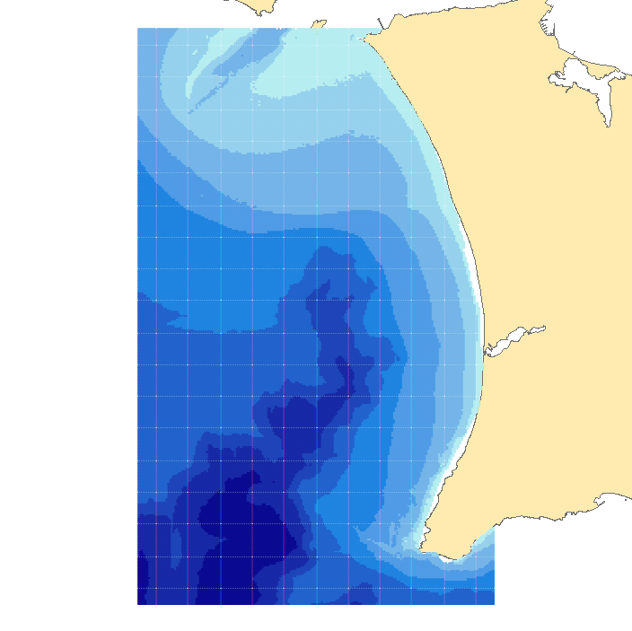
This dataset contains a depth grid with 100 meters spacing, built on sounding information from the hydrographic surveys in Sines. The depth values are referred to the Hydrographic Zero (ZH).
-
This dataset contains a depth grid with 100 meters spacing, built on sounding information from the hydrographic surveys in Cascais. The depth values are referred to the Hydrographic Zero (ZH).
-

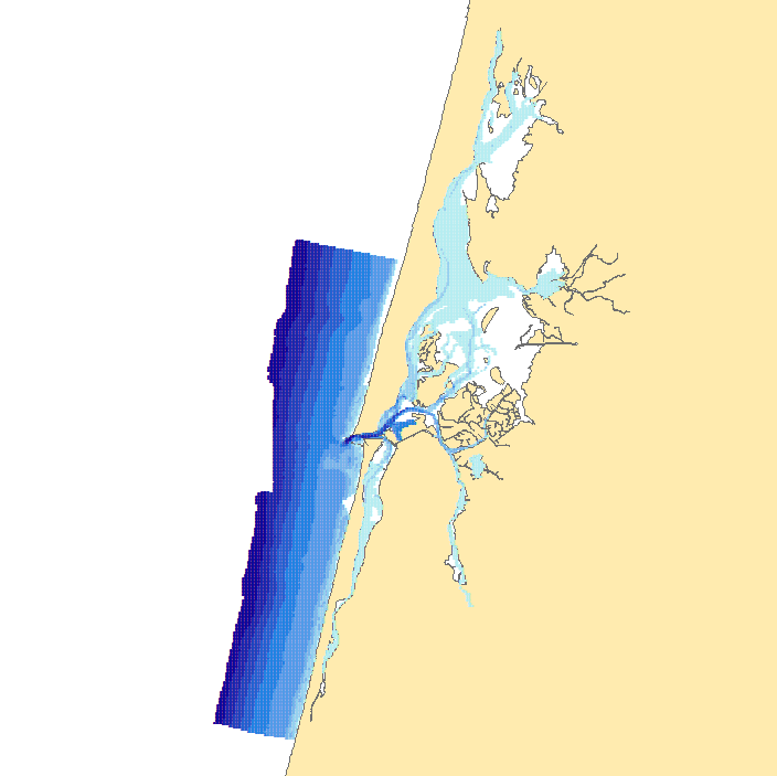
This dataset contains a depth grid with 100 meters spacing, built on sounding information from the hydrographic surveys in Formosa. The depth values are referred to the Hydrographic Zero (ZH).
-
This dataset contains a depth grid with 100 meters spacing, built on sounding information from the hydrographic surveys in Guadiana River. The depth values are referred to the Hydrographic Zero (ZH).
-
This dataset contains a depth grid with 100 meters spacing, built on sounding information from the hydrographic surveys in Costa da Caparica. The depth values are referred to the Hydrographic Zero (ZH).
-
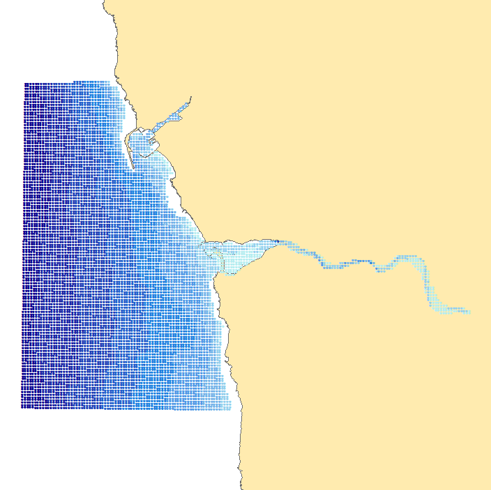
This dataset contains a depth grid with 100 meters spacing, built on sounding information from the hydrographic surveys in Aveiro. The depth values are referred to the Hydrographic Zero (ZH).
-

Communes de l'agglomération de Chartres Métropole issue de la BD Carto de l'IGN
-

Le SCAN 1000® est un fond cartographique raster continu sur la France métropolitaine. Il s'agit d'une image raster géoréférencée issue de la rastérisation de la carte routière nationale 901 au 1: 1 000 000 éditée par l'IGN. Utilisations potentielles : localisation d'information géographique d'emprise nationale, voire inter-régionale ; référentiel pour la numérisation d'information d'emprise nationale et inter-régionale ; fond cartographique pour élaborer des documents cartographiques de très petite échelle, à vocation de synthèse ou de communication. Ce document raster couvre la France métropolitaine en 5 dalles et contient de nombreuses informations topographiques pour des usages à petites échelles. Le contenu informationnel est compatible avec des échelles de travail de l’ordre du 1 : 1 000 000. Cependant la lecture des toponymes reste possible jusqu'au 1 : 2 000 000, tandis que la pixellisation n'est pas perceptible pour des échelles inférieures à 1 : 500 000. Les fichiers de la version 2.0 ont été librement téléchargés depuis le site web de l'IGN et sont disponibles à la Plate-forme technologique de la MSHE Ledoux