 Metadata catalogue
inlandWaters
Type of resources
Available actions
Topics
INSPIRE themes
Keywords
Contact for the resource
Provided by
Years
Formats
Representation types
Update frequencies
status
Scale
Resolution
-
Scottish legislation (Section 17) of the Flood Risk Management (Scotland) Act 2009 dictates that records of culverts must be created and maintained. Specifically: (1) Every local authority must prepare a map which shows (or more than one map which, taken together, show) relevant bodies of water and sustainable urban drainage systems in its area. (2) Each map must - (a) be prepared by such date as the Scottish Ministers may direct, (b) be prepared at a scale that the authority considers most appropriate, and (c) contain such information and be in such form as the Scottish Ministers may specify in regulations. (3) A local authority must, from time to time, review and where appropriate update the map (or maps) prepared for its area under subsection (1). (4) A local authority must make available for public inspection the map (or maps) prepared under this section for the time being applicable to its area. (5) In this section and section 18 - “relevant body of water” - (a) means - (i) a body of surface water other than a stretch of coastal water, or (ii) a body of underground water forming part of a watercourse (but not including a watercourse which is wholly underground), but (b) does not include sewers and drains which drain into sewers, “sustainable urban drainage system” has the meaning given in section 59(1) of the Sewerage (Scotland) Act 1968 (c.47). Most Local Authorities have contributed (natural) culvert data to the new OS MasterMap Water Network Layer either through providing data to the Scottish Government or through the James Hutton Institute. As this data is now live, a mechanism for managing/maintaining/updating this data needs to be put in place. SCOTS (Society of Chief Officers for Transportation in Scotland) have approved for this dataset to be managed by the Spatial Hub and any amended data can be uploaded (and potentially downloaded) before being shared with OSMA members and the OS. We have initially created a point and line data layer representing the data we have been sent by some LAs. However, we really need line data in order for it to be merged into the OS MasterMap Water Network Layer data in due course. The LA "culverts" data as included in the OS MasterMap Water Network Layer is also available for LAs to download and use as part of this dataset
-

The map sheet: 1. Carte schématique des stations hydrologiques en Nouvelle Calédonie. Scale of 1:1 660 000. Date of publication: unknown.
-
This vector map delineate the boundary of the Berambadi watershed
-

The map sheet: 1. Carte du département de la Guyane française. Scale of 1:1 200 000. Date of publication: 1957.
-

The map sheet: 1. Les grandes régions. Scale of 1:1 000 000. Date of publication: 1958.
-
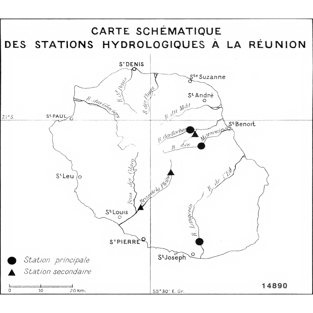
The map sheet: 1. Carte schématique des stations hydrologiques à la Réunion. Scale of 1:570 000. Date of publication: unknown.
-
Hydrographic elements, including river basins and sub-basins.
-

The map sheet: 1. Plan de la lagune Ébrié : feuille Dabou : D25 : Côte d'Ivoire. Scale of 1:50 000. Date of publication: 1947.
-

The map sheet: 1. République Malgache. Scale of 1:6 500 000. Date of publication: 1971.
-

The map sheet: 1. Abidjan : système lagunaire Ebrié. Scale of 1:100 000 to 1:50 000. Date of publication: 1977.