As part of SIMCelt, SIMNORAT, SIMWESTMED, SEANSE and SIMAtlantic projects, Shom set up a spatial data architecture to centralise and share MSP knowledge related MSP in the European sea basins. Its data catalogue brings together data from European and national sources, preferably disseminated from web services. The architecture evolves as projects, their objectives and the marine planning process progresses in the countries involved.
This data architecture is supporting identifying data gaps when centralising the publication of ata from various sources European and national sources. The data published don't constitute an exhaustive data catalogue.
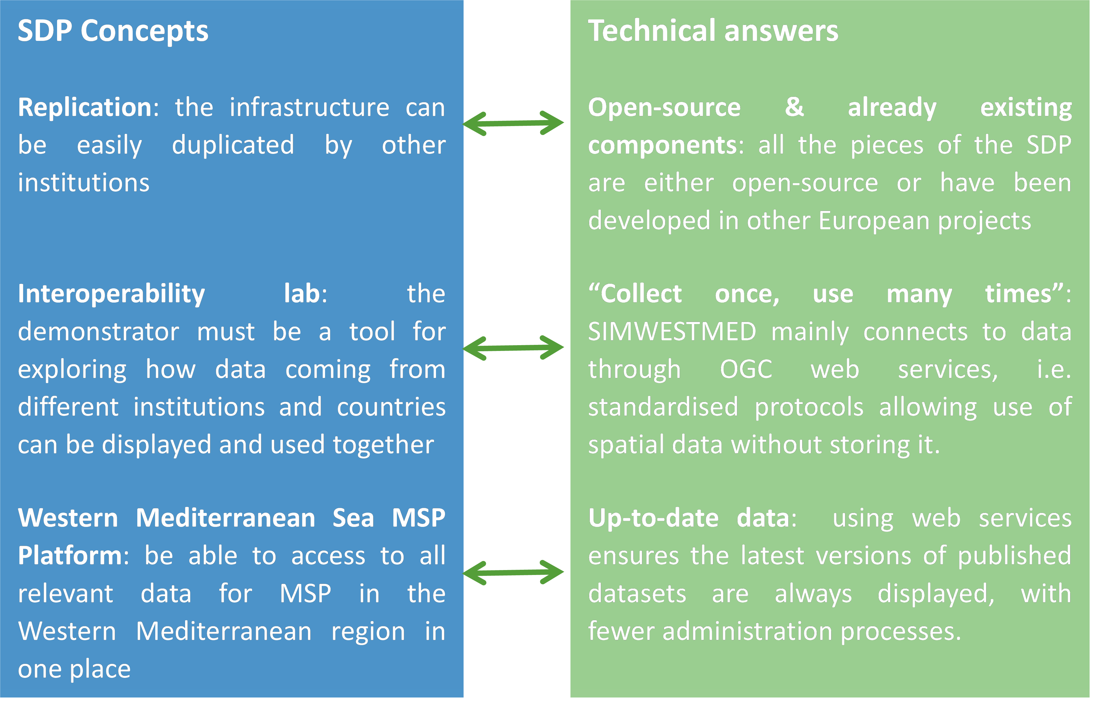
This data portail architecture is based on components either under open-source licenses or already developed through other European projects were used. The portal data catalogue focuses mainly on the use of INSPIRE web services.
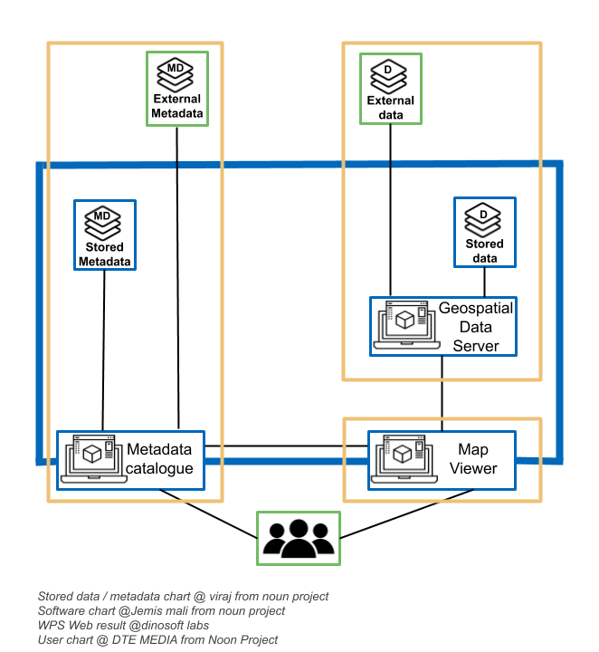
The spatial data infrastructure (SDI) is based on three components:
- The metadata catalogue: it disseminates information on data like its producers or date of creation. It uses the open-source application Geonetwork 3.0.2. It gathers the INSPIRE compliant metadata records associated with the MSP relevant datasets. Although some metadata records are hosted locally, the major part is harvested from external catalogues.
- The geospatial data server: this component allows publishing geographical data on the web through OGC protocols. If in most cases, its vocation is to spread data (either vector or raster) stored on a local server, it is used in the projects in a different way. This tool was experimented to act as an intermediate between producers’ data infrastructures and the Map Viewer, by connecting directly to the partners’ web services. The Open-source software Geoserver 2.8 is used for this task.
- Map viewer (front end): It is the main access point to the data portal. It is an interactive mapping application connected to the metadata catalogue and to the geospatial data server. It allows displaying selected data together on a map. It also has some specific features like a preconfigured map catalogue, drawing tools and time series. The map viewer is developed by a private subcontractor, based on the viewer previously used in EMODnet Coastal Mapping project.