 Metadata catalogue
MARS3D
Type of resources
Available actions
Topics
INSPIRE themes
Keywords
Contact for the resource
Provided by
Years
Formats
Representation types
Update frequencies
status
Scale
Resolution
-
Plusieurs maquettes hydrodynamiques à des emprises et résolutions différentes ont été développées par l'UR LEAD (Lagons, Ecosystèmes et Aquaculture Durable en Nouvelle-Calédonie) dans le cadre du projet PRESENCE : - La grille KENU possède une emprise à l'échelle régionale de la Nouvelle-Calédonie avec une résolution de 1500 m sur 50 niveaux verticaux et une rotation de 40°. - L'emprise de la grille KAGOU est centrée sur la partie Sud de la Grand Terre (Province Sud) à une résolution de 300 m sur 50 niveaux verticaux et une rotation de 40°. - La grille KANA est axée sur la Grande Terre avec une résolution de mailles de 300 m, sur 50 niveaux verticaux et une rotation de 40°. - La maquette POE possède une emprise locale entre le lagon du Cap et le lagon de Moindou (Province Sud) avec une résolution de grille égale à 50 m sur 50 niveaux verticaux.
-

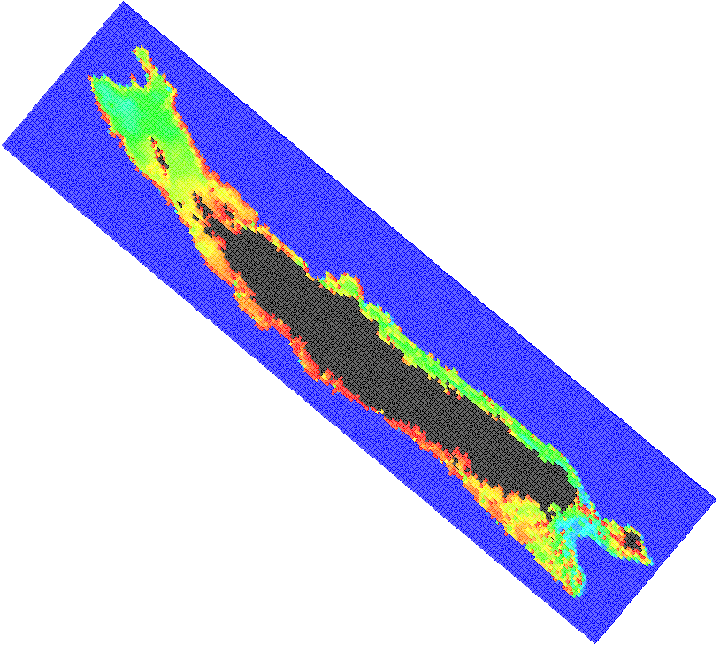
The Gambier lagoon has a diamond-shaped form and surrounds seven high islands that are very exposed to the ocean. It is bordered by a barrier reef, which is submerged along the southern and western sides and by an intertidal to emerged barrier reef along the northern and eastern sides. The northern side is cut in some sections by several hoa, (shallow passages) allowing connections between the lagoon and the open ocean. The average depth of the domain is 25 m, with a maximum depth of 80 m along the southeastern coast of Mangareva Island. The bathymetry is complex, forming several basins, including the Rikitea enclosed lagoon, which is bordered by Mangareva and Aukena islands. The bathymetry of the Gambier Islands lagoon was generated using three data sources: SHOM soundings acquired in the 1960s, multi-beam data from Geopolynesie (5 m resolution) collected between 2020 and 2021, and satellite-derived bathymetry (SDB) at 10 m resolution using Sentinel-2 imagery to fill depth gaps in shallow areas. The final bathymetric grid was produced for implementation in the numerical hydrodynamic model MARS3D at a resolution of 100 m, using the compiled sounding datasets described above. The interpolation process included a Hanning low-pass filter applied five consecutive times for depths below 50 m, followed by an additional low-pass filter (ROMS) with a factor of 0.25.