 Metadata catalogue
repository
Type of resources
Topics
INSPIRE themes
Keywords
Contact for the resource
Provided by
Years
Representation types
-

Accredited through the MEDIN partnership, and core-funded by the Department for the Environment, Food and Rural Affairs (Defra) and the Scottish Government, DASSH provides tools and services for the long-term curation, management and publication of marine species and habitats data, within the UK and internationally. Below are a selection of projects, outputs and deliverables that DASSH and the MBA Data Team have been involved in recently. - NE Data Management: DASSH have been contracted by the Marine team at Natural England (NE) to support NE data dissemination. We have been digitising datasets used in Article 17 reporting and helping them input data to Marine Recorder and MEDIN guidelines. In addition, DASSH is running a 2-day workshop with the marine data team in October 2014 on data management and standards. The aims of the workshop are to present MEDIN data guidelines and standards and to run practicals on quality assurance (QA) issues with data, creating MEDIN formatted data, and creation of MEDIN metadata. - MCZ Data Archiving: DASSH staff have been working with Defra, JNCC, Natural England, Cefas and the other MEDIN DAC's in the development and implementation of a strategy for the archiving and dissemination of MCZ survey data. This involves the archives of many terrabytes of data from the survey work undertaken at 127 sites. DASSH is currently working with the other DACs archiving the data from several MCZ sites before taking delivery of the complete survey catalogue. - Non-Natives Data Management: DASSH staff work with other members of the KE team to help deliver the MBA contribution to the GB Non-native Species Information Portal. The data team ensure the validation of records submitted and raise alerts when records of Invasive Non-Native Species of concern and in disseminating information about species distribution via DASSH and the NBN. DASSH staff continue to liaise with organisations to ensure the prompt flow of marine non-native species distribution data to the public domain. The KE team facilitated the identification of two new marine invasive non-native species in 2014 and have subsequently created the identification sheet for these species. Hemigrapsus sanguineus (from volunteer records sent in for identification) and Hemigrapsus takanoi (first recorded by the John Bishop Group survey team). - EMODNet Biology: The Data Team are part of a consortium led by the Flanders Marine Institute (VLIZ) for the biological data component of EMODNet (European Marine Observation and Data Network). The Data Team will lead a work package relating to biological traits and indicator species as identified for Marine Strategy Framework Directive (MSFD) reporting, bringing an additional €130k of funding. - VALMER: The Data Team led a key work package in a £3.7 million (ca. €260k for the MBA) INTERREG project to "Develop, trial and refine methodologies that will be used to quantify and communicate the value (economical, social and environmental) of marine and coastal ecosystem services". The research identified an operational framework to value marine ecosystem services, and which could be used to enhance marine planning and policy decisions.
-

The Department of Forestry, Fisheries and the Environment (DFFE) has initiated the development of the Marine Information Management System (MIMS). MIMS is tasked with the long-term preservation of South Africa’s ocean and coastal data. It provides the primary access to all data collected by the Oceans and Coasts Chief Directorate while also acting as a trusted broker of scientific marine data for a wide range of South African institutions. - MIMS operates on the Findable, Accessible, Interoperable, and Reusable (FAIR) data principles, and strives to adhere to the Open Archival Information System (OAIS) Reference Model with the aim of maximising ocean data exchange and use while respecting the conditions stipulated by the Data Provider. - MIMS is a component of the national Oceans and Coastal Information Management System (OCIMS) and manages the Southern African Data Centre for Oceanography (SADCO). - MIMS has been developed by the South African Environmental Observation Network (SAEON) under the leadership of the Chief Directorate: Oceans and Coastal Research Branch of DEFF, South Africa.
-

MAREANO maps depth and topography, sediment composition, biodiversity, habitats and biotopes, and pollution in the seabed in Norwegian coastal and offshore regions. MAREANO is coordinated by the Institute of Marine Research, in collaboration with the Geological Survey of Norway and the Norwegian Hydrographic Service. The Programme is financed by the Ministry of Fisheries and Coastal Affairs, the Ministry of Environment and the Ministry of Trade and Industry, via contributions from the National Budget. The Programme aims to provide answers to questions such as: - How is the seascape of the Norwegian continental shelf? - What does the seabed consist of? - How is the biodiversity distributed on the seabed? - How are habitats and biotopes distributed on the seabed? - What is the relationship between the physical environment, biodiversity and biological resources? - How much contaminants are stored in the bottom sediments? The Institute of Marine Research, the Geological Survey of Norway and the Norwegian Mapping Authority comprise the Executive Group which is responsible for carrying out the MAREANO field sampling and other scientific activities. The Programme Group, led by the Norwegian Environment Agency, has the executive responsibility for the MAREANO activities.
-
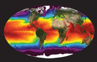
NASA's Physical Oceanography Distributed Active Archive Center (PO.DAAC) is located at NASA's Jet Propulsion Laboratory in Pasadena, California. PO.DAAC manages and provides tools and services for NASA's oceanographic and hydrologic data (satellite, airborne, and in-situ) to enable a greater understanding of the physical processes and conditions of the global ocean. Measurements include gravity, ocean winds, sea surface temperature, ocean surface topography, sea surface salinity, and circulation. The data support a wide range of applications including climate research, weather prediction, resource management, policy, and the stewardship of ocean data resources.
-
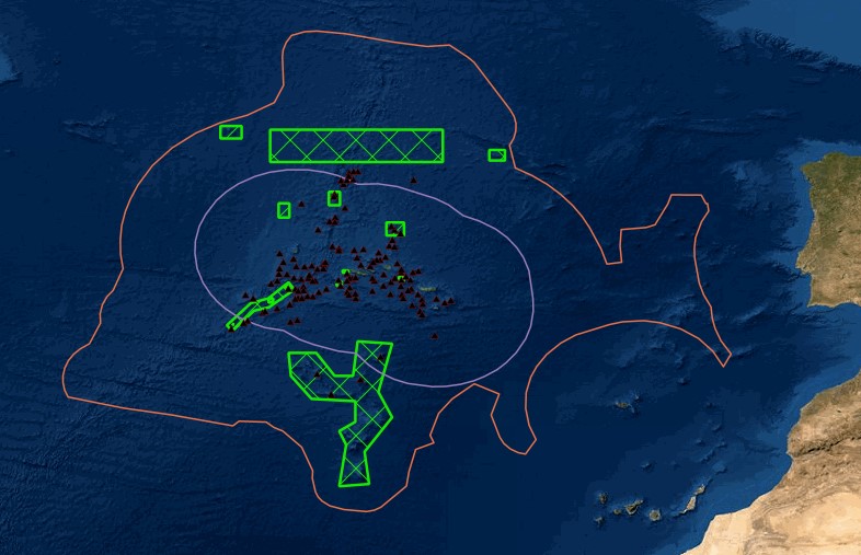
Portal of Maritime Spatial Planning of the Azores which hosts several GIS layers, such as: - Fishing areas and aquaculture production areas - Bathymetry - Mineral resources: Deep seabed polymetallic nodules - Hydrothermal vents - Distribution of seamount extracted, 2008 - Seafloor geomorphologic classification - Ocean environmental variables mean between the years 2002 and 2013: Sea Surface Temperature, Chlorophyll-a Concentration, Particulate Organic Carbon and Particulate Inorganic Carbon, Photosynthetically, Available Radiation, Ocean Productivity - Maerl habitats - Predictive distribution modelling for 26 cold-water coral species - Coldwater corals - Legal issues - Infrastructure and equipment - Underwater cultural heritage - Aggregate extraction - Tourist maritime activities
-

The Marine Environmental Data and Information Network (MEDIN) is a partnership of UK organisations committed to improving access to UK marine data. MEDIN is open to all with an interest in marine data and information. We are sponsored by a consortium of 15 sponsors and partnered with over 50 organisations. MEDIN Sponsors include a range of UK marine organisations who support MEDIN’s principles and lead the UK in marine data management. To officially join the network and become a MEDIN Sponsor, please email MEDIN stating your interest at enquiries@medin.org.uk. Our partners represent government departments and agencies, research organisations and private companies and have committed to practise good data management to help future-proof and secure UK’s valuable marine data. MEDIN reports to the Marine Science Coordination Committee. The MEDIN portal contains information about 15,000 marine datasets. The United Kingdom Directory of Marine Observing Systems (UKDMOS), is a unique internet-based searchable database of marine monitoring conducted by UK organisations. Aiming to fulfil the basic requirement to know where, when and what is being monitored in the marine environment around the UK and provide information to help coordinate monitoring across different organisations, UKDMOS is a tool for searching monitoring programmes and series based on information such as the parameters measured or the frequency of measurements taken. UKDMOS is managed and updated by the Marine Environmental Data and Information Network (MEDIN).
-
The Western Channel Observatory (WCO) is an oceanographic time-series and marine biodiversity reference site in the Western English Channel. In situ measurements are undertaken weekly at coastal station L4 and fortnightly at open shelf station E1 using the research vessels of the Plymouth Marine Laboratory and the Marine Biological Association. These measurements are complemented by PML's recognised excellence in ecosystem modelling and satellite remote sensing science. By integrating these different observational disciplines we can begin to disentangle the complexity of the marine ecosystem. The WCO measures several key parameters important to the functioning of the marine ecosystem such as light, temperature, salinity and nutrients. Station L4 has some of the longest time-series in the world for zooplankton and phytoplankton, and fish trawls have been made by the MBA for a century. Station E1 has a hydrographic series dating from 1903. These long series are complemented by hourly measurements made at our moorings situated at both stations. These can elucidate changes not captured by the routine weekly sampling.
-
Explore global fisheries and aquaculture. Understand their status and how impacts are being managed. Learn what improvements are underway, and see what actions seafood stakeholders can take to drive sustainability. FishSource is a publicly available online resource about the status of fisheries, fish stocks, and aquaculture. FishSource compiles and summarizes publicly available scientific and technical information and presents it in an easily interpretable form. FishSource was created in 2007 by Sustainable Fisheries Partnership to provide major seafood buyers with up-to-date, impartial, and actionable information on the sustainability of fisheries and the improvements they need to make to become more sustainable. In 2018, information on aquaculture sources was added to the database to provide FishSource users with a more robust tool that covers all types of seafood production. Although the primary intended audience of FishSource is seafood businesses, other audiences - such as academics, researchers, and non-profit organizations - have also become frequent and welcomed users of FishSource. The information on FishSource is primarily developed and updated by a small team of in-house analysts, but their capacity is recognizably insufficient to maintain complete coverage of all global fisheries. As such, profiles may be incomplete or information may be out of date. The seafood industry and external contributors are invited to help fill any gaps that they consider priorities through our Rapid Assessment Program. FishSource always welcome comments on any of our profiles and encourage an open debate on the sources of information used and our interpretation of the data. Our objective is to use only publicly available sources and fully credit those sources, effectively acting as an inventory of information sources on fisheries and aquaculture.
-

EMODnet (European Marine Observation and Data Network) is the long term marine data initiative supported by the European Commission since 2009 to ensure that European marine data will become easily accessible, interoperable, and free on restrictions on use. EMODnet Chemistry provides access to standardized, harmonized and validated chemical data collections for water quality evaluation at a regional scale, as defined by the Marine Strategy Framework Directive (MSFD). The data portal has adopted and adapted SeaDataNet standards and services, establishing interoperability between the data sets from the many different providers (more than 60 in EMODnet Chemistry network). Concentration maps of nutrients, chlorophyll-a and dissolved oxygen are computed on a standard grid, providing information at a regular time interval, per season and over several vertical layers, including the deepest one. Dedicated OGC standard services for browsing, viewing and downloading chemistry observation, data and data products for the European waters have been developed, and are actively maintained and monitored.
-
Marine research is truly multidisciplinary as evidenced by e.g. the EMODnet I, II, and III projects that have been running since 2009. EMODnet Geology has succeeded in bringing together harmonised offshore data including sea-floor geology, seabed substrates, rates of coastline migration, geological events and probabilities and mineral resources. The EMODnet Geology Portal aims at providing harmonised information on marine geology in Europe. It is one of several EMODnet portals with the purpose to strengthen blue growth in Europe.