 Metadata catalogue
0.9375 Arc second
Type of resources
Topics
INSPIRE themes
Keywords
Contact for the resource
Provided by
Years
Formats
Representation types
Scale
Resolution
-
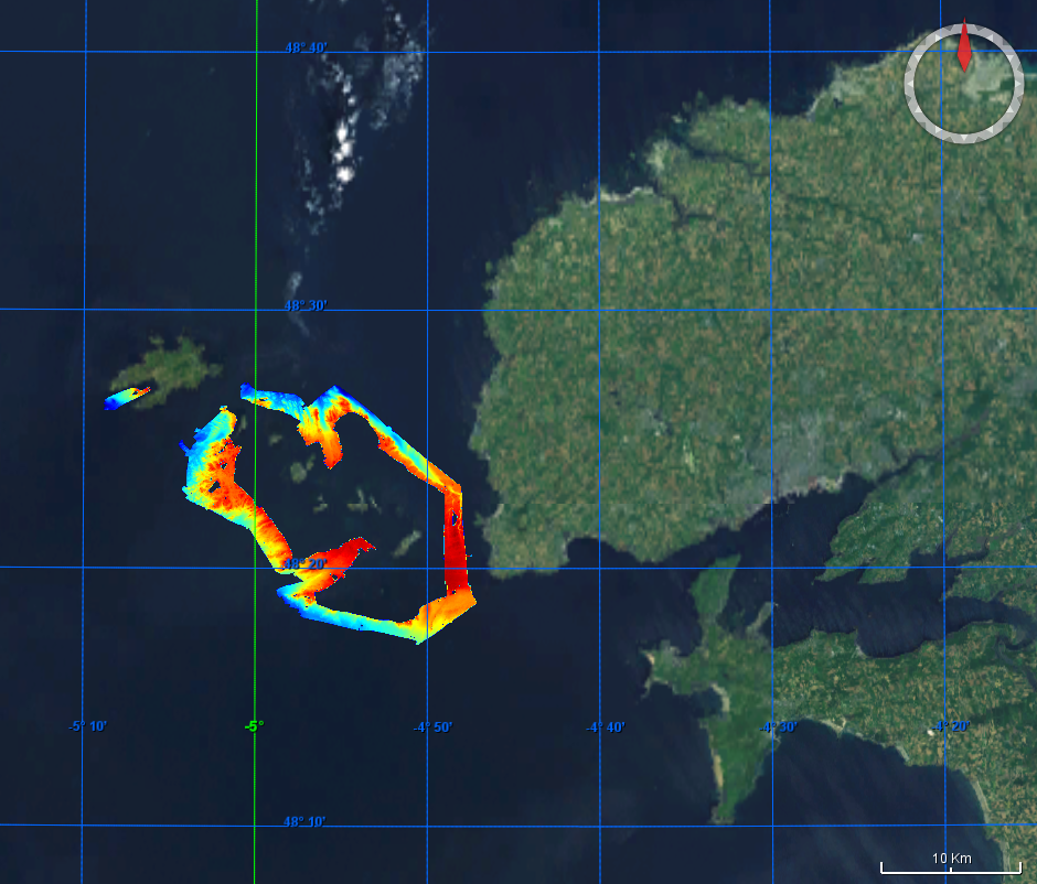
Multibeam data acquired during the Rhosos survey. R/V Le Suroit, 2008, EM300 multibeam system.
-
Multibeam data acquired during the Rhosos survey. R/V Le Suroit, 2008, EM300 multibeam system.
-

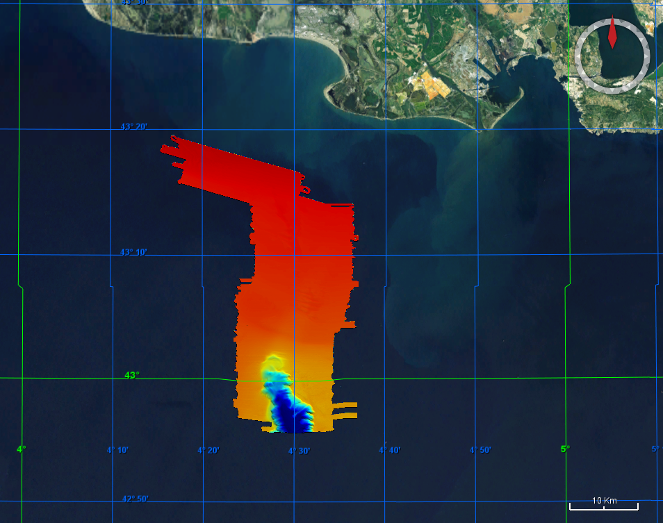
Multibeam data acquired during the Beachmed survey. R/V Le Suroit, 2004, EM300 multibeam system
-
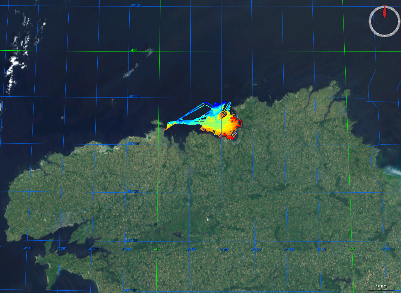
Multibeam data acquired during the Carbala and Carbala2 surveys, 2005 and 2006, multibeam acquisition.
-
Multibeam data acquired during the Calimero 2 survey. R/V Le Suroit, 2005, EM300 multibeam system.
-
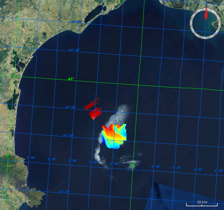
Multibeam data acquired during the Thalamacou survey. R/V Thalia, 2011, EM1000 multibeam system.
-
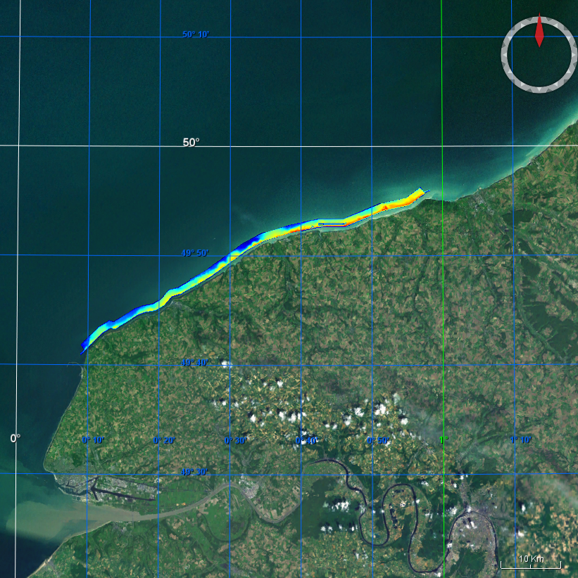
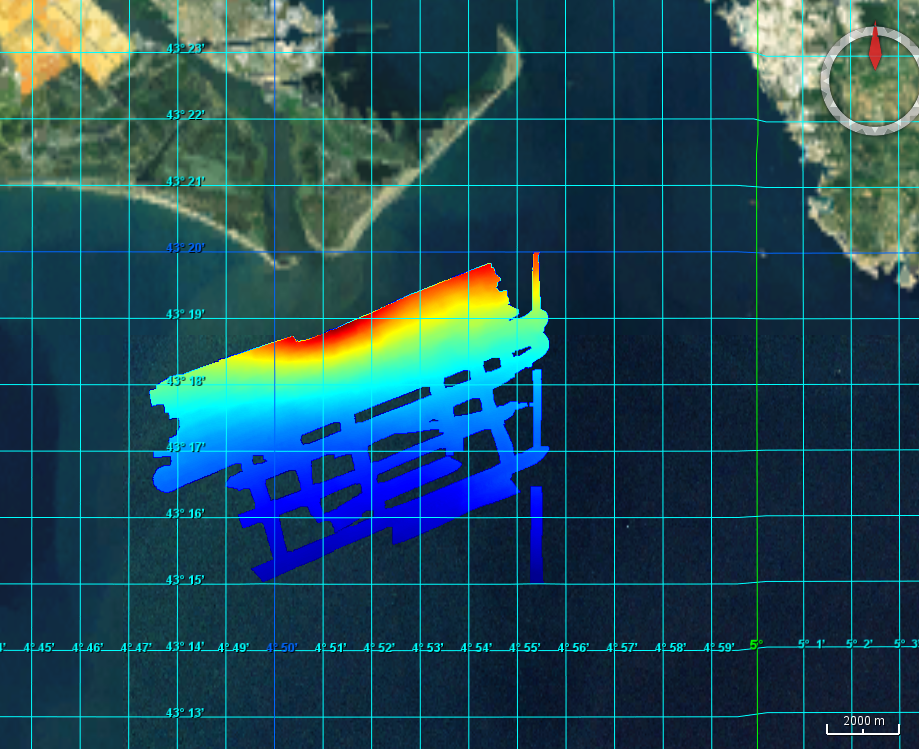
Multibeam data acquired during the PLA-HANO survey. R/V Thalia, 2006, EM1000 multibeam system.
-
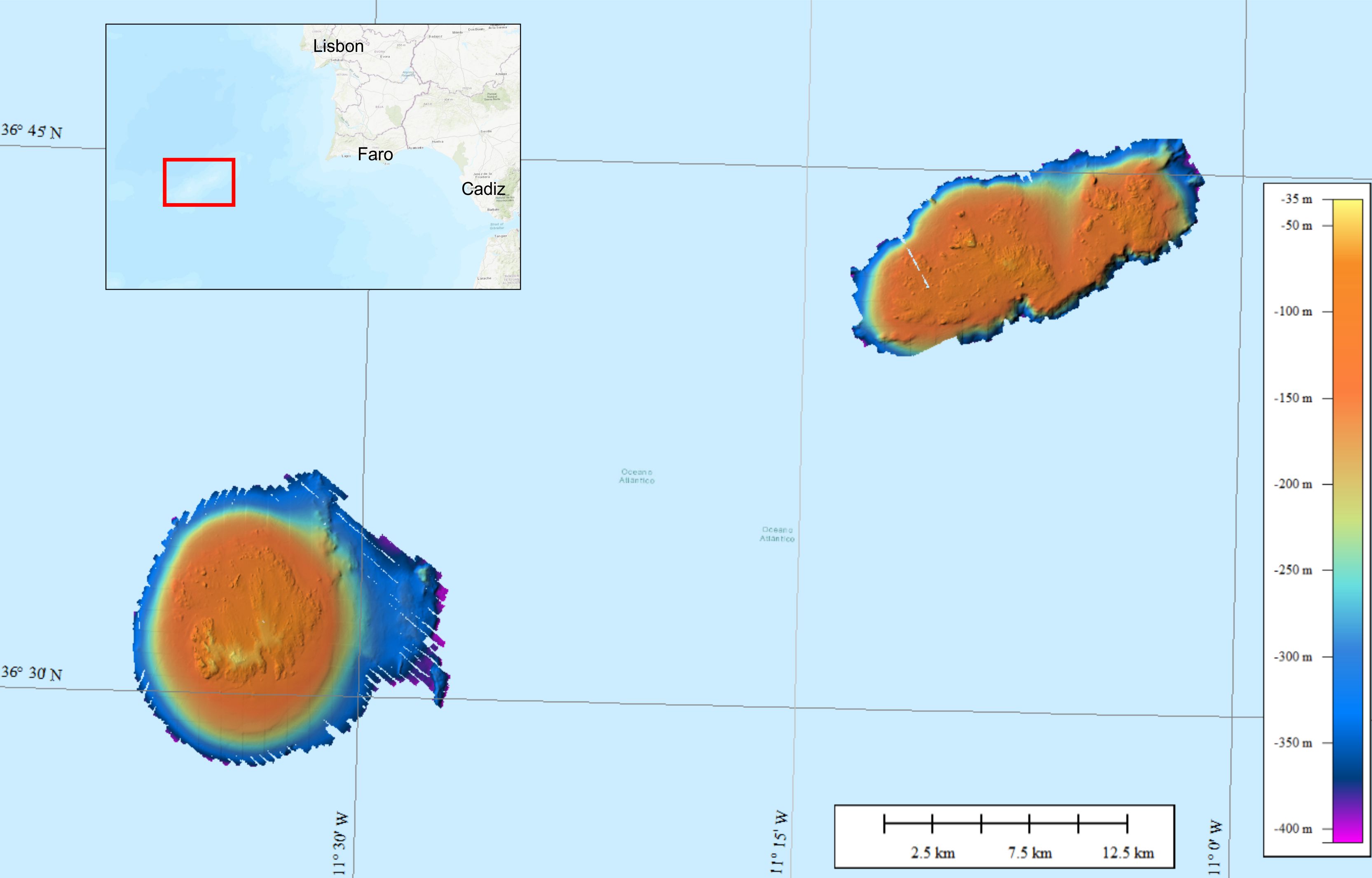
Bathymetric data were collected on the Gorringe Bank, located along the Europe-Africa obliquely convergent plate boundary offshore SW Portugal. The high-resolution swath bathymetry dataset allowed the investigation of the shallow-depth structure of the Horseshoe Seamounts. Data were collected by means of the MBES system Reson SeaBat8101. The MBES was hull-mounted on a 60 meters long vessel. The MBES has 101 beams 1,5° x 1,5°; the operational frequency was 240 kHz. A LandStar 12 channel DGPS system was used for ship positioning and a motion sensor TSS-DMS02-05 was used to provide corrections for attitude data. A Sound Velocity Sensor was installed near the transducers thus providing realtime sound speed for beam steering. A sound velocity profiler Reson SVP20 was lowered through the water column every 6–8 h to get the velocity profile required for the depth computation. The bathymetric data were processed using the PDS2000 software. Data de-spiking was carried out without the application of automatic filters in order to preserve data accuracy and resolution.