 Metadata catalogue
0.015625 Arc minute
Type of resources
Available actions
Topics
INSPIRE themes
Keywords
Contact for the resource
Provided by
Years
Formats
Representation types
Scale
Resolution
-
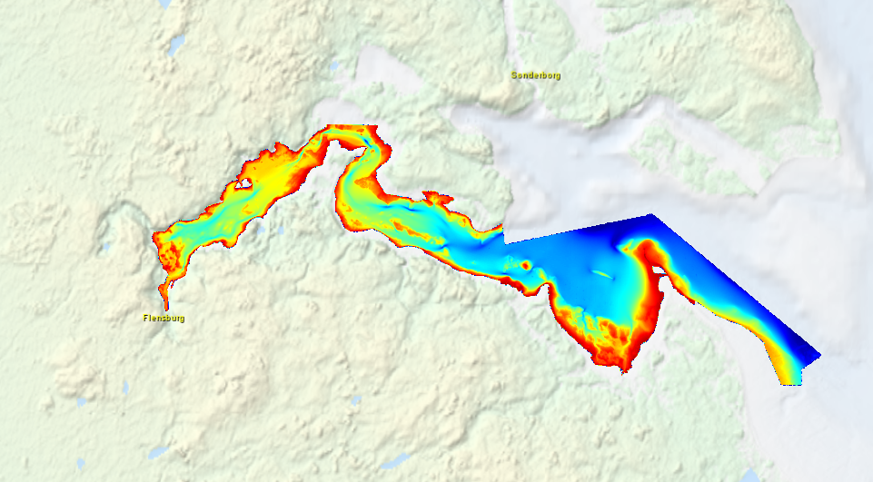
High resolution composite DTM based on multi beam surveys in Flensburg Bay. All data acquired in the years 2012-2013.
-
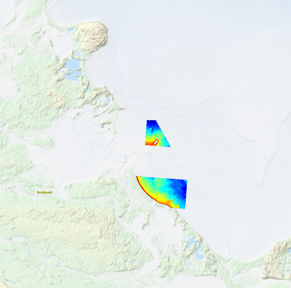
High resolution composite DTM based on multi beam surveys in German Bodden waters. All data acquired in 2016.
-

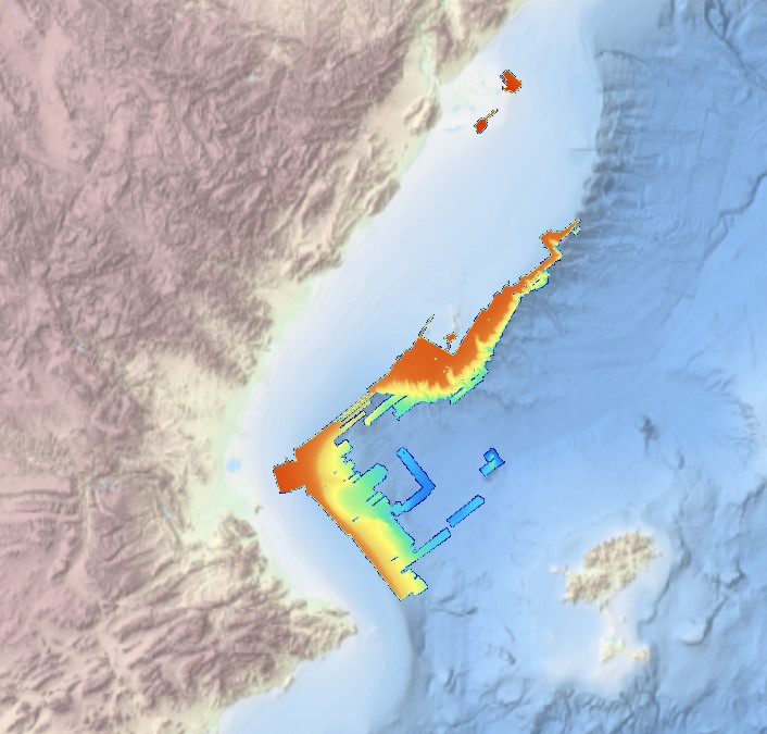
Systematic survey performed by ITS ARETUSA with Multibeam EchoSounder Simrad EM2040C
-
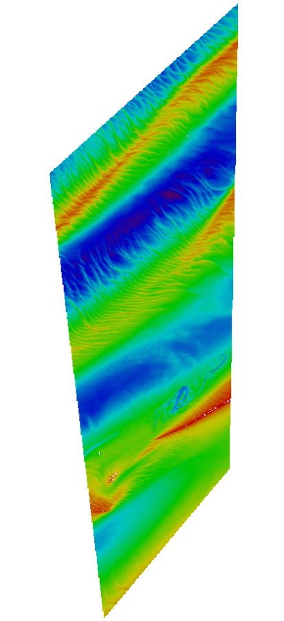
This composite Digital Terrain Model (cDTM) is a high resolution bathymetry dataset that covers CASCADES-I, CASCADES-II, COSTEM-1, COSTEM-2, COSTEM-3, COSTEM-4, FORMED-2, FORMED-4 and FORMED-6 cruises. Multibeam data acquired in 2008, 2009, 2010, 2011, 2013, 2014 and 2015 on board the R/V Sarmiento de Gamboa and the R/V García del Cid with an Atlas Hydrosweep DS-3 and an Elac Seabeam 1050D echo-sounder.
-
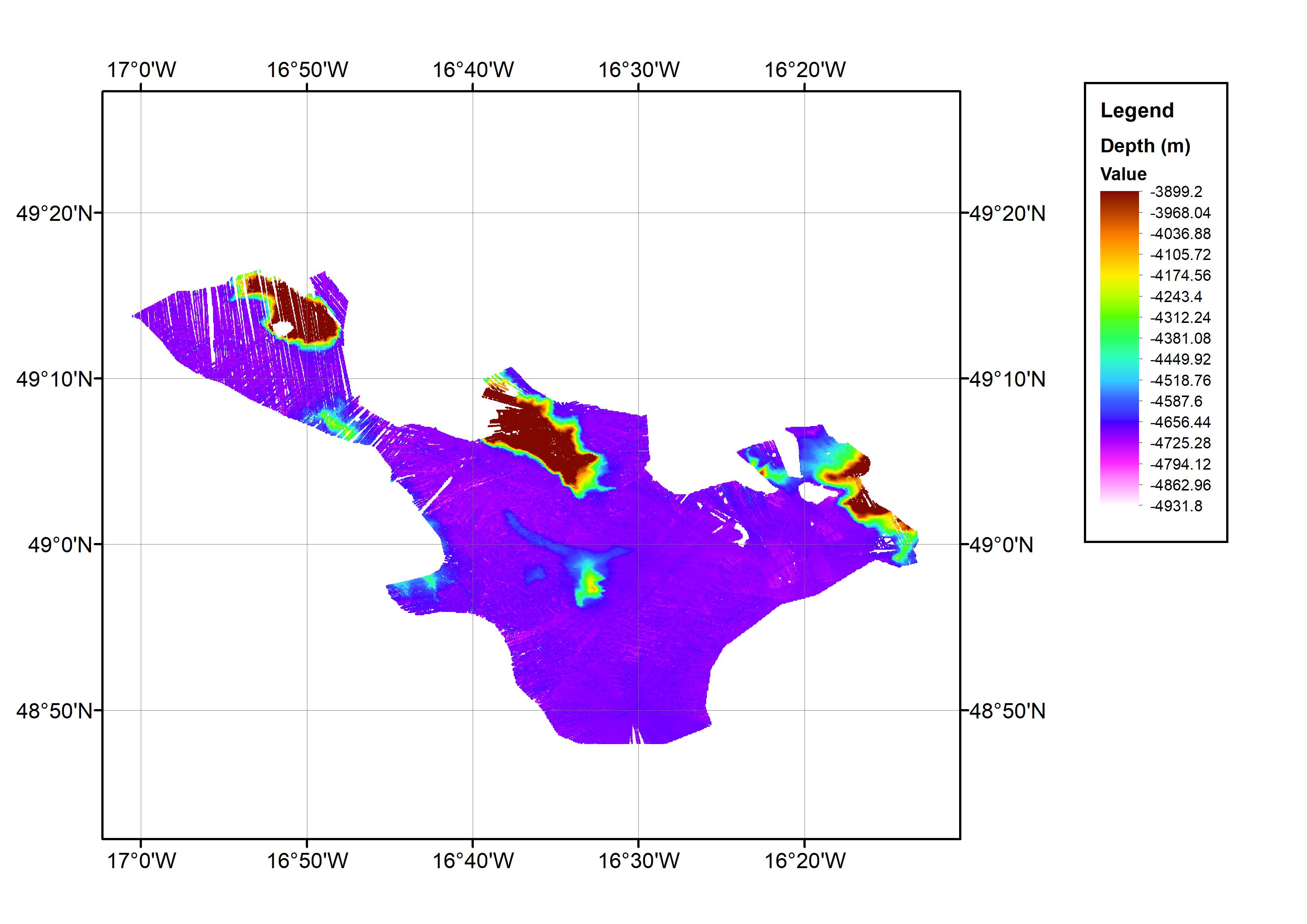
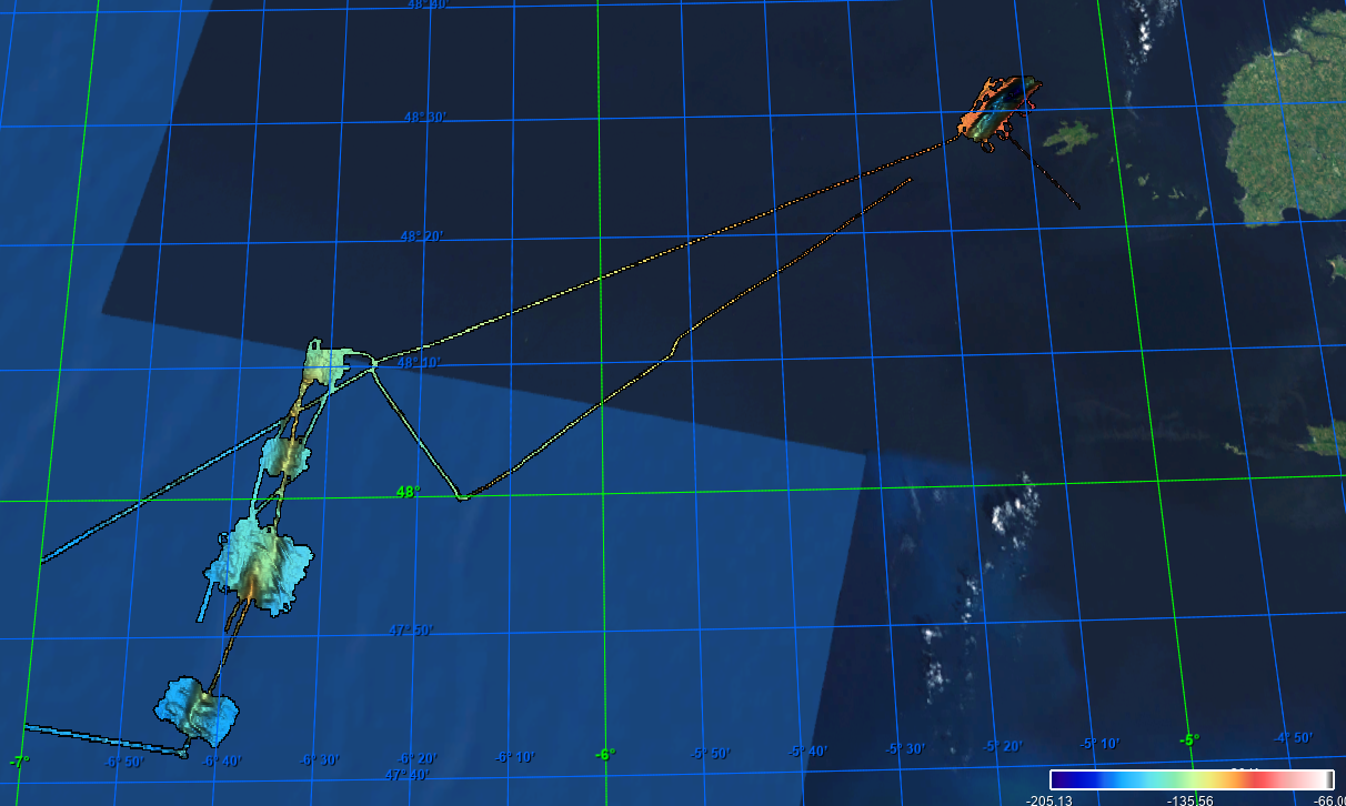
This data set consists of a bathymetric grid derived from multibeam bathymetry data from cruise JC071. The bathymetric grid was created by gridding cleaned raw multibeam data from JC071 at 1/64 arc-minute intervals. The data set covers an approximate one degree square with the minimum and maximum longitude and latitude co-ordinates: 17.016667W-16.216667W; 48.78333N-49.28333N. This is located in the Northeast Atlantic Ocean area. The data were collected from 7th-8th May 2012 using an EM120 Multibeam Echo-sounder. The cruise was part of the Porcupine Abyssal Plain (PAP): sustained ocean observation project. The bathymetry data were collected on an opportunistic basis during the cruise. The cruise was operated by the National Oceanography Centre (NOC), equipment operated by National Marine Facilities Sea Systems. The bathymetric grid was created by BODC for contributing to the EMODnet HRSM Project.
-
Grid processed for the purpose of the HR DTMs layer of EMODnet Bathymetry HRSM, October 2020
-
Maas West Outer Vlissingen, South part. There are sand waves. Surveyed by one of the Hydrographic Survey Vessels of the Royal Netherlands Navy.
-

Bathymetric data resulting from hydrographic surveys for cartographic purposes and/or port management. Surveys carried out in accordance with the IHO S-44 standard.
-
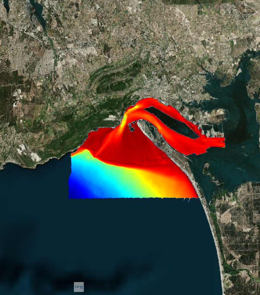
Bathymetric data resulting from hydrographic surveys for cartographic purposes and/or port management. Surveys carried out in accordance with the IHO S-44 standard.
-
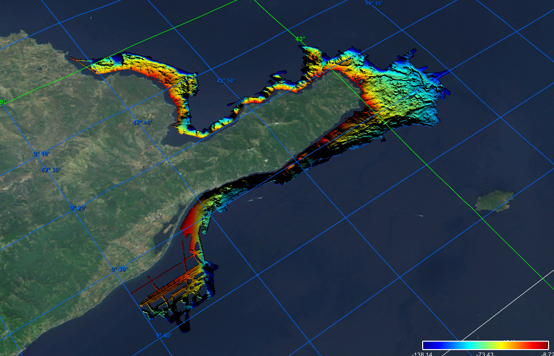
Grid processed in the framework of EMODnet Bathymetry HRSM, October 2020