 Metadata catalogue
Marum - Center for Marine Environmental Sciences, University of Bremen
Type of resources
Available actions
Topics
INSPIRE themes
Keywords
Contact for the resource
Provided by
Years
Formats
Representation types
Scale
Resolution
-

Bathymetry data was acquired during R/V MARIA S. MERIAN cruise MSM44 in the northeastern Baffin Bay between 30.06.2015 and 30.07.2015. The cruise carried out multidisciplinary research in order to investigate the deglaciation history of the Greenland Ice Sheet (GIS). To research the involved ocean, cryosphere and climate processes and feedbacks and to address the complex spatial and temporal distribution patterns of the marine GIS terminations in the northeast Baffin Bay, RV MARIA S. MERIAN visited sites in the Davis Strait, the Uumannaq Trough, and the Melville Bay during expedition MSM44. The objectives were to systematically search for and map glacigenic seafloor features providing information on the maximum extend and retreat histories of ice sheets since the last glacial maximum and during the Holocene. Extensive mapping was conducted due to the fact, that several huge parts of Greenland’s coast are only insufficiently mapped or completely uncharted and thus are barely reliable in concern of navigation and interpretation towards glacigenic features of the last ice ages. CI Citation: Paul Wintersteller (seafloor-imaging@marum.de) as responsible party for bathymetry raw data ingest and approval.
-
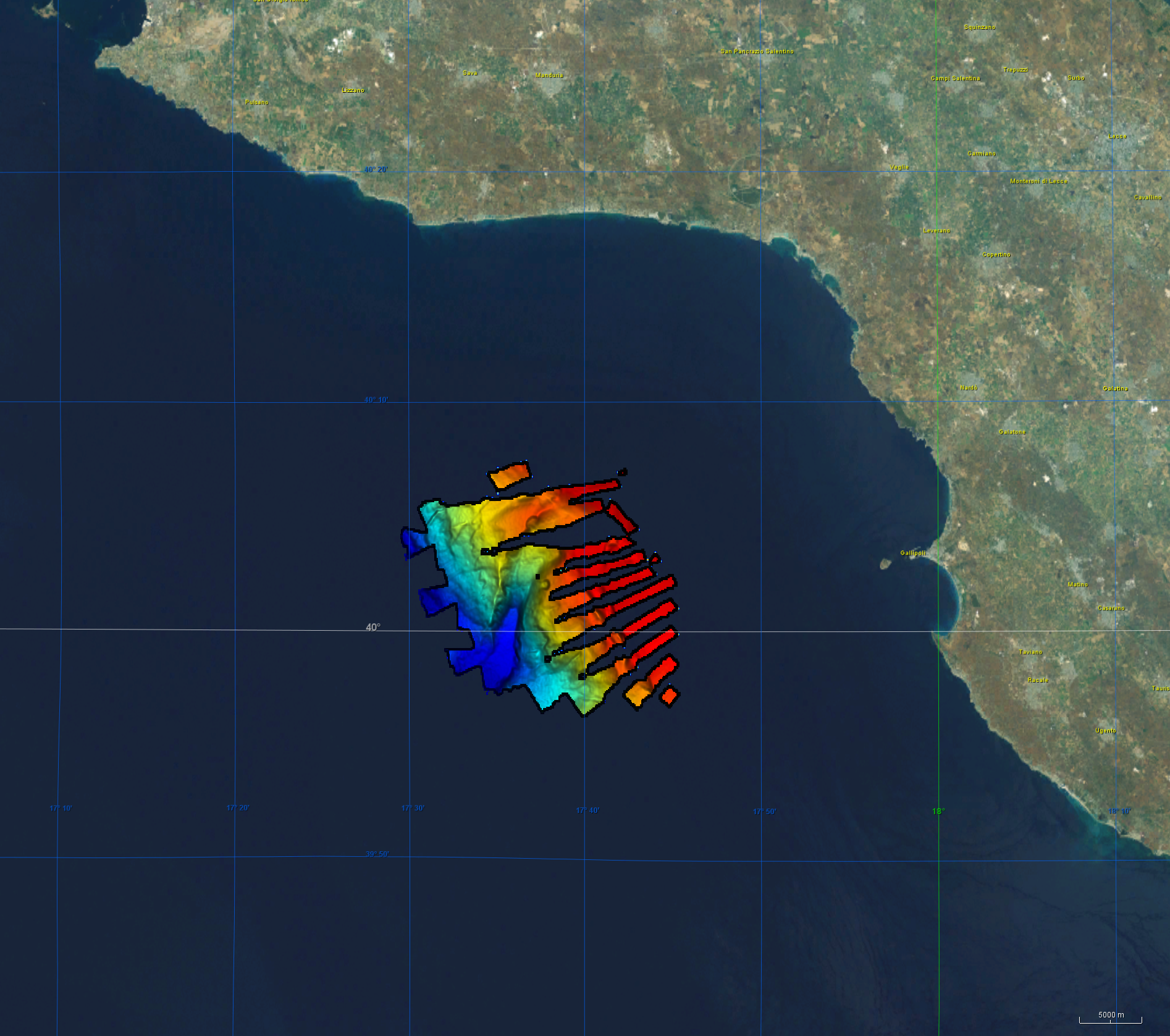
Bathymetry data was acquired during R/V Meteor cruise M144/1 in the aegean region of the Mediterranean Sea between 27.12.2017 and 18.01.2018. The cruise aimed to clarify the causal links between climate and ecosystem change on the one hand by sociocultural evolution on the other hand by climatic and environmental change that can be aligned with the archeological record. CI Citation: Paul Wintersteller (seafloor-imaging@marum.de) as responsible party for bathymetry raw data ingest and approval. Description of data source: During the M144/1 cruise, the hull-mounted KONGSBERG EM122 multibeam ecosounder (MBES) was utilized to perform bathymetric mapping in medium to deep waters. Two linear transducer arrays in a Mills Cross configuration transmit acoustic signals of a nominal sonar frequency of 12 kHz. With 432 soundings per swath, the emission cone has a dimension of max 150° across track and 1° along track. With a reception obtained from 288 beams, the actual beam footprint is 1° by 2°. Depending on the roughness of the seafloor and the water depth, the swath width on a flat bottom is maximum six times the water depth. For further information on the system, consult https://www.km.kongsberg.com/. The position and depth of the water column is estimated for each beam by using the detected two-way-travel time and the beam angle, ray-traced through the water column, utilizing a proper sound speed profile. Throughout this cruise the swath width was mainly at 120° and did not exceed 130°. Responsible person during this cruise / PI: unstated.
-

The "EMODnet Digital Bathymetry (DTM)- 2018" is a multilayer bathymetric product for Europe’s sea basins covering: • the Greater North Sea, including the Kattegat and stretches of water such as Fair Isle, Cromarty, Forth, Forties,Dover, Wight, and Portland • the English Channel and Celtic Seas • Western Mediterranean, the Ionian Sea and the Central Mediterranean Sea • Iberian Coast and Bay of Biscay (Atlantic Ocean) • Adriatic Sea (Mediterranean) • Aegean - Levantine Sea (Mediterranean). • Madeira and Azores (Macaronesia) • Baltic Sea • Black Sea • Norwegian and Icelandic Seas • Canary Islands (Macaronesia) • Arctic region and Barentz Sea The DTM is based upon more than 9400 bathymetric survey data sets and Composite DTMs that have been gathered from 49 data providers from 24 countries riparian to European seas. Also Satellite Derived Bathymetry data products have been included derived from Landsat 8 satellite images. The source reference layer in the portal viewing service gives metadata of the data sets used with their data providers; the metadata also acknowledges the data originators. The incorporated survey data sets itself can be discovered and requested for access through the Common Data Index (CDI) data discovery and access service that in September 2018 contained > 27.000 survey data sets from European data providers for global waters. The Composite DTMs can be discovered through the Sextant Catalogue service. Both discovery services make use of SeaDataNet standards and services and have been integrated in the EMODnet Bathymetry web portal (http://www.emodnet-bathymetry.eu). In addition, the Bathymetry Viewing and Download service of the EMODnet bathymetry portal gives users wide functionality for viewing and downloading the EMODnet digital bathymetry such as: • water depth (refering to the Lowest Astronomical Tide Datum - LAT) in gridded form on a DTM grid of 1/16 * 1/16 arc minute of longitude and latitude (ca 115 * 115 meters) • option to view depth parameters of individual DTM cells and references to source data • option to download DTM in 64 tiles in different formats: EMO, EMO (without GEBCO data), ESRI ASCII, ESRI ASCII Mean Sea Level, XYZ, NetCDF (CF), RGB GeoTiff and SD • option to visualize the DTM in 3D in the browser without plug-in • layer with a number of high resolution DTMs for coastal regions • layer with wrecks from the UKHO Wrecks database. The EMODnet DTM is also available by means of OGC web services (WMS, WFS, WCS, WMTS), which are specified at the EMODnet Bathymetry portal. The original datasets themselves are not distributed but described in the metadata services, giving clear information about the background survey data used for the DTM, their access restrictions, originators and distributors and facilitating requests by users to originator.
-
The "EMODnet Digital Bathymetry (DTM)- 2020" is a multilayer bathymetric product for Europe’s sea basins covering: • the Greater North Sea, including the Kattegat and stretches of water such as Fair Isle, Cromarty, Forth, Forties,Dover, Wight, and Portland • the English Channel and Celtic Seas • Western Mediterranean, the Ionian Sea and the Central Mediterranean Sea • Iberian Coast and Bay of Biscay (Atlantic Ocean) • Adriatic Sea (Mediterranean) • Aegean - Levantine Sea (Mediterranean). • Madeira and Azores (Macaronesia) • Baltic Sea • Black Sea • Norwegian and Icelandic Seas • Canary Islands (Macaronesia) • Arctic region and Barentz Sea The DTM is based upon more than 16360 bathymetric survey data sets and Composite DTMs that have been gathered from 49 data providers from 24 countries riparian to European seas. Also Satellite Derived Bathymetry data products have been included derived from Landsat 8 and Sentinel satellite images. Areas not covered by observations are completed by integrating GEBCO 2020 and IBCAO V4. The source reference layer in the portal viewing service gives metadata of the data sets used with their data providers; the metadata also acknowledges the data originators. The incorporated survey data sets itself can be discovered and requested for access through the Common Data Index (CDI) data discovery and access service that in December 2020 contained > 30.000 survey data sets from European data providers for global waters. The Composite DTMs can be discovered through the Sextant Catalogue service. Both discovery services make use of SeaDataNet standards and services and have been integrated in the EMODnet Bathymetry web portal (http://www.emodnet-bathymetry.eu). In addition, the Bathymetry Viewing and Download service of the EMODnet bathymetry portal gives users wide functionality for viewing and downloading the EMODnet digital bathymetry such as: • water depth (refering to the Lowest Astronomical Tide Datum - LAT) in gridded form on a DTM grid of 1/16 * 1/16 arc minute of longitude and latitude (ca 115 * 115 meters). • option to view depth parameters of individual DTM cells and references to source data • option to download DTM in 64 tiles in different formats: ESRI ASCII, XYZ, EMODnet CSV, NetCDF (CF), GeoTiff and SD • option to visualize the DTM in 3D in the browser without plug-in • layer with a number of high resolution DTMs for coastal regions • layer with wrecks from the UKHO Wrecks database. The EMODnet DTM is also available by means of OGC web services (WMS, WFS, WCS, WMTS), which are specified at the EMODnet Bathymetry portal. The original datasets themselves are not distributed but described in the metadata services, giving clear information about the background survey data used for the DTM, their access restrictions, originators and distributors and facilitating requests by users to originator.
-
The "EMODnet Digital Bathymetry (DTM) - 2018" is a multilayer bathymetric product for Europe’s sea basins covering: • the Greater North Sea, including the Kattegat and stretches of water such as Fair Isle, Cromarty, Forth, Forties,Dover, Wight, and Portland • the English Channel and Celtic Seas • Western Mediterranean, the Ionian Sea and the Central Mediterranean Sea • Iberian Coast and Bay of Biscay (Atlantic Ocean) • Adriatic Sea (Mediterranean) • Aegean - Levantine Sea (Mediterranean). • Madeira and Azores (Macaronesia) • Baltic Sea • Black Sea • Norwegian and Icelandic Seas • Canary Islands (Macaronesia) • Arctic region and Barentz Sea The DTM is based upon more than 9400 bathymetric survey data sets and Composite DTMs that have been gathered from 49 data providers from 24 countries riparian to European seas. Also Satellite Derived Bathymetry data products have been included derived from Landsat 8 satellite images. The source reference layer in the portal viewing service gives metadata of the data sets used with their data providers; the metadata also acknowledges the data originators. The incorporated survey data sets itself can be discovered and requested for access through the Common Data Index (CDI) data discovery and access service that in September 2018 contained > 27.000 survey data sets from European data providers for global waters. This discovery service makes use of SeaDataNet standards and services and have been integrated in the EMODnet portal (https://emodnet.ec.europa.eu/en/bathymetry#bathymetry-services ). The Composite DTMs are described using the Sextant Catalogue Service that makes also use of SeaDataNet standards and services. Their metadata can be retrieved through interrogating the Source Reference map in the Central Map Viewing service (https://emodnet.ec.europa.eu/geoviewer/ ). In addition, the EMODnet Map Viewer gives users wide functionality for viewing and downloading the EMODnet digital bathymetry such as: • water depth (refering to the Lowest Astronomical Tide Datum - LAT) in gridded form on a DTM grid of 1/16 * 1/16 arc minute of longitude and latitude (ca 115 * 115 meters) • option to view depth parameters of individual DTM cells and references to source data • option to download DTM in 58 tiles in different formats: EMO, EMO (without GEBCO data), ESRI ASCII, ESRI ASCII Mean Sea Level, XYZ, NetCDF (CF), RGB GeoTiff and SD • option to visualize the DTM in 3D in the browser without plug-in • layer with a number of high resolution DTMs for coastal regions • layer with wrecks from the UKHO Wrecks database. The EMODnet DTM is also available by means of OGC web services (WMS, WFS, WCS, WMTS), which are specified at the EMODnet Bathymetry portal. The original datasets themselves are not distributed but described in the metadata services, giving clear information about the background survey data used for the DTM, their access restrictions, originators and distributors and facilitating requests by users to originator.