 Metadata catalogue
Marine Geosciences Org.
Type of resources
Available actions
Topics
Keywords
Contact for the resource
Provided by
Years
Formats
-
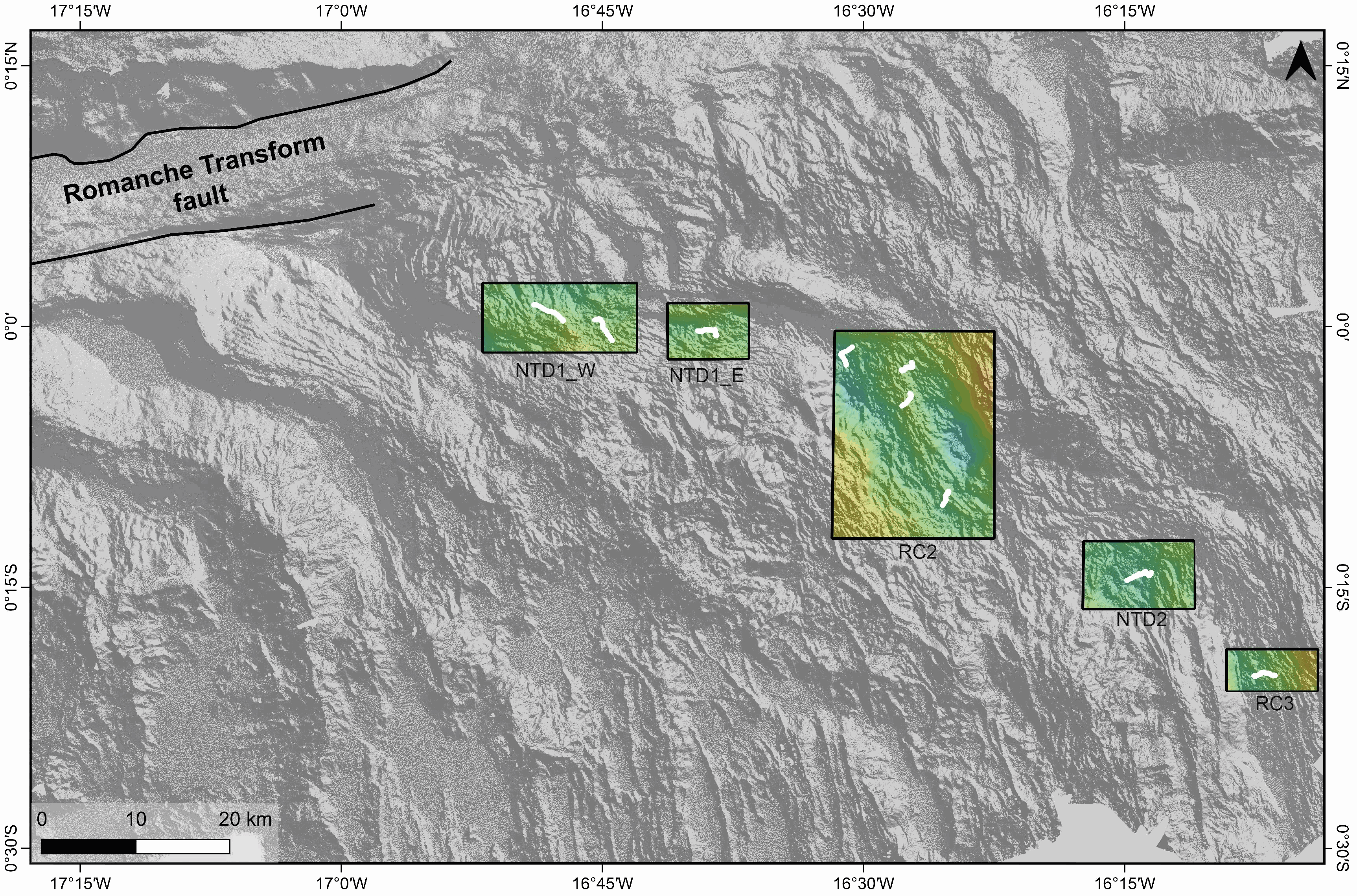
Gridded shipboard multibeam bathymetry and backscatter mosaics along the axis of the Mid-Atlantic Ridge. The used data are part of the dataset acquired during the SMARTIES cruise (2019). The gridded datasets cover different portions of the axis of the Mid-Atlantic Ridge south of the Romanche transform fault. Bathymetry grids format: nf = GMT netCDF format (32-bit float), CF-1.7 area NTD1_W grid information: x_min: -16.8647 x_max: -16.716917313 x_inc: 0.000180003272838 name: x n_columns: 822 y_min: -0.0246146868 y_max: 0.0418 y_inc: 0.000179985601084 name: y n_rows: 370 area NTD1_E grid information: x_min: -16.6878 x_max: -16.6098585829 x_inc: 0.000180003272748 name: x n_columns: 434 y_min: -0.0313156947 y_max: 0.0225 y_inc: 0.000179985601003 name: y n_rows: 300 area RC2 grid information: x_min: -16.5302 x_max: -16.3748571756 x_inc: 0.000180003272769 name: x n_columns: 864 y_min: -0.2029041037 y_max: -0.0042 y_inc: 0.000179985601178 name: y n_rows: 1105 area NTD2 grid information: x_min: -16.29 x_max: -16.183078056 x_inc: 0.000180003272727 name: x n_columns: 595 y_min: -0.2707547876 y_max: -0.2056 y_inc: 0.000179985601105 name: y n_rows: 363 area RC3 grid information: x_min: -16.1522 x_max: -16.065078416 x_inc: 0.000180003272727 name: x n_columns: 485 y_min: -0.3490268035 y_max: -0.30907 y_inc: 0.000179985601351 name: y n_rows: 223
-
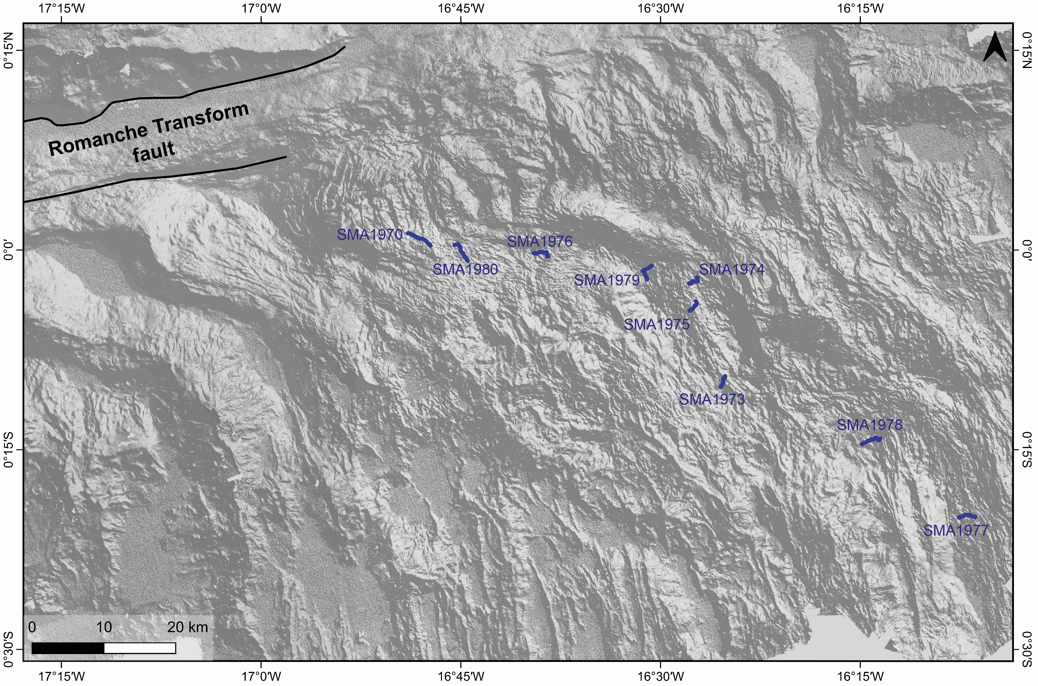
Videos recorded during the SMARTIES cruise with the Nautile cameras (fixed and mobile) during dives along the axial domain of the Mid-Atlantic Ridge south of Romanche transform fault. The following dives are part of this datatset: - SMA-1970 - SMA-1973 - SMA-1974 - SMA-1975 - SMA-1976 - SMA-1977 - SMA-1978 - SMA-1979 - SMA-1980 These videos illustrate different volcanic structures along the neo-volcanic zone of the ridge axis. The dives explored two non-transform discontinuities and two ridge segments between Romanche and Chain transform faults (RC-2 and RC-3). Dives SMA-1970 , SMA-1976 and SMA-1980 explored volcanic formations inside a large non-transform discontinuity between segments RC-1 and RC-2. Dive SMA-1978 explored the floor of the discontinuity between segments RC-2 and RC-3. Dives SMA-1973, SMA-1974, SMA-1975 and SMA-1979 explored different parts of the neo-volcanic ridge of segment RC-2. Dive SMA-1977 explored volcanic formations in the northern part of segment RC-3. The detailed study of these videos were published in Grenet et al., 2023 associated paper.
-
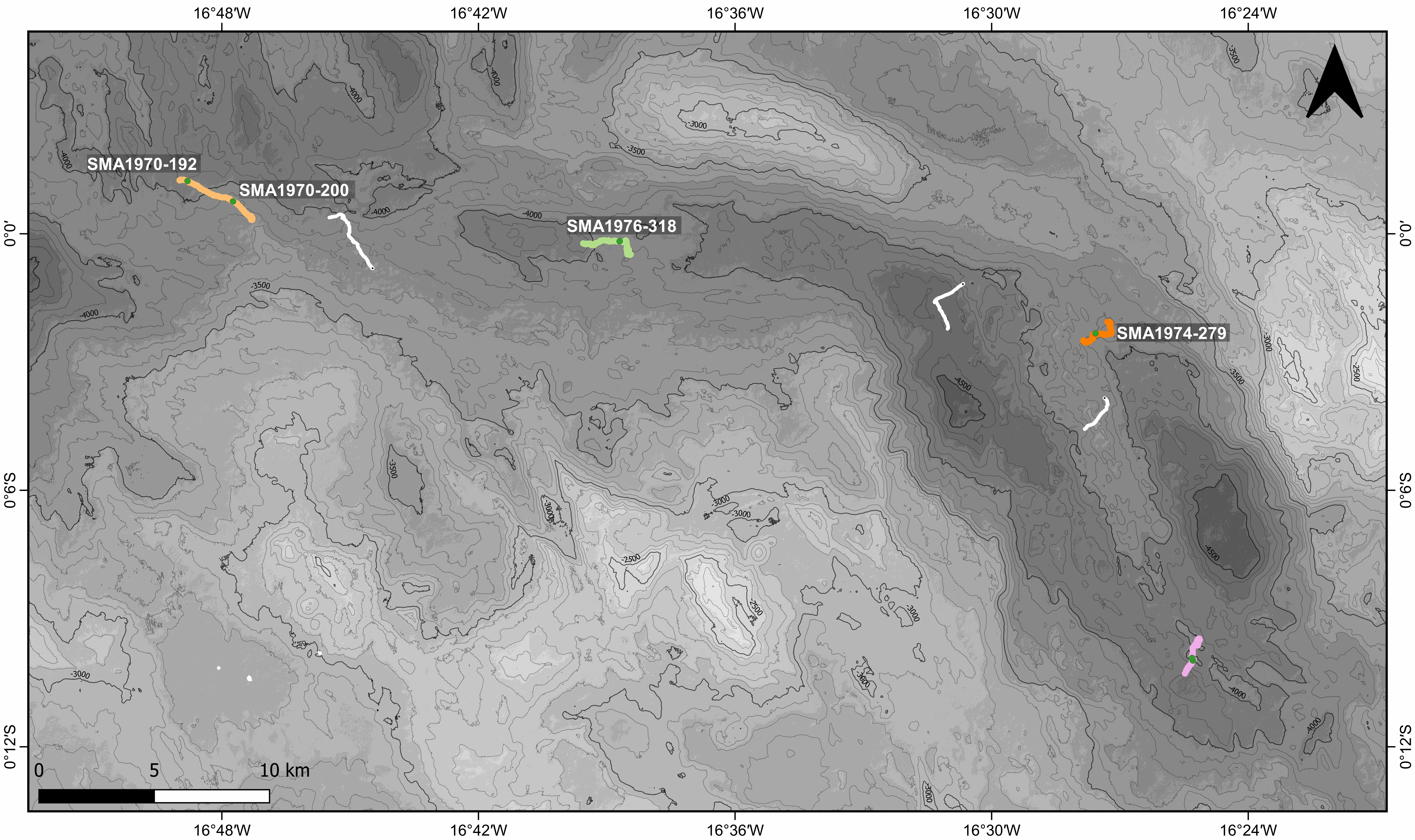
Ages obtained through the 40Ar/39Ar method for basalt samples with the Nautile submersible along the axis of the Mid-Atlantic Ridge south of the Romanche transform fault. Major elements measurements were performed on the same samples. For a complete description of the method and discussion of results, please refer to the Grenet et al. 2023 article.