 Metadata catalogue
Ifremer, Marine Geosciences
Type of resources
Available actions
Topics
INSPIRE themes
Keywords
Contact for the resource
Provided by
Years
Formats
Representation types
Scale
Resolution
-
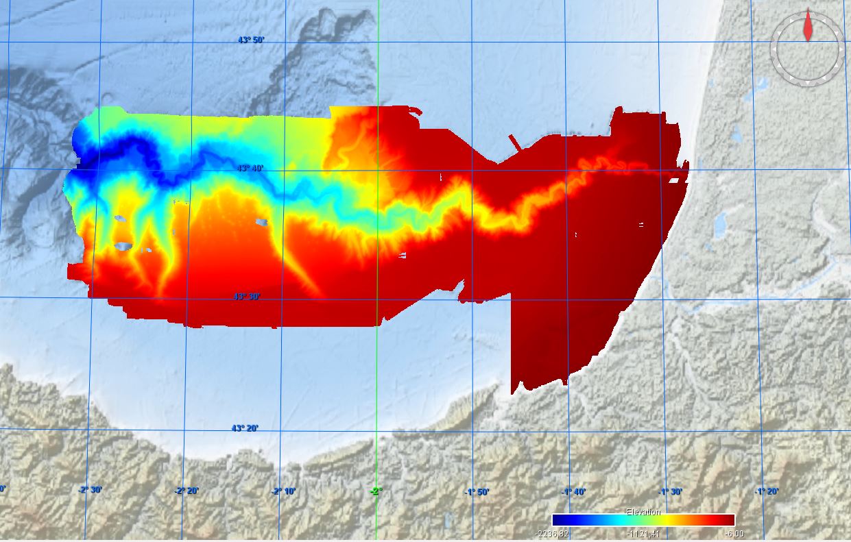
Conversion into the EMODnet format of the published grid for the Capbreton Canyon in 2007: http://dx.doi.org/10.12770/72e2f750-c255-11df-a9b6-005056987263
-
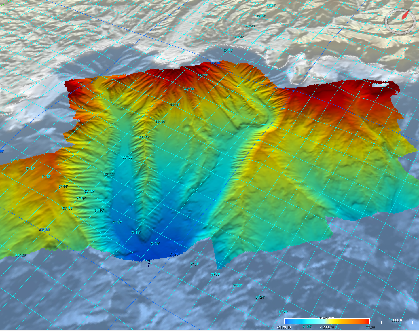
Grid processed for the purpose of the HR DTMs layer of EMODnet Bathymetry HRSM, October 24
-
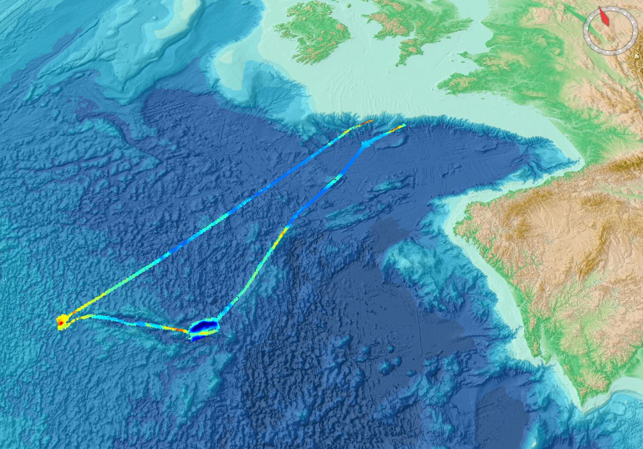
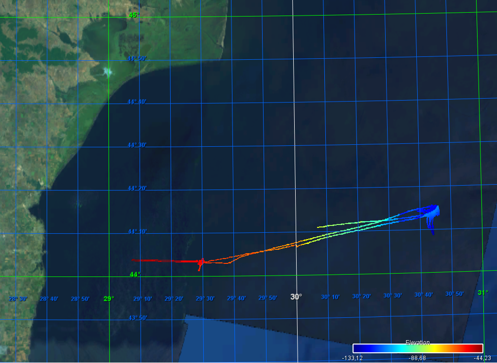
Gridded data for the ESS-ULYX-PP-2023-2 cruise.
-

Gridded multibeam data acquired during scientific surveys and transits of French research vessels from 1992 to 2017 off the French Caribbean Islands.
-

Grid processed for the purpose of the HR DTMs layer of EMODnet Bathymetry HRSM, October 2024
-
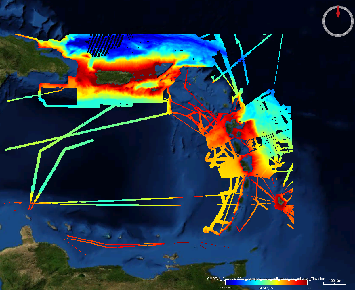
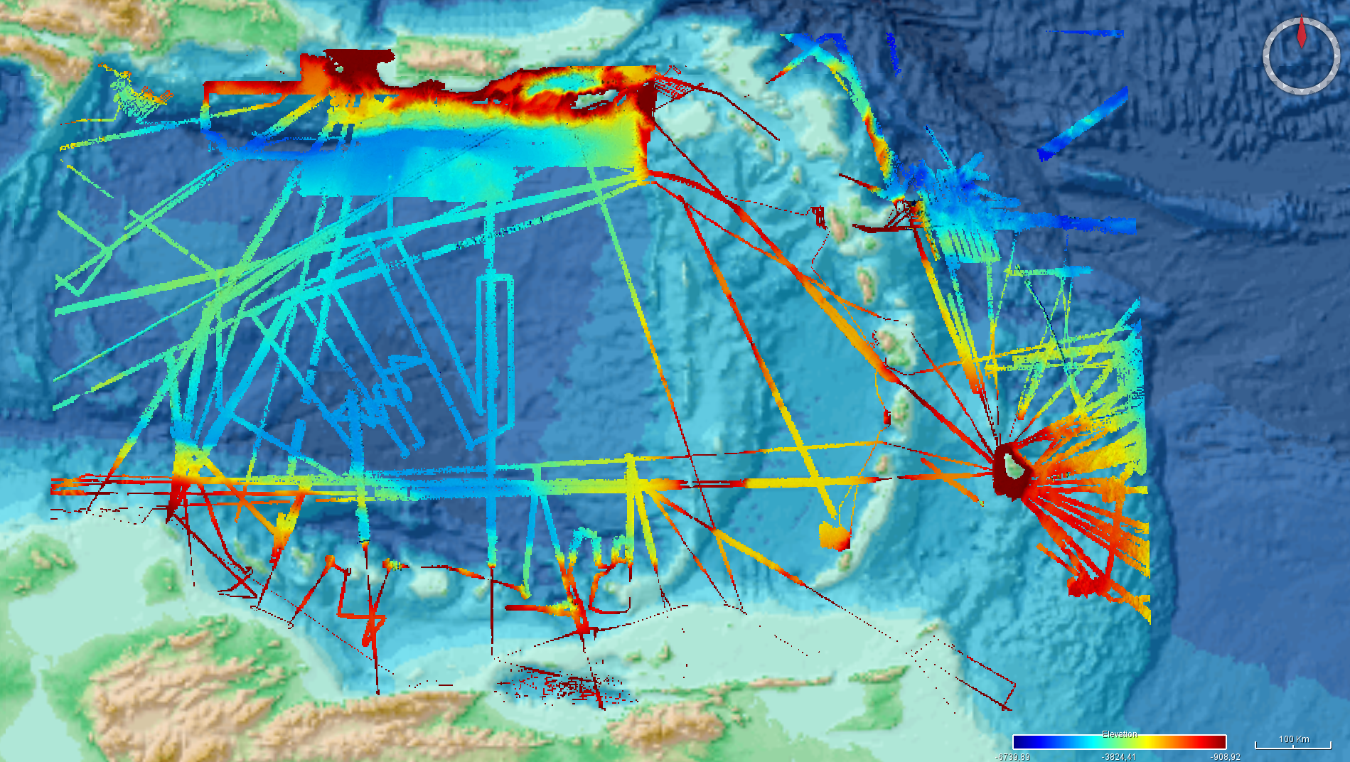
Ryan, W.B.F., S.M. Carbotte, J.O. Coplan, S. O'Hara, A. Melkonian, R. Arko, R.A. Weissel, V. Ferrini, A. Goodwillie, F. Nitsche, J. Bonczkowski, and R. Zemsky (2009), Global Multi-Resolution Topography synthesis, Geochem. Geophys. Geosyst., 10, Q03014, doi: 10.1029/2008GC002332 Extraction of the GMRT grid for the Caribbean region of EMODnet bathymetry. The extraction is updated in June 2024. GMRT overview from https://www.gmrt.org/about/index.php The Global Multi-Resolution Topography (GMRT) Synthesis is a multi-resolution Digital Elevation Model (DEM) maintained in three projections and managed with a scalable global architecture that offers infrastructure for accessing the DEM as grids, images, points and profiles. A mask layer is available that highlights the location of high-resolution data. Most curatorial effort for GMRT is focused on cleaning and processing ship-based multibeam sonar data acquired by the US Academic Research Fleet (ARF) so they can be gridded at their full spatial resolution (~100m in the deep sea). These data are seamlessly overlain on lower resolution observed and predicted bathymetry data and are integrated with terrestrial elevation data to deliver to users the best resolution data that have been curated for a particular area area of interest.
-
During a cruise within the ENVRI+ Project WP4, a joint pilot experiment to measure methane transfer from the seafloor to the atmosphere, bathymetry was recorded using a hull-mountes Elac Seabeam 1050 multibeam system. https://doi.org/10.1594/PANGAEA.913704 Cruise of the R/V Mare Nigrum vessel (https://www.eurofleets.eu/vessel/rv-mare-nigrum/)
-
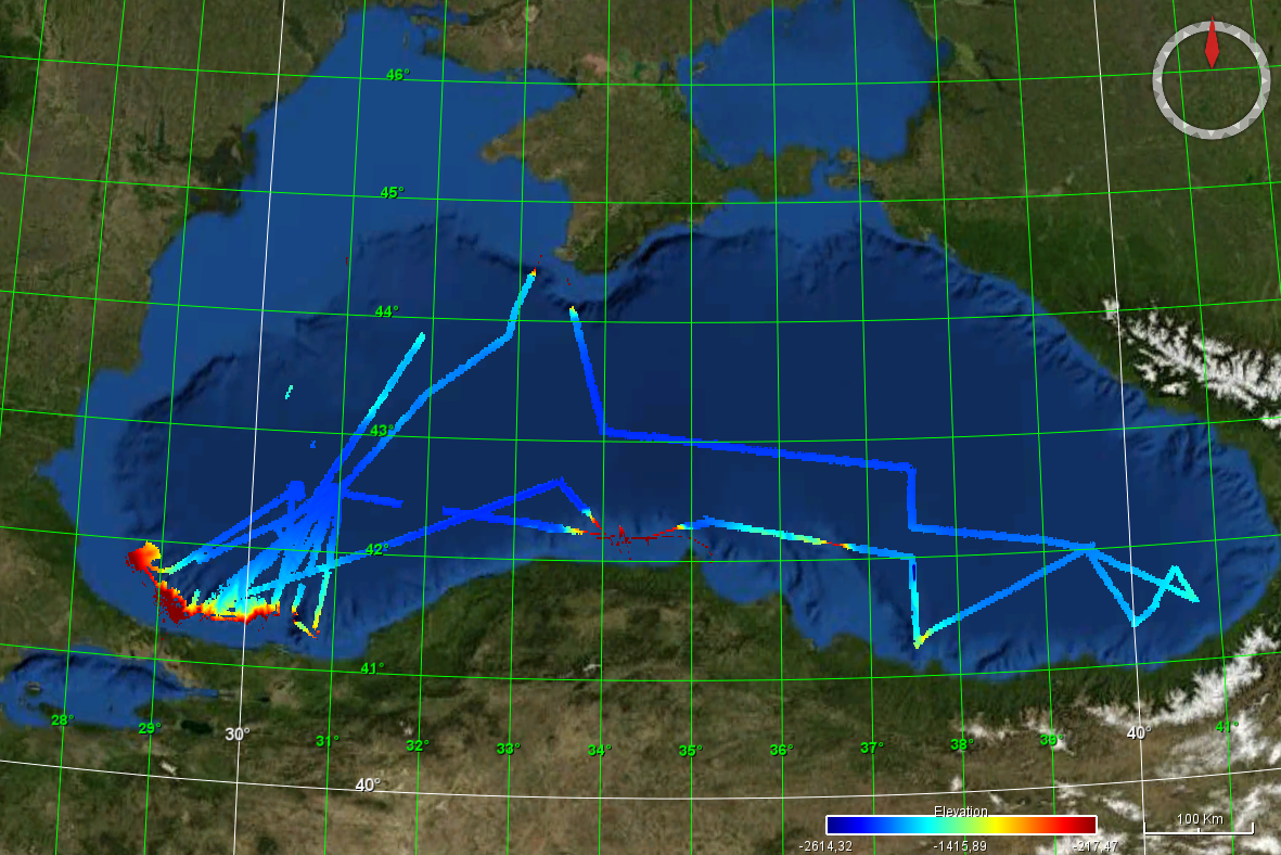
Ryan, W.B.F., S.M. Carbotte, J.O. Coplan, S. O'Hara, A. Melkonian, R. Arko, R.A. Weissel, V. Ferrini, A. Goodwillie, F. Nitsche, J. Bonczkowski, and R. Zemsky (2009), Global Multi-Resolution Topography synthesis, Geochem. Geophys. Geosyst., 10, Q03014, doi: 10.1029/2008GC002332 Extraction of the GMRT grid for the Black Sea region of EMODnet bathymetry. GMRT overview from https://www.gmrt.org/about/index.php The Global Multi-Resolution Topography (GMRT) Synthesis is a multi-resolution Digital Elevation Model (DEM) maintained in three projections and managed with a scalable global architecture that offers infrastructure for accessing the DEM as grids, images, points and profiles. A mask layer is available that highlights the location of high-resolution data. Most curatorial effort for GMRT is focused on cleaning and processing ship-based multibeam sonar data acquired by the US Academic Research Fleet (ARF) so they can be gridded at their full spatial resolution (~100m in the deep sea). These data are seamlessly overlain on lower resolution observed and predicted bathymetry data and are integrated with terrestrial elevation data to deliver to users the best resolution data that have been curated for a particular area area of interest.
-
The grid is extracted from the NCEI Bathymetry Data Viewer, using the "Grid Extract" tools. https://www.ncei.noaa.gov/maps/bathymetry/
-
The grid is extracted from the NCEI Bathymetry Data Viewer, using the "Grid Extract" tools. https://www.ncei.noaa.gov/maps/bathymetry/