 Metadata catalogue
GEMS Survey Ltd
Type of resources
Topics
INSPIRE themes
Keywords
Contact for the resource
Provided by
Years
Formats
Representation types
Scale
Resolution
-
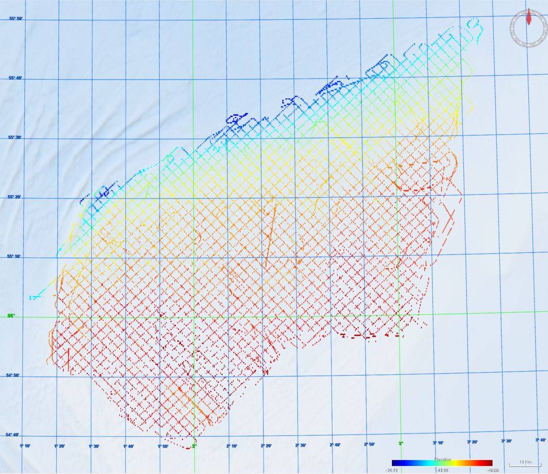
GEMS Survey Ltd. (GEMS) were contracted by Forewind Limited to undertake a bathymetric and geophysical survey of the Tranche A development area and two met mast locations (which were later revised) within the Dogger Bank Zone, in addition to a cable reconnaissance from Tranche A to the Yorkshire coastline. The primary objectives of the survey were to produce sufficiently high resolution bathymetric and geophysical data and interpretations to allow regional interpretation for planning and modelling purposes; for met mast design to commence and to provide high quality data to inform further benthic and environmental surveys. This survey was carried out between 8 July 2010 and 26 December 2010. The vertical datum for this project is LAT using predicted tides. This metadata relates to the bathymetric datasets. The surveys were undertaken onboard the MV Aquarius and MV Kommandor Jack.