 Metadata catalogue
ENS, CNRS UMR 8538, Paris, France
Type of resources
Available actions
Topics
Keywords
Contact for the resource
Provided by
Years
Formats
-
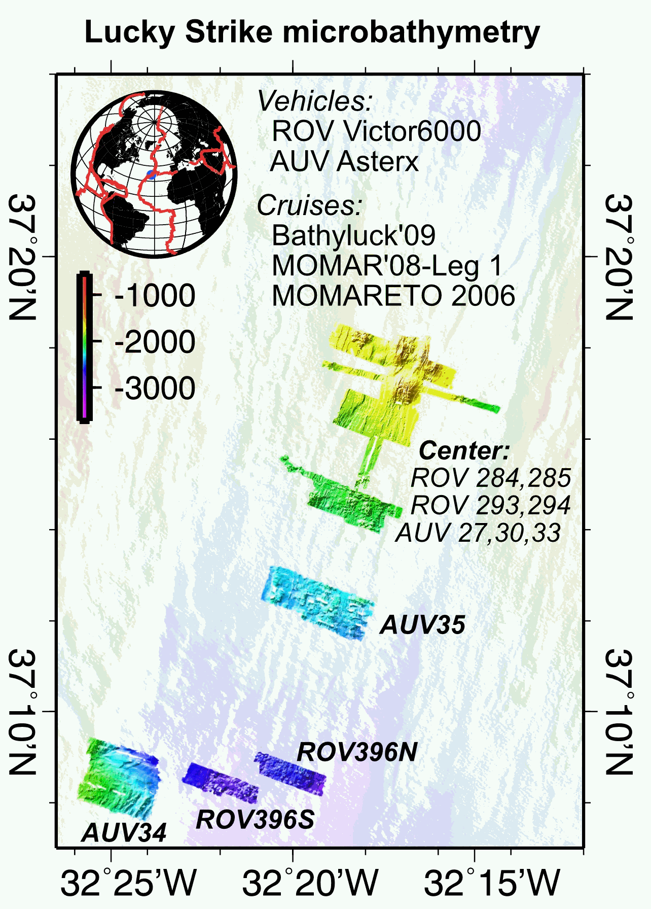
Multibeam near-bottom bathymetry from the Lucky Strike ridge segment along the Mid-Atlantic Ridge. The bathymetry data were acquired during AUV Asterx and ROV Victor6000 surveys during three different cruises (MOMARETO 2006, MOMAR'08-Leg1, & BATHYLUCK'09). The dataset includes a central grid (LuckyStrike_microbathymetry_Centre) that combines data from several AUV and ROV dives, and where original bathymetry grids for each dive have been manually shifted and combined into a single grid, using other datasets (shipboard bathymetry, acoustic sonar data from the Lustre'96 data) for geographical reference. The rest of the grids are from individual ROV or AUV dives. All grids are provided in NETCDF GMT .grd format, and with two associated GEOTIFFS with both the bathymetry DEM and the hillside (illumination) file. All grids are given in WGS84 (WGS 84 - WGS84 - EPSG:4326).
-
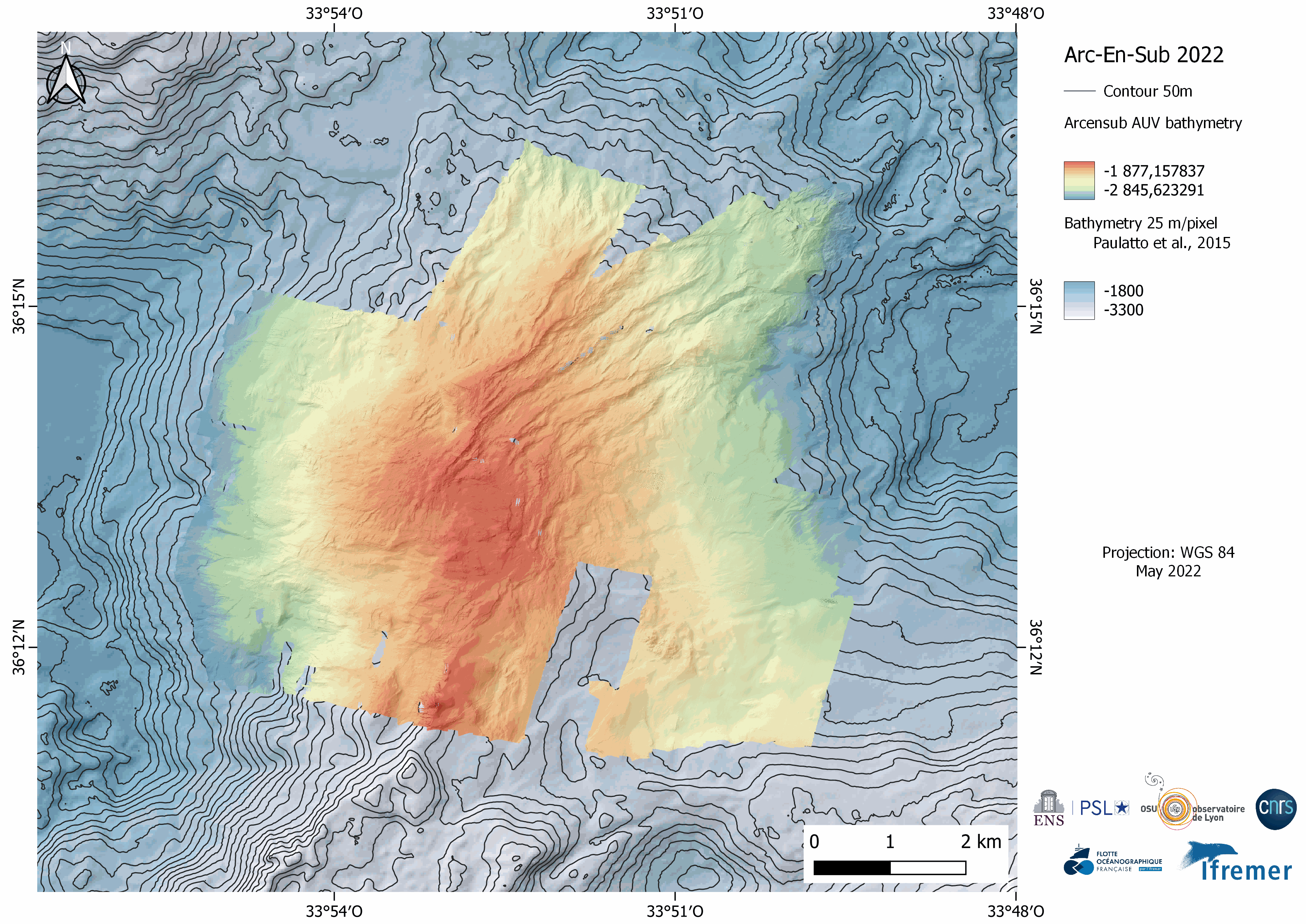
Near-bottom multibeam bathymetry and acoustic backscatter acquired at the Rainbow Massif (Mid-Atlantic Ridge). High-resolution bathymetry data (2 m/pixel) were acquired by the autonomous underwater vehicle (AUV) IdefX, deployed during the ARC-EN-SUB (https://doi.org/10.17600/18000663) cruise in May 2022. The dataset consists of grids for each individual AUV dive, as well as a global grid merging the ten completed dives. This global grid was obtained by manually shifting and combining original bathymetric grids of each dive using other datasets (primarily shipboard bathymetry from Paulatto et al. [2015]) for geographical reference. The combined grid shows the inter-dive shift artefacts, absent in the individual dive grids. Elevation grids are provided for each AUV dive without interpolation (fillgap 0), with medium (fillgap 3) and high (fillgap 15) interpolation.Acoustic backscatter grids are edited without interpolation (fillgap 0). All grids are provided in NETCDF GMT .grd format, and with two associated GEOTIFFS with the bathymetry DEM, the acoustic backscatter, and the hillshade (illumination) file. All grids are given in WGS84 (WGS 84 - WGS84 - EPSG:4326), in projection Mercator.