 Metadata catalogue
Department of Geology, University of Athens, Panepistimioupoli Zografou, 157 84 Athens, Greece
Type of resources
Available actions
Topics
Keywords
Contact for the resource
Provided by
Years
Formats
-
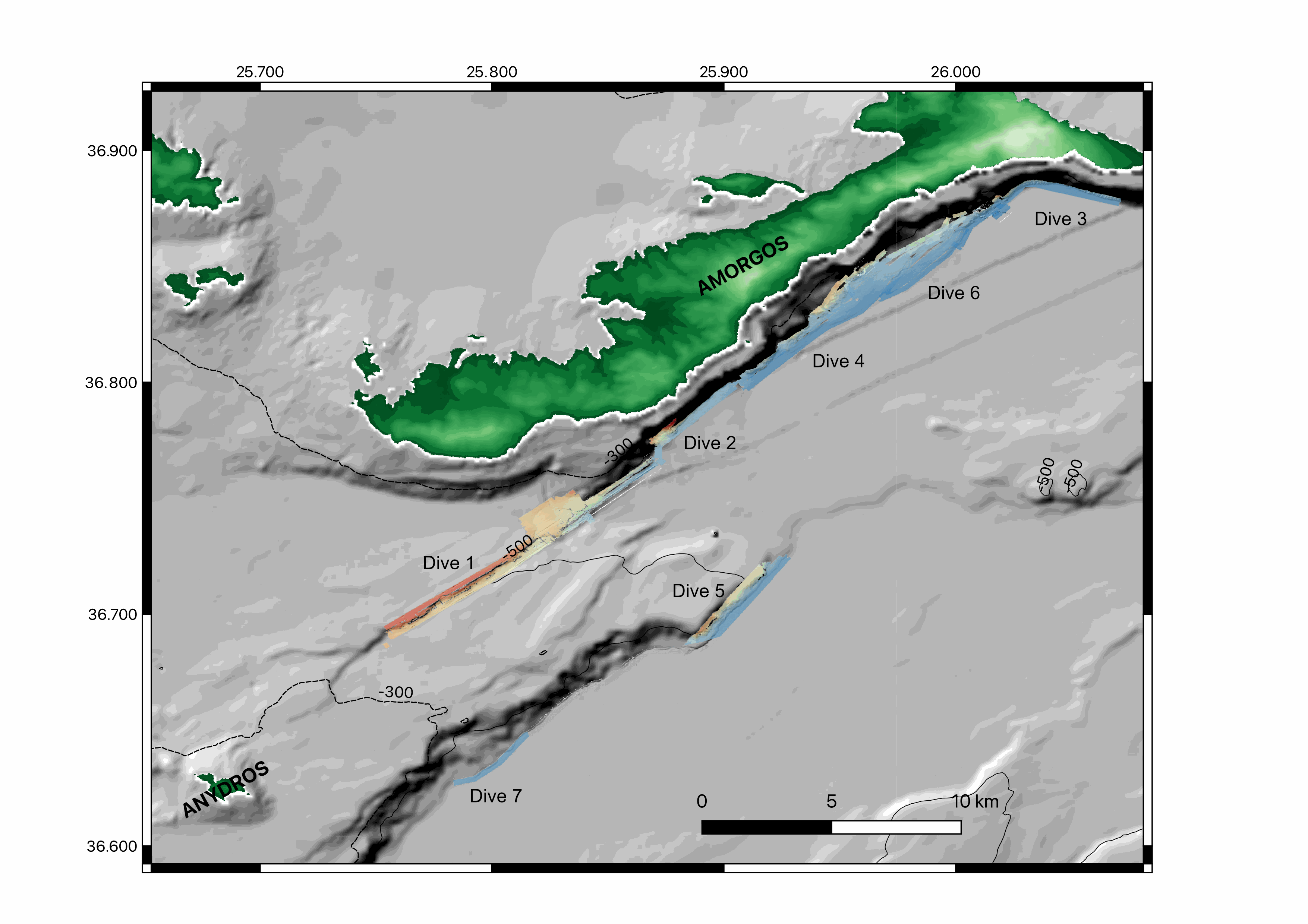
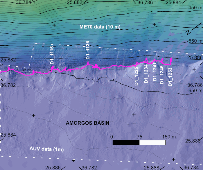
Near-bottom multibeam bathymetry and back-scatter data acquired along the Amorgos and Santorini-Amorgos faults, in the Aegean sea. High-resolution bathymetry data (1 m/pixel) were acquired by the autonomous underwater vehicle (AUV) IdefX, deployed during the AMORGOS-22 cruise (https://doi.org/10.17600/18001479) with the MBES EM2040. The dataset consists of six DEMs as well as fourteen back-scatter mosaics (i.e. two versions for each dives, raw and processed (compention of the antenna diagram)). In addition, a DEM extracted from dive 2 is provided. The bathymetric data were processed with GLOBE, while the back-scatter data were processed with Sonarscope. Renavigation of the vehicule was necessary during processing and is applied to both the bathymetric grids and backscatter mosaics. Files are provided in TIF format, projected in UTM 35 N (WGS 84).
-
The AMORGOS-23 cruise (https://doi.org/10.17600/18003211) was conducted onboard R/V Europe from April 26th 2023 to May 9th 2023. Using HROV Ariane equipped with 4K cameras, we surveyed the main active faults between Amorgos and Anafi islands in order to identify and quantify recent deformation of the seafloor linked to the 1956 Amorgos earthquake. During dive 244-1, we surveyed the steepest scarp of the Amorgos fault, along its central segment. We provide here seven scaled Digital Outcrop Models (in .obj format) calculated from the HROV videos with MATISSE 3D software. There location (model origin) is also provided in a table, together with information about the portions of the videos used to produce the models. Due to incomplete navigation data, the models are not properly oriented.