 Metadata catalogue
volcanism
Type of resources
Available actions
Topics
Keywords
Contact for the resource
Provided by
Years
Formats
-
AUV photomosaics of the seafloor at the shallow-water Milos hydrothermal system. Photomosaics were acquired with the Sparus II (Iqua, Girona) AUV and constructed from vertically acquired still images. Images were acquired in July 2019 at the Paleochori and Spathi Bays. Photomosaics are provided as geotiffs (UTM Zone 35). This dataset includes both original photomosaics, that show distortions due to AUV navigation drift, and georeferenced photomosaics, that have been registered with the associated drone photomosaics at these same areas.
-
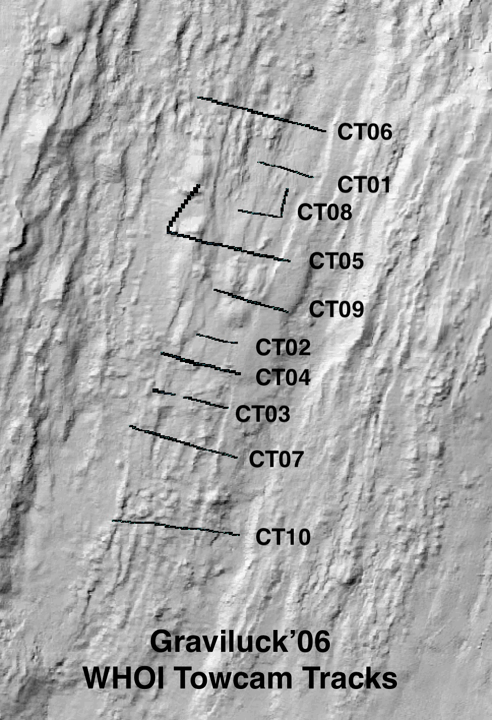
Colour seafloor photomosaics along towed camera tracks crossing the axis of the Lucky Strike ridge segment (Mid Altantic Ridge). Images were acquired with the WHOI TowCam system (https://www.whoi.edu/what-we-do/explore/underwater-vehicles/towed-vehicles/towcam/), during the Graviluck 2016 cruise. Images are process for colour and illumination correction. Images are placed and photomosaiced based on USBL navigation of the TowCam, altitude, and orientation. The datasets include geotiffs for each of the tracks. To be cited: cited: Gini et al. (submitted); Escartin et al. (2008; 2014).
-
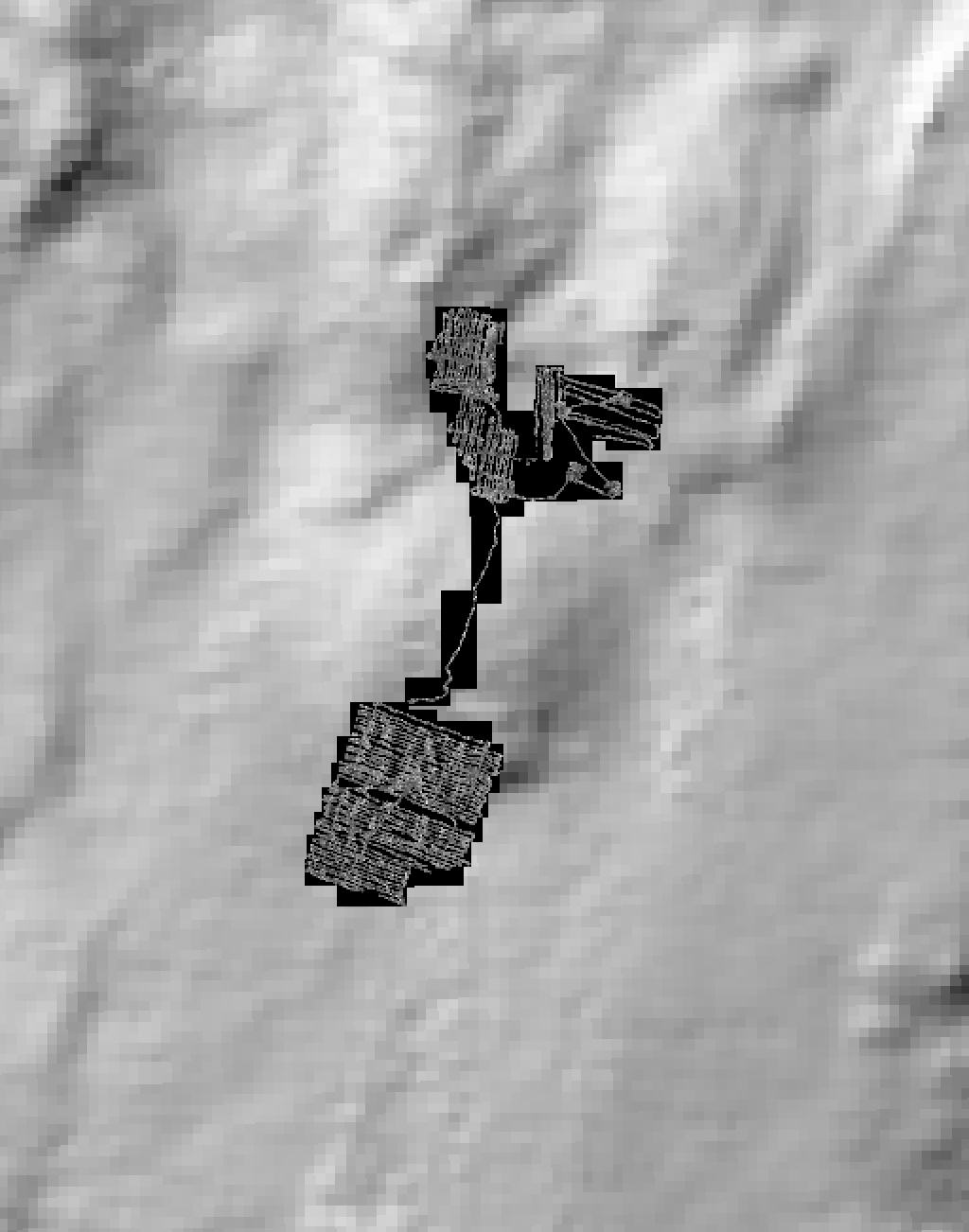
Black and white seafloor photomosaic of the Lucky Strike hydrothermal field and the ridge axis to the South, acquired with VICTOR6000 during the Bathyluck 2009. Individual still images were matched, corrected for uneven illumination, renavigated and blended for a seamless photomosaic. This data release includes partial geotiffs covering the whole surveyed area. To be cited: Gini et al. (submitted); Barreyre et al. (2012); Escartin et al. (2013); Escartín et al. (2015).
-
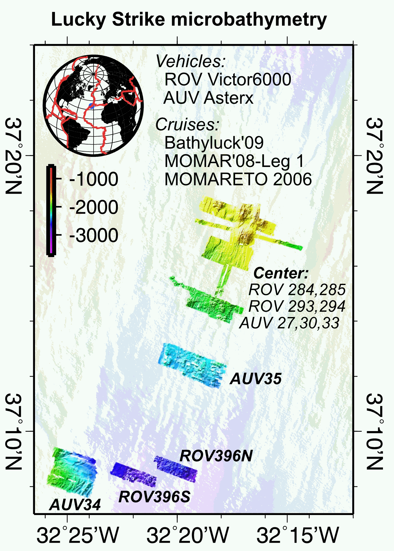
Multibeam near-bottom bathymetry from the Lucky Strike ridge segment along the Mid-Atlantic Ridge. The bathymetry data were acquired during AUV Asterx and ROV Victor6000 surveys during three different cruises (MOMARETO 2006, MOMAR'08-Leg1, & BATHYLUCK'09). The dataset includes a central grid (LuckyStrike_microbathymetry_Centre) that combines data from several AUV and ROV dives, and where original bathymetry grids for each dive have been manually shifted and combined into a single grid, using other datasets (shipboard bathymetry, acoustic sonar data from the Lustre'96 data) for geographical reference. The rest of the grids are from individual ROV or AUV dives. All grids are provided in NETCDF GMT .grd format, and with two associated GEOTIFFS with both the bathymetry DEM and the hillside (illumination) file. All grids are given in WGS84 (WGS 84 - WGS84 - EPSG:4326).
-
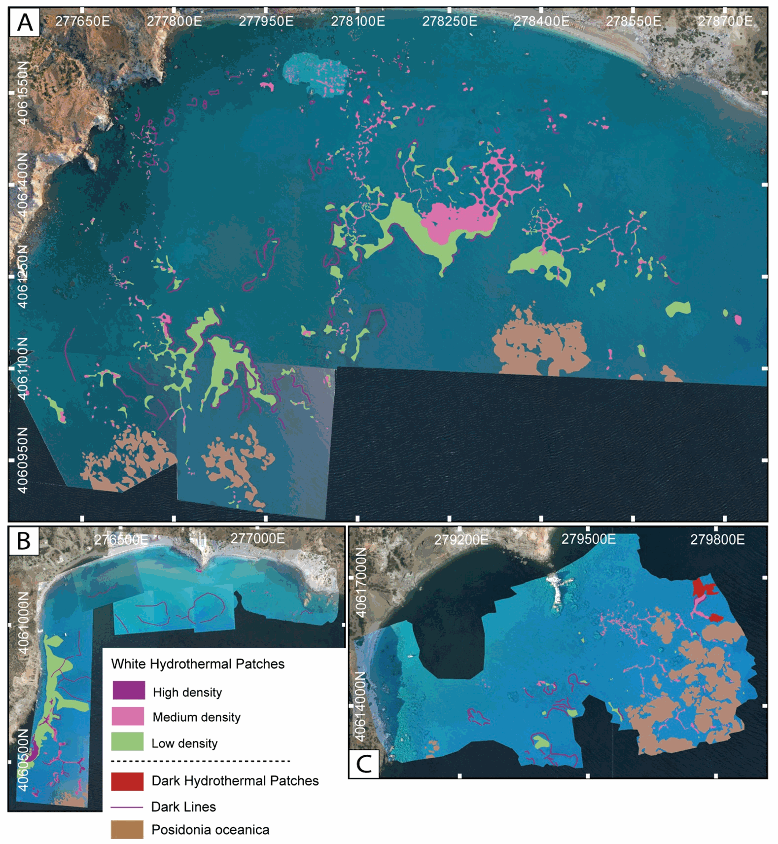
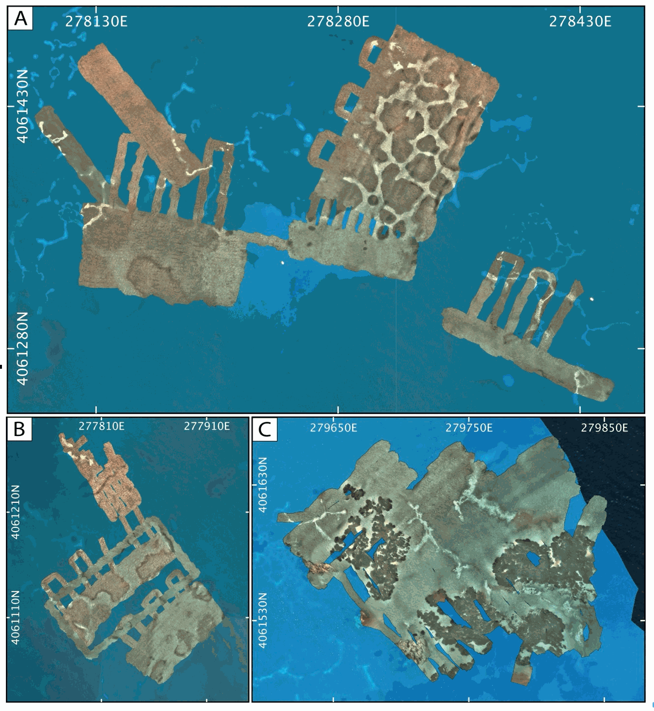
This dataset inscludes shapefiles interpreted from photomosaics over the Milos shallow water hydrothermal system, and instrument locaitons, from fieldwork in July and September 2019. The shapefiles are organized by study areas (Agia Kyria, Paleochori, and Spathi bays). Details are provided in the associated paper (Puzenat et al., 2021) in addition to information in the Readme File associated. a) Shapefiles of seafloor textures interpreted from drone imagery. b) Shapefiles of seafloor texttures interpreted from AUV imagery. c) Shapefiles of instruments deployed in the study area in September 2019.
-
Milos Shallow Water Hydrothermal System: Drone seafloor photomosaics (July/September 2019 fieldwork)
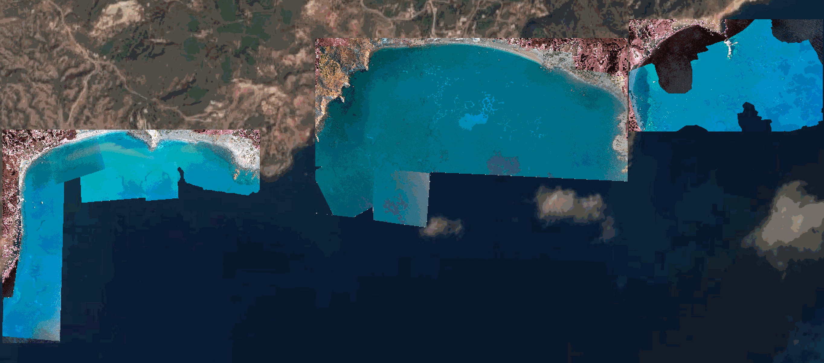
Drone photomosaics of the seafloor at the shallow-water Milos hydrothermal system. Photomosaics were acquired with a Phantom and a Mavic Pro drone. Images were acquired in July and September 2019. Photomosaics are provided as geotiffs (UTM Zone 35).