 Metadata catalogue
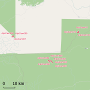
tropical forest
Type of resources
Available actions
Topics
Keywords
Contact for the resource
Provided by
Years
Formats
Representation types
Update frequencies
status
Scale
-

This dataset is contains herbarium specimens collected in the Dzanga-Sangha Reserve in the Central African Republic. These data are collected and used by David Harris at the Royal Botanic Garden Edinburgh, scientific collaboration are welcomed, please get in touch with a point of contact.
-

Geographical database that was used to create the Atlas of endemics of the Western Ghats: distribution of tree species in the evergreen and semi-evergreen forests. There are 352 endemic tree species present in the database spreaded over around 2500 locations, More information about the database is available at http://www.ifpindia.org/ecrire/upload/digital_database/Site/Endemic_Tree_Species/html/main.htm. We have migrated the database into DataManager during the Pl@ntGhats project.
-

This database records the collection of leaf or cambium samples of African plants (mostly Guineo-Congolian forest trees) conserved at the Evolutionary Biology and Ecology Unit of the Université Libre de Bruxelles (team lead by Olivier Hardy) for DNA analyses. The material is used for genetic analyses in the fields of phylogenetics, population genetics and phylogeography. Each sample has a unique identifier in the form of 2-3 letters (most often the initials of a collector) followed by a 4 digit number. A sampe corresponds to one individual plant collected in the field, or sometimes taken from an herbarium voucher conserved in a herbarium collection, which has been identified to species or genus level and geolocated.
-
Geographical distribution of three nuclear clusters (Q1, Q2, Q3) inferred by a Bayesian clustering analysis (STRUCTURE) after evaluating genetic diversity at nine nuSSR over 217 Jacaranda copaia in five regions in the Neotropics (Western Amazonia, Southern Amazonia, Central Amazonia, Guiana Shield, Central America). For more details, see Scotti-Saintagne et al., 2013 Journal of biogeography vol 40 pp 707-719. This work was funded by the EU-funded INCO “SEEDSOURCE” project, by the EU-funded PO-FEDER “ENERGIRAVI” program and the ANR funded Programme “BRIDGE”
-

This data set reports woody plant species abundances in a network of 96 sampling sites spread across 22000 km² in central Western Ghats region, Karnataka, India . The database stores abundance and girth data for 76813 trees and lianas of 446 species collected in 96 sampling sites during 1996-1997. A total of 61965 individuals >10 cm girth at breast height (gbh) were recorded in 96 1-ha macroplots, while 14848 individuals <10 cm gbh but >1 m height were sampled in three 0.1-ha microplots located within each macroplot. Additional data regarding the stand structure (average canopy height, percent canopy cover, number of strata) and the level of degradation are available for the macroplots, along with environmental data derived from other sources and analyses, such as soil types, rainfall, length of the dry season, and altitude. These data have been used to produce ecological research papers as well as to elaborate conservation value maps and recommendations toward sustainable management of the forests of the central Western Ghats region. We have migrated the initial database available at http://esapubs.org/Archive/ecol/E091/216/default.htm to DataManager during the Pl@ntGhats project.
-

Data set on demography of trees monitored over 20 years in Uppangala permanent sample plot (UPSP) in undisturbed, old-growth wet evergreen Dipterocarp forest located within the Pushpagiri Wildlife Sanctuary in India's Western Ghats biodiversity hotspot. During 1989–1990, all trees ≥30 cm girth at breast height (gbh) were sampled in five north–south transects 20 m wide and 180–370 m long covering a total area of 3.12 ha. In 1992–1993, additional rectangular plots were established, bringing the total area sampled to 5.07 ha. In all, 3870 trees were identified, tagged, mapped, and provided with permanent dendrometer bands. Since then, the sampled area has been regularly censused at 3–5-year intervals, recording tree recruitment, mortality, and growth. We present data from censuses conducted in 1990–1993, 1994, 1997–1998, 2001–2002, 2007, and 2010. These data have been used to study the natural forest dynamics and to calibrate spatially explicit simulation models.
-

This database contains botanical records either relating to material present in one of the Naturalis collections, or to material that has been or is being used in research projects. The records usually relate to herbarium specimens, but it also contains data on silica-gel samples, wood samples, spirit collections, carpological collections, etc. rarely to observations only.
-
Africadiv is a network of 1-ha forest monitoring plots spread across the moist forests in central Africa. This dataset holds the biomass calculated from plot inventory data......
-

This dataset gathers the floristic composition in a network of about 100 transects across terra firme forests in Gabon, considering stems above or equal to 5 cm diameter at breast height. In each transect, the following data are collected : 1. Diameter at breast height (dbh), 2. Species identification. Herbarium samples are conserved at the Herbarium of the Université Libre de Bruxelles (BRLU, Belgium) and the database is frequently updated by ULB's botanists. 3. GPS geolocation. These data are collected and used by Evolutionnary Biology and Ecology unit from the Université Libre de Bruxelles (ULB) and Missouri Botanical Garden (MBG), Central Africa Program.
-

The site Yaroupi is composed of four 3km-transects (20m wide). 3965 trees with dbh>=20cm have been recorded by Office national des forêts (ONF). Fauna inventories have been made by Office national de la chasse et de la faune sauvage (ONCFS) few days after. No under-storey plots on this site. Soils have been described using 22 samples (1.20m depth max.). Laboratory analysis are available for one soil-profile.