 Metadata catalogue
sub-national boundary
Type of resources
Available actions
Topics
Keywords
Contact for the resource
Provided by
Years
Formats
Representation types
Update frequencies
status
Scale
-

The map sheet: 1. Madagascar : limites administratives. Scale of 1:2 000 000. Date of publication: 1966.
-

The map sheet: 1. Gabon - circonscription des Adouma 1933. Scale of 1:500 000. Date of publication: 1933.
-
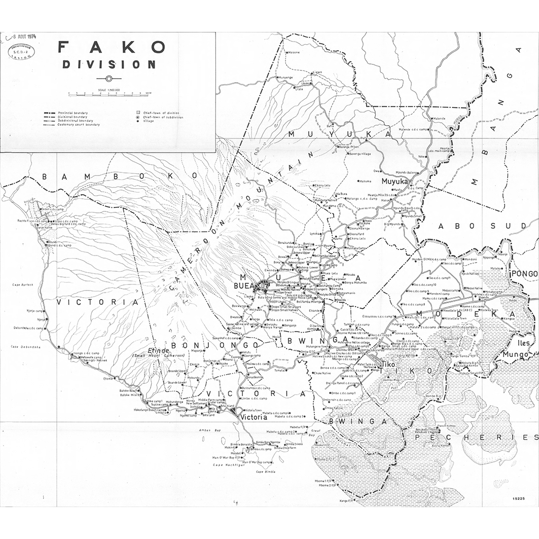
A set of 25 map sheets: 1. Bui division. Scale of 1:100 000. Date of publication: 1973. 2. Département Bamoun. Scale of 1:1 000 000 to 1:400 000. Date of publication: 1968. 3. Département de l'Adamaoua. Scale of 1:500 000. Date of publication: 1975. 4. Département de la Haute-Sanaga. Scale of 1:2 000 000 to 1:400 000. Date of publication: 1968. 5. Département de la Lekié. Scale of 1:100 000. Date of publication: unknown. 6. Département de la Mifi. Scale of 1:100 000. Date of publication: 1971. 7. Département de la Sanaga Maritime : arrondissements d'Édéa, Dizangue, Ngambe, Ndom, Pouma : district de Mouanko. Scale of 1:200 000. Date of publication: unknown. 8. Département des Bambouto. Scale of 1:500 000 to 1:200 000. Date of publication: 1968. 9. Département du Haut Nyong. Scale of 1:2 000 000 to 1:500 000. Date of publication: 1968. 10. Département du la Kadéi : arrondissements de Batouri et Ndélélé. Scale of 1:400 000. Date of publication: 1968. 11. Département du Margui Wandala. Scale of 1:200 000. Date of publication: unknown. 12. Département du Mayo Danaï. Scale of 1:200 000. Date of publication: 1972. 13. Département du Mbam : arrondissements de Bafia, Bokito, Ndikinimeki, Ntui : districts de Ngorro, Ombessa, Makenene, Deuk. Scale of 1:200 000. Date of publication: unknown. 14. Département du Mungo. Scale of 1:200 000. Date of publication: unknown. 15. Département du Ndé. Scale of 1:100 000. Date of publication: 1976. 16. Département du Nkam. Scale of 1:200 000. Date of publication: unknown. 17. Département du Ntem. Scale of 1:2 000 000 to 1:400 000. Date of publication: 1969. 18. Département du Nyong et Kellé : arrondissement de Bot Makak, de Makak et de Eseka : districts de Messondo, Matomb, Dibang, Ngog-Mapubi. Scale of 1:200 000. Date of publication: unknown. 19. Département du Wouri. Scale of 1:100 000 to 1:50 000. Date of publication: 1970. 20. Dictionnaire des villages de Kribi. Scale of 1:200 000. Date of publication: unknown. 21. Donga Mantung division. Scale of 1:200 000. Date of publication: 1973. 22. Fako division. Scale of 1:100 000. Date of publication: 1973. 23. Manyu division : carte provisoire. Scale of 1:200 000. Date of publication: 1974. 24. Meme division. Scale of 1:200 000. Date of publication: 1974. 25. Ndian division. Scale of 1:200 000. Date of publication: 1973.
-

The available shapefile represents the administrative divisions of Inia. The shapefile divides India into 27 states and seven union territories. The states and union territories are subdivided into 560 districts. These, in turn, have 2101 subdivisions that are generically called sub-districts, but that have different statuses by state. We received the shapefile from the French Institute of Pondicherry (IFP). The original source of the shapefile remains unknow but it seem it is from he government. We used the shapefile as the best available information to georeferrence the samples of the Herbarium of the French Institute of Pondicherry (IFP).
-

One mosaic of 2 map sheets and one additional map sheet: 1. Carte géomorphologique de la République Centrafricaine : feuille Est. Scale of 1:1 000 000. Date of publication: 1995. 2. Carte géomorphologique de la République Centrafricaine : feuille Ouest. Scale of 1:1 000 000. Date of publication: 1995.
-

A set of 8 map sheets: 1. Akiékrou : aires d'exploitation des différents campements cadastres : carte No 17. Scale of 1:25 000. Date of publication: 1977. 2. Akiékrou : dispersion de la propriété : carte No 16. Scale of 1:25 000. Date of publication: 1977. 3. Akiékrou : modes de faire-valoir en 1964 : carte No 15. Scale of 1:25 000. Date of publication: 1977. 4. Akiékrou : modes de fondation des plantations : carte No 14. Scale of 1:25 000. Date of publication: 1977. 5. Akiékrou : nature des cultures : carte No 12. Scale of 1:25 000. Date of publication: 1977. 6. Akiékrou : origine des étrangers d'Akiékrou : carte No 18. Scale of 1:2 500 000. Date of publication: 1977. 7. Akiékrou : parcellaire et implantation de l'habitat : carte No 11. Scale of 1:25 000. Date of publication: 1977. 8. Akiékrou : répartition par années de mise en cultures : carte No 13. Scale of 1:25 000. Date of publication: 1977.
-

A set of 10 map sheets: 1. Carte cynégétique et touristique. Scale of 1:1 000 000. Date of publication: 1975. 2. Carte hydrogéologique du Cameroun : Garoua. Scale of 1:2 000 000 to 1:500 000. Date of publication: 1971. 3. Circonscriptions administratives. Scale of 1:500 000. Date of publication: 1974. 4. Densité de la population. Scale of 1:500 000. Date of publication: 1975. 5. Élevage. Scale of 1:1 000 000. Date of publication: 1975. 6. Infrastructure. Scale of 1:500 000. Date of publication: 1974. 7. Plantes cultivées : A. Scale of 1:500 000. Date of publication: 1975. 8. Plantes cultivées : B. Scale of 1:500 000. Date of publication: 1975. 9. Populations. Scale of 1:500 000. Date of publication: 1974. 10. Utilisation actuelle de l'espace. Scale of 1:500 000. Date of publication: 1975.
-

A set of 10 map sheets: 1. Atlas régional Ouest 2 : café = Regional atlas : coffee. Scale of 1:500 000. Date of publication: 1971. 2. Atlas régional Ouest 2 : circonscriptions administratives : carte à jour au 1er avril 1971 = Regional atlas : administrative areas : map revised as at 1st April 1971. Scale of 1:500 000. Date of publication: 1970. 3. Atlas régional Ouest 2 : démographie = Regional atlas : demography. Scale of 1:1 000 000. Date of publication: 1972. 4. Atlas régional Ouest 2 : densité de population = Regional atlas : population density. Scale of 1:500 000. Date of publication: 1971. 5. Atlas régional Ouest 2 : élevage = Regional atlas : livestock. Scale of 1:500 000. Date of publication: 1971. 6. Atlas régional Ouest 2 : enseignement = Regional atlas : education. Scale of 1:500 000. Date of publication: 1971. 7. Atlas régional Ouest 2 : infrastructure = Regional atlas : infrastructure. Scale of 1:500 000. Date of publication: 1970. 8. Atlas régional Ouest 2 : milieu physique = Regional atlas : physical environment. Scale of 1:1 000 000. Date of publication: 1971. 9. Atlas régional Ouest 2 : organisation de l'espace = Regional atlas : regional organisation. Scale of 1:500 000. Date of publication: 1971. 10. Atlas régional Ouest 2 : populations = Regional atlas : populations. Scale of 1:500 000. Date of publication: 1970.
-

A set of 25 map sheets: 1. Baie de Cook - Paopao : pl. No 13. Scale of 1:10 000. Date of publication: 1970. 2. Carte No 2 : état de la propriété en 1940 : pl. No 15. Scale of 1:10 000. Date of publication: 1970. 3. Commerces et services dans les districts de Punaauia et Paea : pl. No 23. Scale of 1:40 000. Date of publication: 1970. 4. Les grands traits du paysage dans les districts de Punaauia et Paea : pl. No 22. Scale of 1:40 000. Date of publication: 1970. 5. Mo'orea : carte générale : pl. No 7. Scale of 1:40 000. Date of publication: 1970. 6. Mooréa : densité kilométrique de la population : pl. No 8. Scale of 1:40 000. Date of publication: 1970. 7. Mooréa : déplacements de travail : pl. No 11. Scale of 1:40 000. Date of publication: 1970. 8. Mooréa : répartition de la population : pl. No 9. Scale of 1:40 000. Date of publication: 1970. 9. Mooréa : structures socio-professionnelles : pl. No 10. Scale of 1:40 000. Date of publication: 1970. 10. Papeari : habitat et activités : pl. No 19. Scale of 1:10 000. Date of publication: 1970. 11. Papeari : la structure foncière : pl. No 20. Scale of 1:10 000. Date of publication: 1970. 12. Papeari : le paysage agricole : pl. No 18. Scale of 1:10 000. Date of publication: 1970. 13. Papeari : les tenures : pl. No 21. Scale of 1:10 000. Date of publication: 1970. 14. Plan parcellaire d'Afareaitu : levé cadastral de 1939 : pl. No 14. Scale of 1:10 000. Date of publication: 1970. 15. Situation de la cocoteraie littorale de Mo'orea : exemple de la façade Nord et Nord-ouest - date : août 1968 : pl. No 12. Scale of 1:20 000. Date of publication: 1970. 16. Tahiti-Iti : densité kilométrique de la population : pl. No 17 bis. Scale of 1:40 000. Date of publication: 1970. 17. Tahiti-Iti : répartition de la population : pl. No 16 bis. Scale of 1:40 000. Date of publication: 1970. 18. Tahiti-Nui : densité kilométrique de la population : pl. No 17. Scale of 1:40 000. Date of publication: 1970. 19. Tahiti-Nui : répartition de la population : pl. No 16. Scale of 1:40 000. Date of publication: 1970. 20. Tahiti : aires de recrutement des travailleurs en 1966 (C.E.P., C.E.P.D.T.G., S.C.A., Dragages) : pl. No 4. Scale of 1:100 000. Date of publication: 1970. 21. Tahiti : circulation des trucks : pl. No 1. Scale of 1:200 000. Date of publication: 1970. 22. Tahiti : déplacements de travail sur la côte W Ouest : pl. No 3. Scale of 1:100 000. Date of publication: 1970. 23. Tahiti : immigration des gens des îles extérieures sur la côte W Ouest : pl. No 2. Scale of 1:100 000. Date of publication: 1970. 24. Tahiti : structures socio-professionnelles sur la côte W Ouest : pl. No 6. Scale of 1:100 000. Date of publication: 1970. 25. Tahiti : transferts immobiliers : pl. No 5. Scale of 1:100 000. Date of publication: 1970.
-

A set of 12 map sheets: 1. Carte administrative = Administrative map. Scale of 1:500 000. Date of publication: 1972. 2. Cultures commerciales = Cash crops. Scale of 1:500 000. Date of publication: 1972. 3. Densités = Densities. Scale of 1:500 000. Date of publication: 1972. 4. Eléments de démographie = Demographic materials. Scale of 1:1 000 000. Date of publication: 1972. 5. Enseignement primaire = Primary eduction. Scale of 1:500 000. Date of publication: 1972. 6. Infrastructure. Scale of 1:500 000. Date of publication: 1972. 7. L'organisation de l'espace = Space structure. Scale of 1:1 000 000. Date of publication: 1972. 8. Le milieu physique = The physical milieu. Scale of 1:1 000 000. Date of publication: 1972. 9. Plantations industrielles = Industrial plantations. Scale of 1:500 000. Date of publication: 1972. 10. Populations = Populations. Scale of 1:500 000. Date of publication: 1972. 11. Ressources économiques complémentaires = Other economical resources. Scale of 1:1 000 000. Date of publication: 1972. 12. Traits sociaux = Social aspects. Scale of 1:1 000 000. Date of publication: 1973.