 Metadata catalogue
single-beam echosounders
Type of resources
Available actions
Topics
INSPIRE themes
Keywords
Contact for the resource
Provided by
Years
Formats
Representation types
Scale
Resolution
-
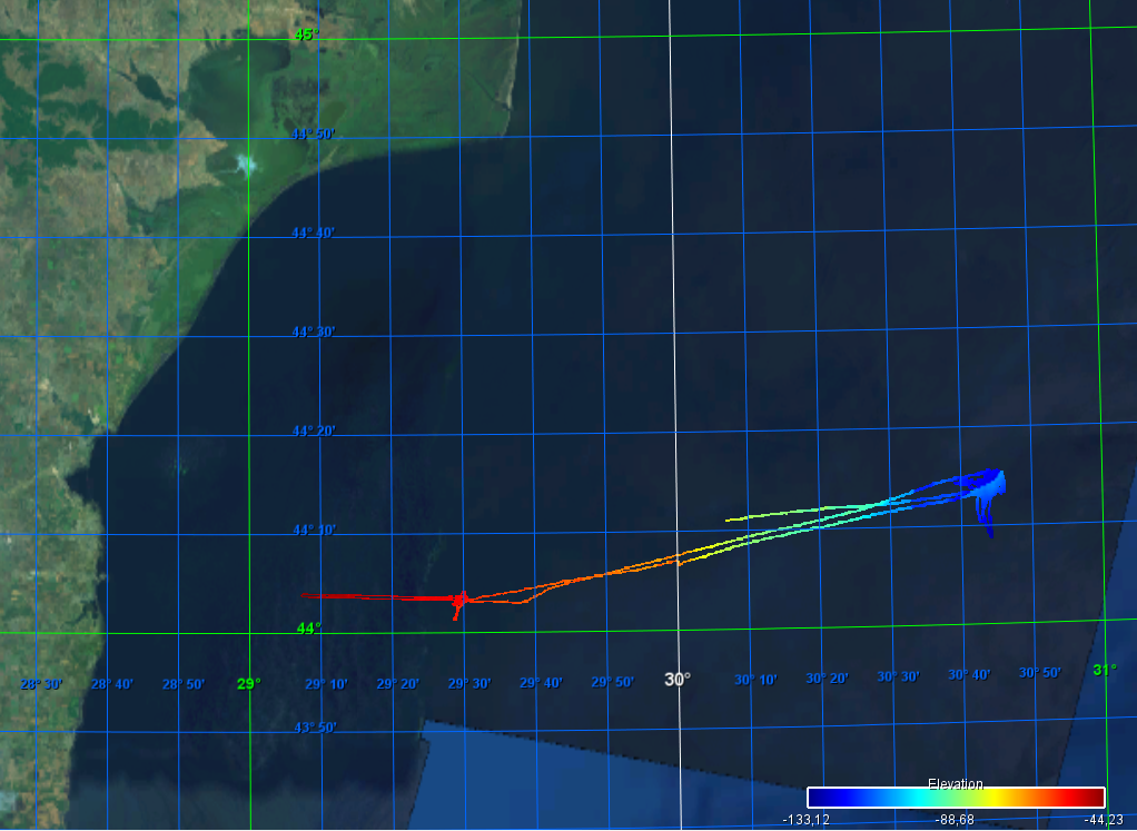
During a cruise within the ENVRI+ Project WP4, a joint pilot experiment to measure methane transfer from the seafloor to the atmosphere, bathymetry was recorded using a hull-mountes Elac Seabeam 1050 multibeam system. https://doi.org/10.1594/PANGAEA.913704 Cruise of the R/V Mare Nigrum vessel (https://www.eurofleets.eu/vessel/rv-mare-nigrum/)
-
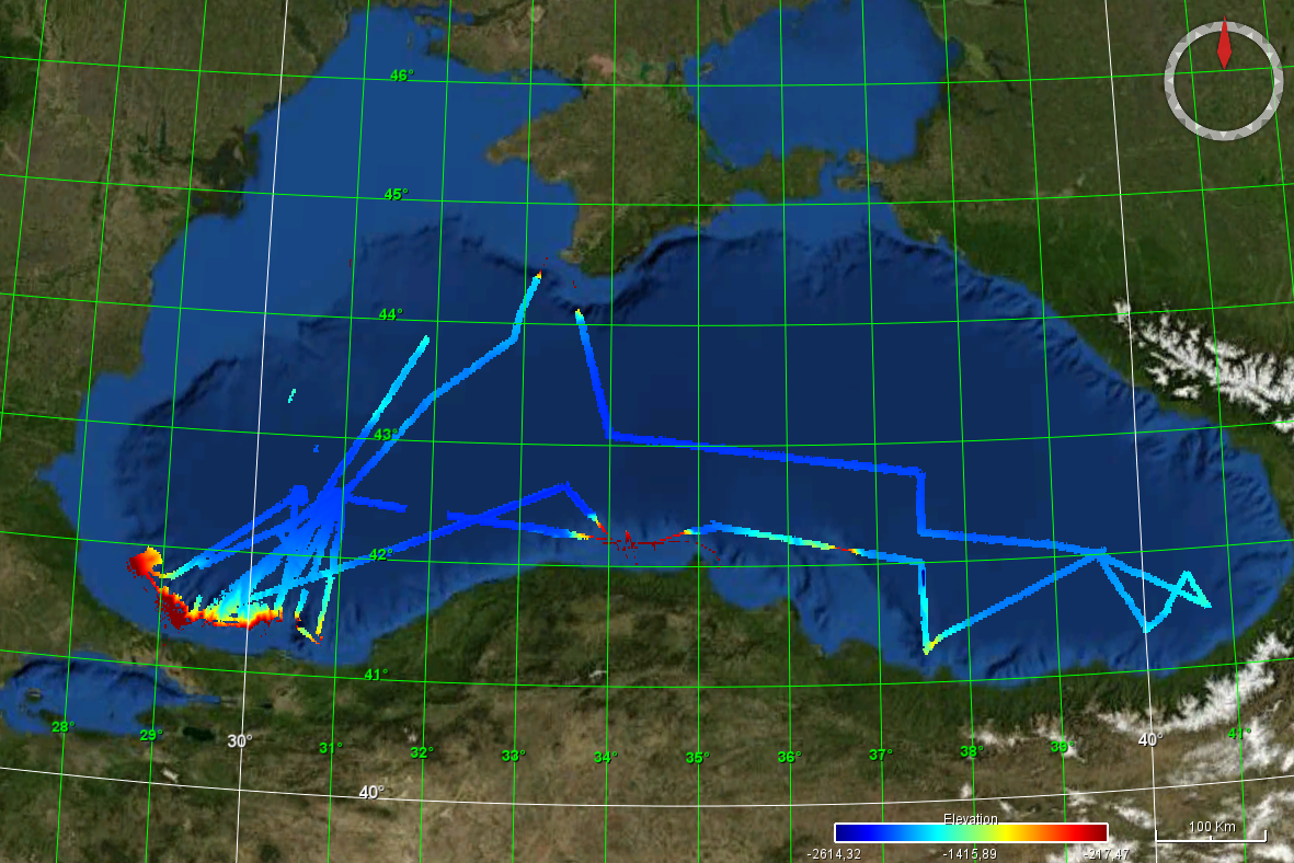
The grid is extracted from the NCEI Bathymetry Data Viewer, using the "Grid Extract" tools. https://www.ncei.noaa.gov/maps/bathymetry/
-
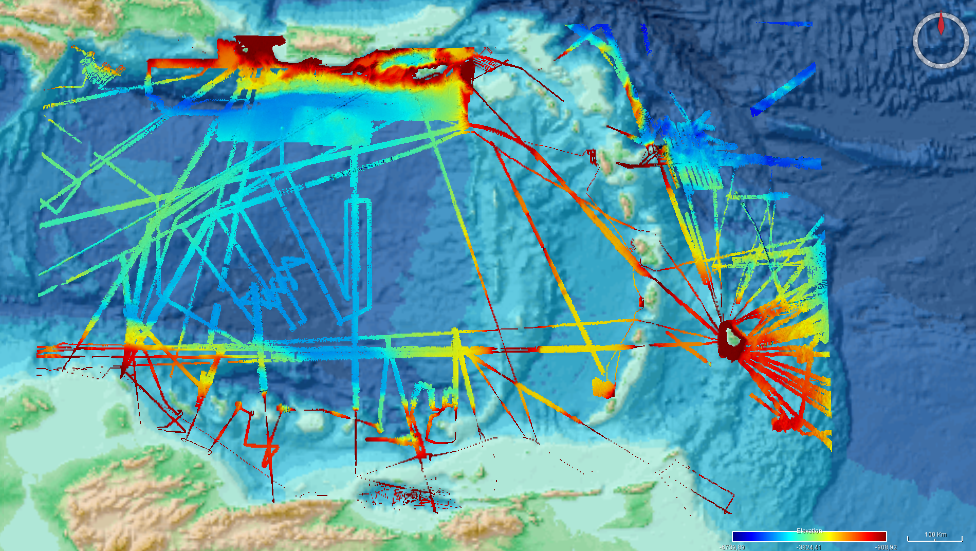
The grid is extracted from the NCEI Bathymetry Data Viewer, using the "Grid Extract" tools. https://www.ncei.noaa.gov/maps/bathymetry/
-

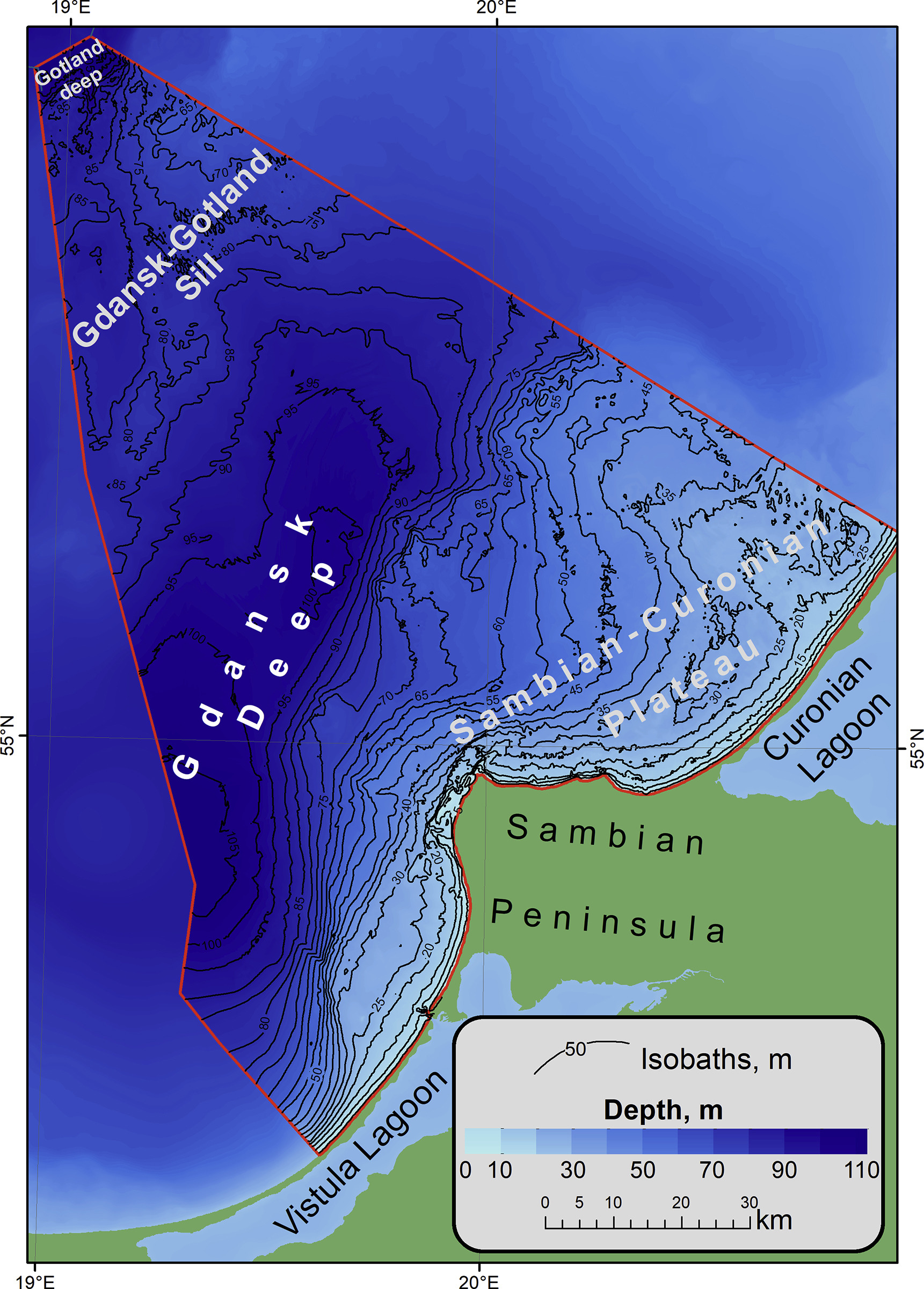
Data extracted from the Hydrographic Office of the Polish Navy (HO) database. Cells in a 200m grid has been populated.
-

The bathymetry data were collected from the online data source Norge Digitalt (http://www.norgedigitalt.no) established by the Norwegian Mapping Authority, the Hydrographic service (Statens Kartverk Sjø). The original resolution is about 50m on an irregular grid. IMR has interpolated the bathymetry to four 50m x 50m UTM-grids, and simple extrapolation is applied towards a high-resolution coast line, also provided by the Norwegian Mapping Authority.
-

Systematic survey performed by IDROSPED with Singlebeam EchoSounder
-
The bathymetric dataset of a single beam sounding. Surveys were conducted in 25 expeditions of the Atlantic branch of Shirshov Institute of Oceanology RAS in the Russian EEZ area of the southeastern part of the Baltic Sea in the period from 2004 to 2018. Acoustic data were acquired by echo sounders Simrad EA-400SP and Furuno FS-700. The raw sounding data were filtered and corrected by sound velocity values. The dataset is presented as spreadsheets (*.xslx) and GIS point-class shapes (*.shp). The digital elevation model (DEM) of 1: 500 000 scale has been constructed for the entire Russian EEZ on base of the original array of sounding profiles and an open sources bathymetry.
-

The bathymetry data were collected from the online data source Norge Digitalt (http://www.norgedigitalt.no) established by the Norwegian Mapping Authority, the Hydrographic service (Statens Kartverk Sjø). The original resolution is about 50m on an irregular grid. IMR has interpolated the bathymetry to four 50m x 50m UTM-grids, and simple extrapolation is applied towards a high-resolution coast line, also provided by the Norwegian Mapping Authority.