 Metadata catalogue
seafloor
Type of resources
Available actions
Topics
Keywords
Contact for the resource
Provided by
Years
Formats
-
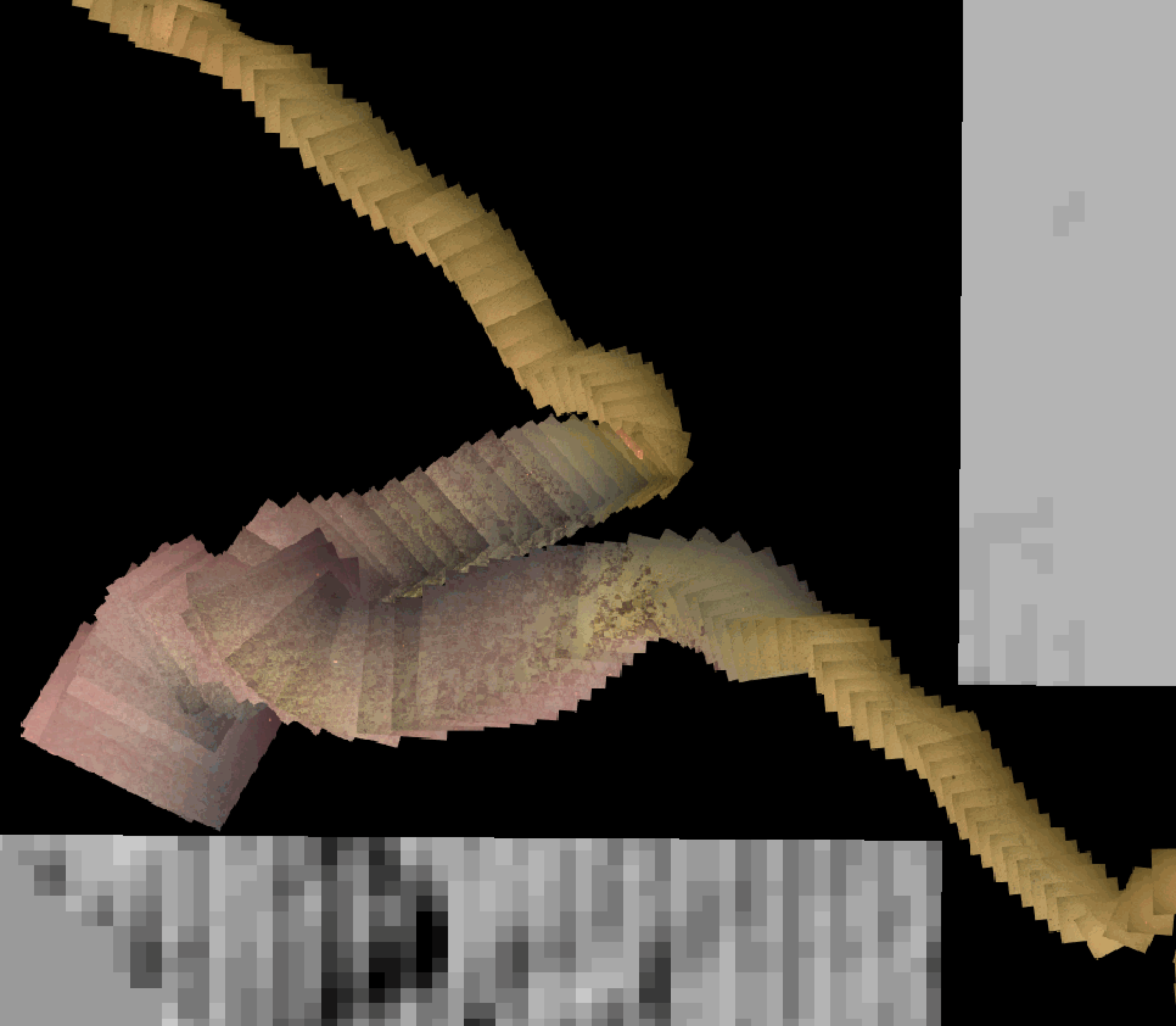
Photomosaics acquired by ROV Victor during dives #653, #654, #655, and #658, along the Roseau Fault (French Antilles). The images, acquired with the ROV vertical camera, were positioned and scales using ROV navigation only (no feature matching, renavigation and reprojection). Images are corrected for uneven illumination. Photomosaics are presented in folders for each dive, and include a Geotiff (.tif) and a location file (.tfw). All photomosaics are in projection WGS84 UTM 20N.
-
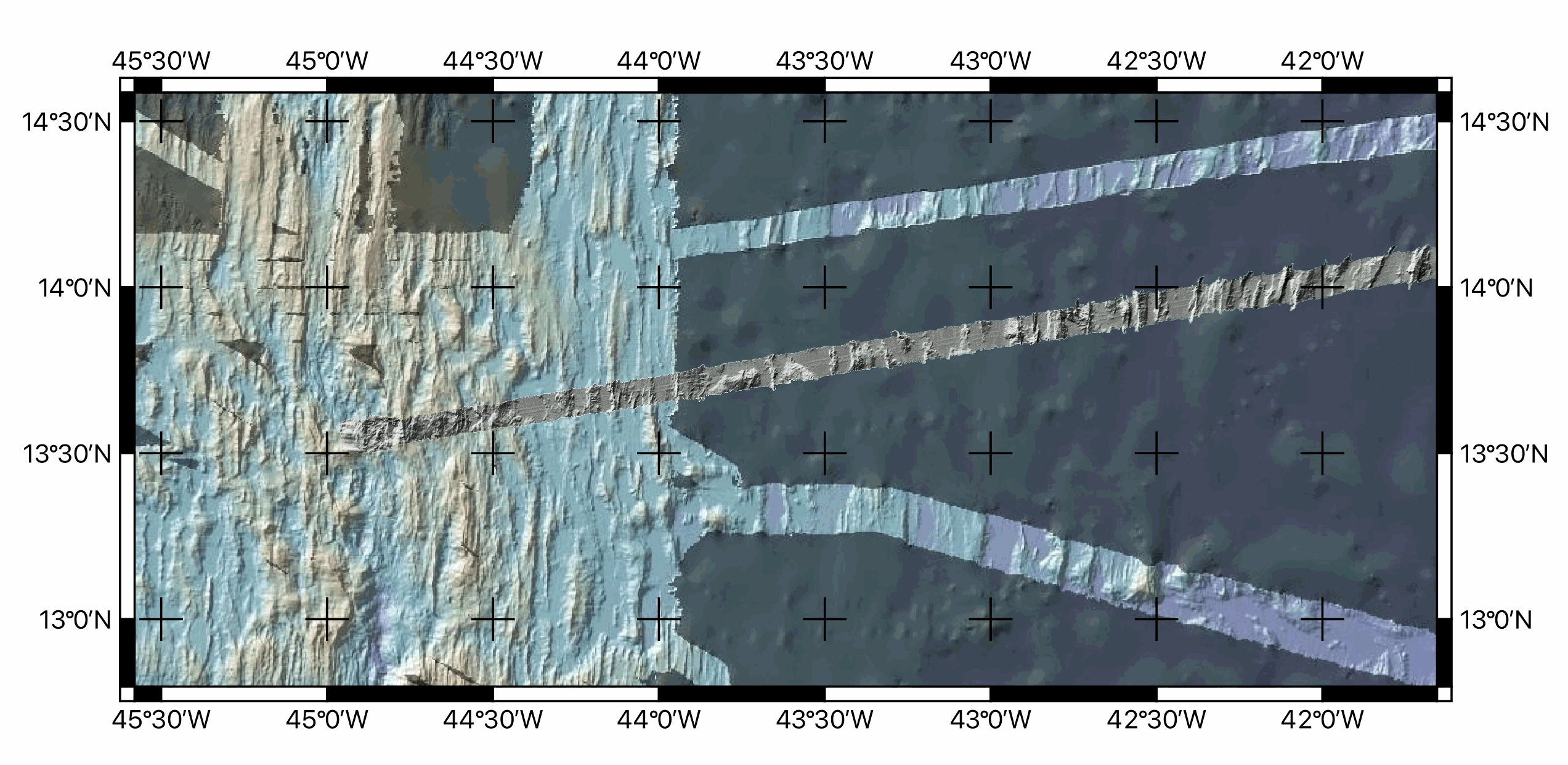
Multibeam bathymetry data, gridded at ~100m, acquired around during the transit towards the Mid-Atlantic ridge axis (13°20'N and 13°30'N oceanic detachments area) during the ODEMAR cruise (2013). Bathymetric data was acquired by the PourQUoi Pas? multibeam system (RESON SEABAT 7150). Data is provided as geotiffs (WGS84) ODM_transit_16Nov.tif Extent -27.8375538800000015,16.3530121699999995 : -26.3755538800000018,16.6860121699999979 Width 1463 Height 334 Data type Float32 - Thirty two bit floating point GDAL Driver Description GTiff GDAL Driver Metadata GeoTIFF Dataset Description /Users/jescartin/WORK/Proyectos/ODEMAR/DATA/Bathygrids/Transit/ODM_transit_16Nov.tif Compression PACKBITS Band 1 STATISTICS_MAXIMUM=-4139.5639648438 STATISTICS_MEAN=-4612.4823849892 STATISTICS_MINIMUM=-4866.7373046875 STATISTICS_STDDEV=121.40234041923 STATISTICS_VALID_PERCENT=29.85 Scale: 1 Offset: 0 More information AREA_OR_POINT=Area TIFFTAG_SOFTWARE=MATLAB 9.14, Mapping Toolbox 5.5 Dimensions X: 1463 Y: 334 Bands: 1 Origin -27.8375538800000015,16.6860121699999979 Pixel Size 0.0009993164730006834189,-0.0009970059880239474058 ODM_transit_17Nov.tif Extent -32.4955601099999996,15.5934151199999995 : -27.8195601099999976,16.4454151199999998 Width 4677 Height 853 Data type Float32 - Thirty two bit floating point GDAL Driver Description GTiff GDAL Driver Metadata GeoTIFF Dataset Description /Users/jescartin/WORK/Proyectos/ODEMAR/DATA/Bathygrids/Transit/ODM_transit_17Nov.tif Compression PACKBITS Band 1 STATISTICS_APPROXIMATE=YES STATISTICS_MAXIMUM=-4458.8168945312 STATISTICS_MEAN=-5144.8000932272 STATISTICS_MINIMUM=-5562.1850585938 STATISTICS_STDDEV=164.55246561258 STATISTICS_VALID_PERCENT=50.04 Scale: 1 Offset: 0 More information AREA_OR_POINT=Area TIFFTAG_SOFTWARE=MATLAB 9.14, Mapping Toolbox 5.5 Dimensions X: 4677 Y: 853 Bands: 1 Origin -32.4955601099999996,16.4454151199999998 Pixel Size 0.0009997861877271759391,-0.0009988276670574447458 ODM_transit_18Nov.tif Extent -36.9279732571747630,14.8264479347363469 : -32.4729732571747647,15.7054479347363465 Width 4456 Height 880 Data type Float32 - Thirty two bit floating point GDAL Driver Description GTiff GDAL Driver Metadata GeoTIFF Dataset Description /Users/jescartin/WORK/Proyectos/ODEMAR/DATA/Bathygrids/Transit/ODM_transit_18Nov.tif Compression PACKBITS Band 1 STATISTICS_APPROXIMATE=YES STATISTICS_MAXIMUM=-5171.58203125 STATISTICS_MEAN=-5712.1738558372 STATISTICS_MINIMUM=-5946.1611328125 STATISTICS_STDDEV=139.45706418798 STATISTICS_VALID_PERCENT=7.565 Scale: 1 Offset: 0 More information AREA_OR_POINT=Area TIFFTAG_SOFTWARE=MATLAB 9.14, Mapping Toolbox 5.5 Dimensions X: 4456 Y: 880 Bands: 1 Origin -36.9279732571747630,15.7054479347363465 Pixel Size 0.0009997755834829438748,-0.0009988636363636358394 ODM_transit_19Nov.tif Extent -41.3188024399999989,14.0843680599999992 : -36.8828024399999990,14.9493680599999994 Width 4437 Height 866 Data type Float32 - Thirty two bit floating point GDAL Driver Description GTiff GDAL Driver Metadata GeoTIFF Dataset Description /Users/jescartin/WORK/Proyectos/ODEMAR/DATA/Bathygrids/Transit/ODM_transit_19Nov.tif Compression PACKBITS Band 1 STATISTICS_APPROXIMATE=YES STATISTICS_MAXIMUM=-4540.5317382812 STATISTICS_MEAN=-5176.2961468757 STATISTICS_MINIMUM=-5426.123046875 STATISTICS_STDDEV=183.14492125461 STATISTICS_VALID_PERCENT=7.674 Scale: 1 Offset: 0 More information AREA_OR_POINT=Area TIFFTAG_SOFTWARE=MATLAB 9.14, Mapping Toolbox 5.5 Dimensions X: 4437 Y: 866 Bands: 1 Origin -41.3188024399999989,14.9493680599999994 Pixel Size 0.0009997746224926751767,-0.0009988452655889147342 ODM_transit_20Nov.tif Extent -44.9630377200000027,13.5018919999999998 : -41.3030377200000061,14.1828919999999989 Width 3661 Height 682 Data type Float32 - Thirty two bit floating point GDAL Driver Description GTiff GDAL Driver Metadata GeoTIFF Dataset Description /Users/jescartin/WORK/Proyectos/ODEMAR/DATA/Bathygrids/Transit/ODM_transit_20Nov.tif Compression PACKBITS Band 1 STATISTICS_APPROXIMATE=YES STATISTICS_MAXIMUM=-3173.7924804688 STATISTICS_MEAN=-4347.3027374804 STATISTICS_MINIMUM=-4821.65625 STATISTICS_STDDEV=276.6463937856 STATISTICS_VALID_PERCENT=42.31 Scale: 1 Offset: 0 More information AREA_OR_POINT=Area TIFFTAG_SOFTWARE=MATLAB 9.14, Mapping Toolbox 5.5 Dimensions X: 3661 Y: 682 Bands: 1 Origin -44.9630377200000027,14.1828919999999989 Pixel Size 0.0009997268505872703662,-0.000998533724340174662
-
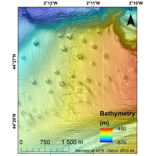
Pockmarks are defined as depressions on the seabed and are usually formed by fluid expulsions. Recently discovered, pockmarks along the Aquitaine slope within the French EEZ, were manually mapped although two semi-automated methods were tested without convincing results. In order to potentially highlight different groups and possibly discriminate the nature of the fluids involved in their formation and evolution, a morphological study was conducted, mainly based on multibeam data and in particular bathymetry from the marine expedition GAZCOGNE1, 2013. Bathymetry and seafloor backscatter data, covering more than 3200 km², were acquired with the Kongsberg EM302 ship-borne multibeam echosounder of the R/V Le Suroît at a speed of ~8 knots, operated at a frequency of 30 kHz and calibrated with ©Sippican shots. Precision of seafloor backscatter amplitude is +/- 1 dB. Multibeam data, processed using Caraibes (©IFREMER), were gridded at 15x15 m and down to 10x10 m cells, for bathymetry and seafloor backscatter, respectively. The present table includes 11 morphological attributes extracted from a Geographical Information System project (Mercator 44°N conserved latitude in WGS84 Datum) and additional parameters related to seafloor backscatter amplitudes. Pockmark occurrence with regards to the different morphological domains is derived from a morphological analysis manually performed and based on GAZCOGNE1 and BOBGEO2 bathymetric datasets. The pockmark area and its perimeter were calculated with the “Calculate Geometry” tool of Arcmap 10.2 (©ESRI) (https://desktop.arcgis.com/en/arcmap/10.3/manage-data/tables/calculating-area-length-and-other-geometric-properties.htm). A first method to calculate pockmark internal depth developed by Gafeira et al. was tested (Gafeira J, Long D, Diaz-Doce D (2012) Semi-automated characterisation of seabed pockmarks in the central North Sea. Near Surface Geophysics 10 (4):303-315, doi:10.3997/1873-0604.2012018). This method is based on the “Fill” function from the Hydrology toolset in Spatial Analyst Toolbox Arcmap 10.2 (©ESRI), (https://pro.arcgis.com/en/pro-app/tool-reference/spatial-analyst/fill.htm) which fills the closed depressions. The difference between filled bathymetry and initial bathymetry produces a raster grid only highlighting filled depressions. Thus, only the maximum filling values which correspond to the internal depths at the apex of the pockmark were extracted. For the second method, the internal pockmark depth was calculated with the difference between minimum and maximum bathymetry within the pockmark. Latitude and longitude of the pockmark centroid, minor and major axis lengths and major axis direction of the pockmarks were calculated inside each depression with the “Zonal Geometry as Table” tool from Spatial Analyst Toolbox in ArcGIS 10.2 (©ESRI) (https://pro.arcgis.com/en/pro-app/tool-reference/spatial-analyst/zonal-statistics.htm). Pockmark elongation was calculated as the ratio between the major and minor axis length. Cell count is the number of cells used inside each pockmark to calculate statistics (https://pro.arcgis.com/en/pro-app/tool-reference/spatial-analyst/zonal-geometry.htm). Cell count and minimum, maximum and mean bathymetry, slope and seafloor backscatter values were calculated within each pockmark with “Zonal Statistics as Table” tool from Spatial Analyst Toolbox in ArcGIS 10.2 (©ESRI). Slope was calculated from bathymetry with “Slope” function from Spatial Analyst Toolbox in ArcGIS 10.2 (©ESRI) and preserves its 15 m grid size (https://pro.arcgis.com/en/pro-app/tool-reference/spatial-analyst/slope.htm). Seafloor backscatter amplitudes (minimum, maximum and mean values) of the surrounding sediments were calculated within a 100 m buffer around the pockmark rim.