 Metadata catalogue
photomosaics
Type of resources
Available actions
Topics
Keywords
Contact for the resource
Provided by
Years
Formats
-
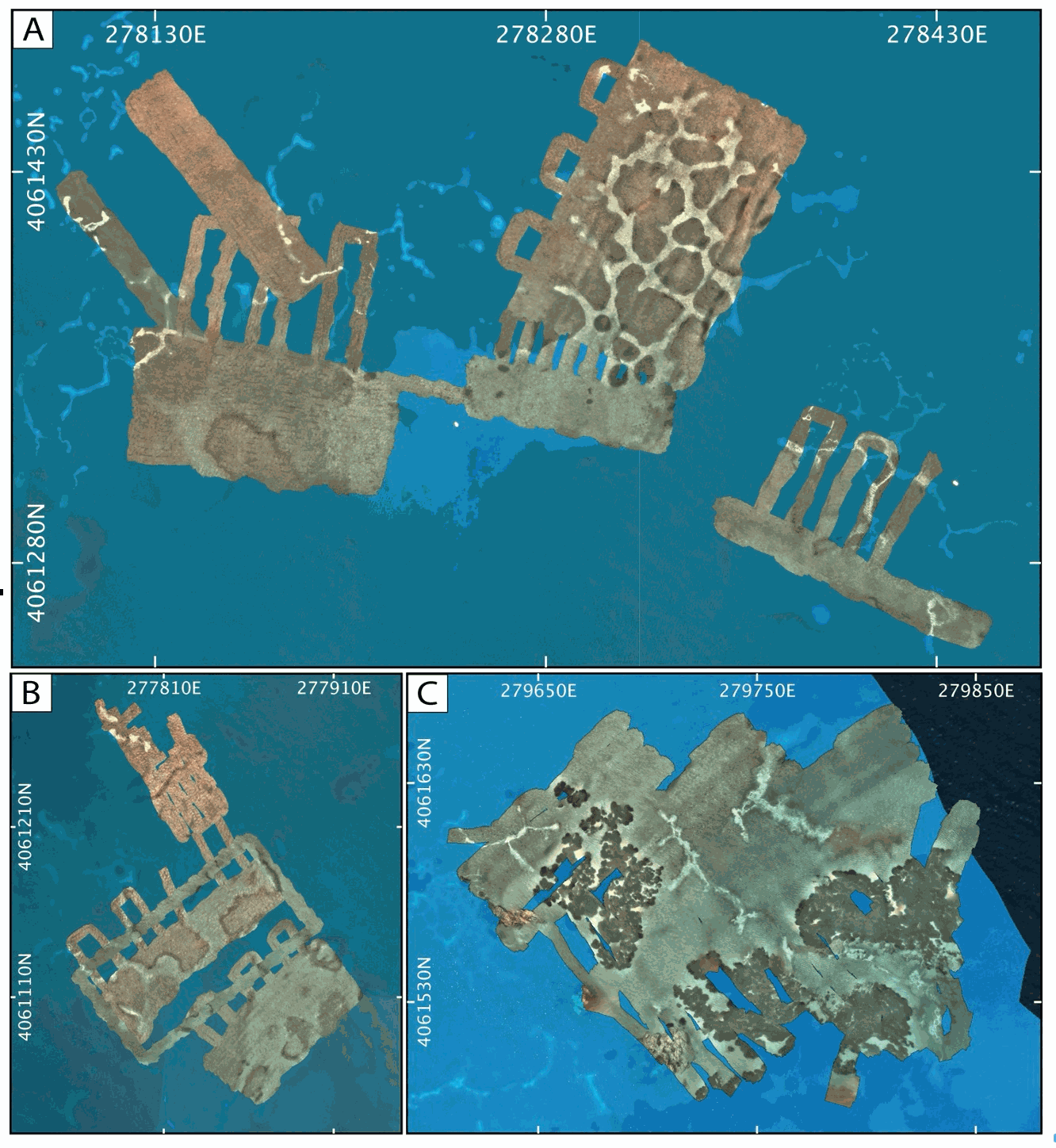
AUV photomosaics of the seafloor at the shallow-water Milos hydrothermal system. Photomosaics were acquired with the Sparus II (Iqua, Girona) AUV and constructed from vertically acquired still images. Images were acquired in July 2019 at the Paleochori and Spathi Bays. Photomosaics are provided as geotiffs (UTM Zone 35). This dataset includes both original photomosaics, that show distortions due to AUV navigation drift, and georeferenced photomosaics, that have been registered with the associated drone photomosaics at these same areas.
-
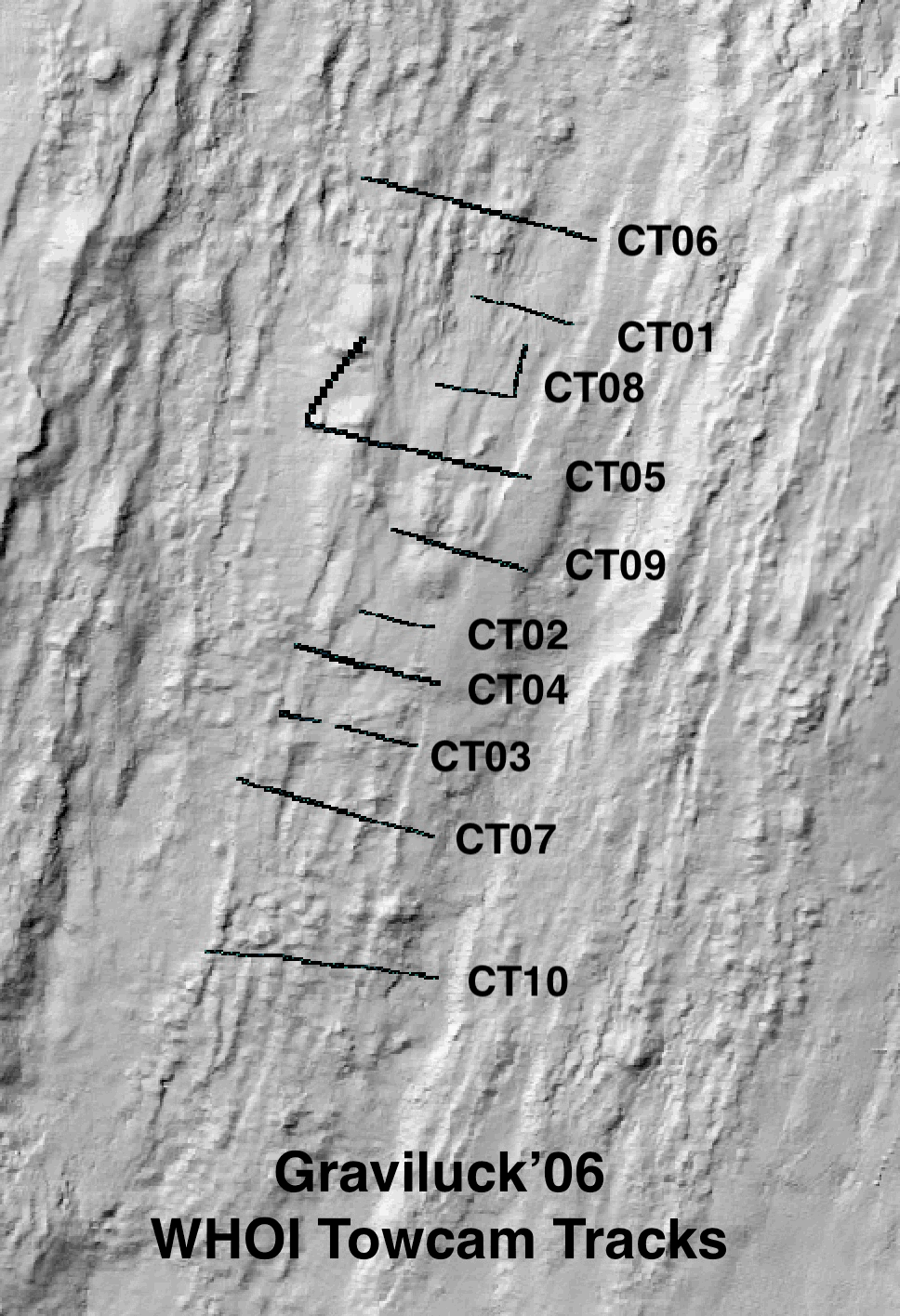
Colour seafloor photomosaics along towed camera tracks crossing the axis of the Lucky Strike ridge segment (Mid Altantic Ridge). Images were acquired with the WHOI TowCam system (https://www.whoi.edu/what-we-do/explore/underwater-vehicles/towed-vehicles/towcam/), during the Graviluck 2016 cruise. Images are process for colour and illumination correction. Images are placed and photomosaiced based on USBL navigation of the TowCam, altitude, and orientation. The datasets include geotiffs for each of the tracks. To be cited: cited: Gini et al. (submitted); Escartin et al. (2008; 2014).
-
Milos Shallow Water Hydrothermal System: Drone seafloor photomosaics (July/September 2019 fieldwork)
Drone photomosaics of the seafloor at the shallow-water Milos hydrothermal system. Photomosaics were acquired with a Phantom and a Mavic Pro drone. Images were acquired in July and September 2019. Photomosaics are provided as geotiffs (UTM Zone 35).