 Metadata catalogue
mean sea level
Type of resources
Available actions
Topics
INSPIRE themes
Keywords
Contact for the resource
Provided by
Years
Formats
Representation types
Scale
Resolution
-

Dataset located on Spitsbergenbanken, a survey from seabed mapping within the MAREANO programme, a collaboration between the Institute of Marine Research, the Geological Survey of Norway and the Norwegian Mapping Authority, Hydrographic Service. MAREANO maps depth and bathymetry, sediment composition, biodiversity, habitats and biotopes, and also pollution in the seabed within Norwegian offshore areas.
-
Dataset located in the North Sea. A survey from seabed mapping within the MAREANO programme, a collaboration between the Institute of Marine Research, the Geological Survey of Norway and the Norwegian Mapping Authority, Hydrographic Service. MAREANO maps depth and bathymetry, sediment composition, biodiversity, habitats and biotopes, and also pollution in the seabed within Norwegian offshore areas.
-
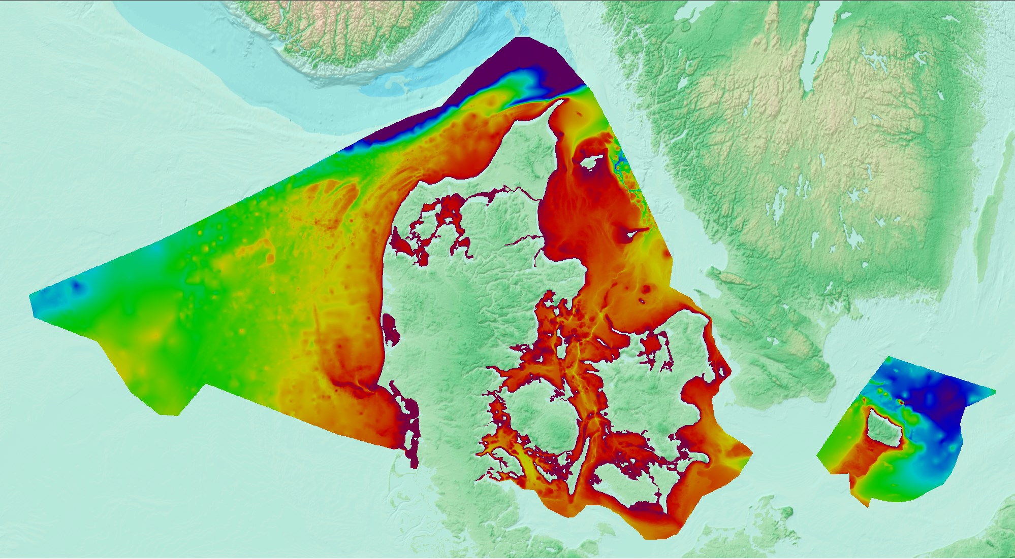
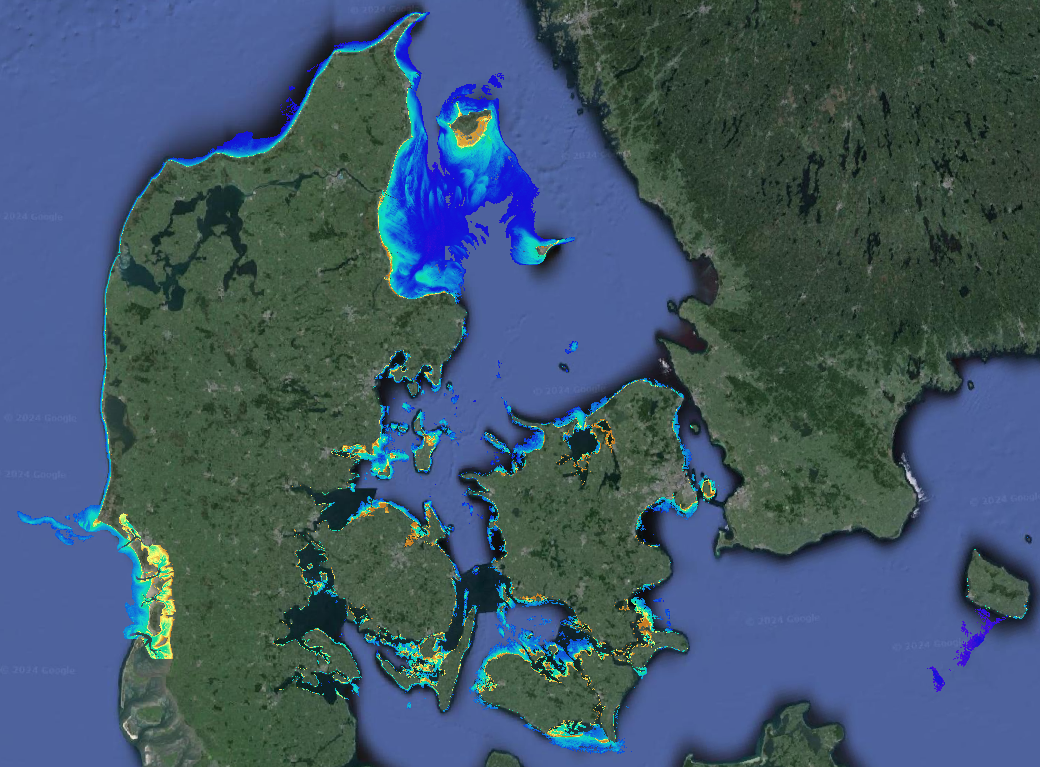
Denmark’s Depth Model (DDM) is a depth-averaged digital bathymetric model, covering Denmark’s Exclusive Economic Zone (EEZ). The model has a grid resolution of 50 meters and is based on a collection of hydrographic survey datasets and other sources.
-

The composite Digital Terrain Model of the Central Bulgarian Black Sea Slope is a result of processing and compilation of multibeam echosounder data gathered under several projects: the Caucasus on-line cable route survey (2007); The South Stream pipeline route survey (2009-2012); CBC Programme “MARINEGEOHAZARD” (2012). The DTM at a source resolution of approximately 55 meters was compiled for inclusion into the EMODnet HRSM dataset. The area embraces 2675 square kilometers from the shelf break to the abyssal plain in the center of the Bulgarian EEZ of the Black Sea.
-

This DTM is the result of merging of several multibeam surveys identified by their CDIs names:145_CNR-ISMAR-134, 145_CNR-ISMAR-135, 145_CNR-ISMAR-136 into a composite DTM. The processing was performed using the CARIS HIP&SIPS software with a standard procedure.
-
Dataset from seabed mapping within the MAREANO programme, a collaboration between the Institute of Marine Research, the Geological Survey of Norway and the Norwegian Mapping Authority, Hydrographic Service. MAREANO maps depth and bathymetry, sediment composition, biodiversity, habitats and biotopes, and also pollution in the seabed within Norwegian offshore areas.
-
Dataset located in the Barents Sea. A survey from seabed mapping within the MAREANO programme, a collaboration between the Institute of Marine Research, the Geological Survey of Norway and the Norwegian Mapping Authority, Hydrographic Service. MAREANO maps depth and bathymetry, sediment composition, biodiversity, habitats and biotopes, and also pollution in the seabed within Norwegian offshore areas.
-
Data provides Satellite-Derived Bathymetry (SDB) data for shallow waters. The analysis is based on EOMAP’s WATCOR-X SDB software and Sentinel-2 data. The native spatial resolution of the data is 10m. Supplemental_Information: EOMAPs Satellite Derived Bathymetry (SDB) method relies on the reflected light energy which is measured at the satellite sensor in space. To calculate water depth, the sea bottom reflection must be separated from all other simultaneously measured portions of light. Other contributors of light scattered to the sensor are atmospheric molecules and aerosols, adjacent scattering from land, the water surface reflection, and light scattered and absorbed due to particular properties of water constituents and the pure water itself. The pure water itself also absorbs light in a spectrally specific manner and therefore leaves unique signatures in the signal while the light passes through the water column and returns after reflection at the sea bottom. This property is relevant to estimate water depth from optical satellite imagery. As many properties can vary over space and time, effective correction, regularization and retrieval algorithms must be applied to avoid instable results. Furthermore, multi-record analytics are part of the process and reduce noise and increase overall vertical accuracies. EOMAP developed and maintains these unique algorithms and its workflows for almost 2 decades and has developed the Watcor-X SDB software. The maximum depth the system is able to sense is related to the complex interaction of radiance of bottom material, incident sun angle and intensity, and the type and quantity of organics or sediments in the water column. As a rule-of-thumb, SDB can measure depths down to one to one point five times the Secchi Disc Depth. The SDB data are compared against Satellite-Lidar Bathymetry (SLB) tracks which have been derived out of the IceSat-2 Atlas instrument and are stored and distributed via EOMAP’s SLB database. No-data-value optically deep water: -9999
-
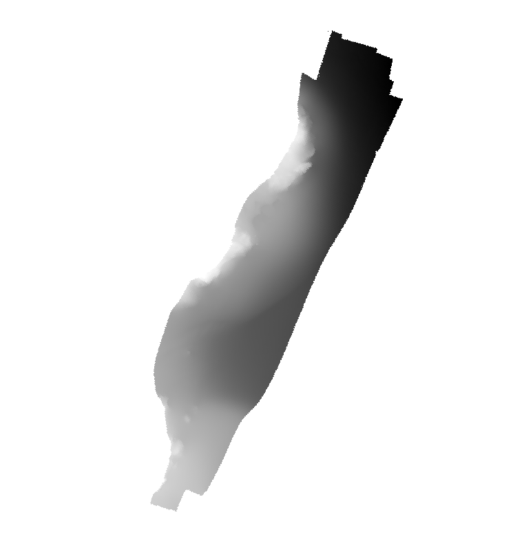
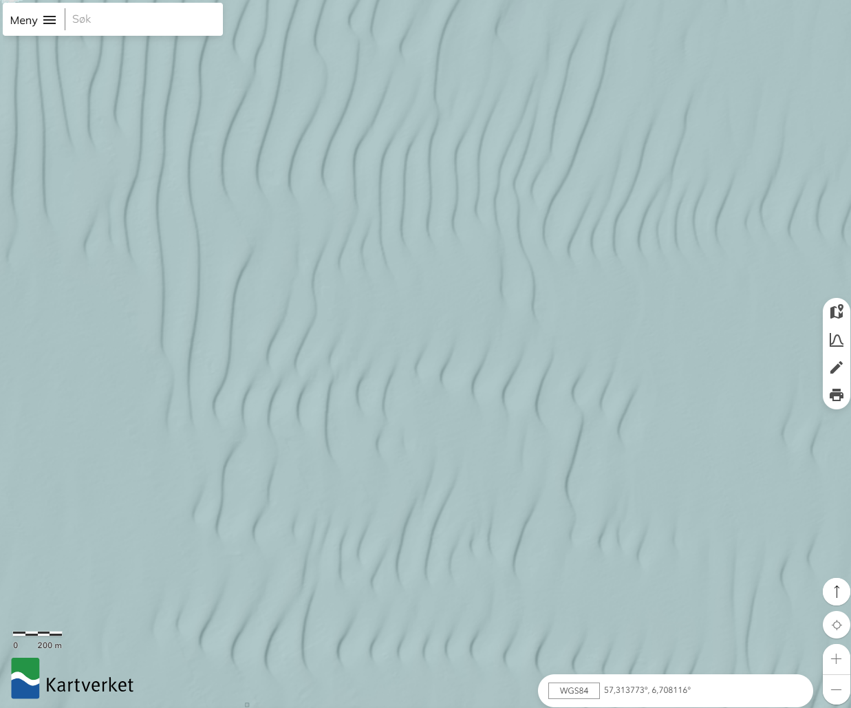
Multibeam bathymetry showing submarine terraces in the seafloor southeast of Tvärminne Zoological Station in southern Finland archipelago. Detailed information about the depth and shape of the seafloor is provided by the acquired multibeam bathymetry. This information is commonly used to study, for example, general seafloor geology, glacial morphology, bottom habitats, and bottom current activities.