 Metadata catalogue
environmental policy
Type of resources
Available actions
Topics
INSPIRE themes
Keywords
Contact for the resource
Provided by
Years
Formats
Representation types
Update frequencies
status
Scale
-
22 candidate Special Landscape Areas (cSLAs) were identified in the approved Review of Local Landscape Designations (Feb 2010). The candidates are based upon landscape character assessment and evaluation of relative landscape value following the methodology set out in ‘Guidance on Local Landscape Designations’ published by SNH and Historic Scotland (2004). Candidates will be designated through the forthcoming Local Development Plan and will replace the existing local landscape designations: Areas of Great Landscape Value (AGLV) and Areas of Outstanding Landscape Quality (AOLQ). In the interim the Review will constitute a material consideration in the determination of planning applications. cSLAs are accompanied by ‘Statements of Importance’, which set out their key characteristics and attributes.
-
The open space audit was carried out in 2009 as part of the open space strategy. The Open Space Strategy was approved by the Council's Policy and Strategy and Planning Committees at the end of September 2010. The preparation of an open space strategy is a recent requirement of national planning policy, requiring the creation of an audit, a strategy and action plans. The implementation of the strategy and action plans will be monitored and every five years, from 2015, the strategy will be reviewed and updated. Further information can be found in the open space audit at http://www.edinburgh.gov.uk/downloads/file/1286/open_space_audit.
-
Trees, groups of trees, woodlands and areas of trees that have been afforded the statutory protection of a Tree Preservation Order.
-
Local landscape designation, relevant to the area of the Edinburgh City Local Plan plus the Pentland Hills Regional Park Area. Originates from the Scottish Office SDD Circular 2/1962 which provides advice on definition of AGLVs in development plans. These areas have been defined from various local plans going back to the 1960s.
-
Polygon shapefile showing the boundaries of all designated Green Belts in and around the City of Edinburgh. These boundaries come from the Edinburgh City Local Plan and the Rural West Edinburgh Local Plan.
-
Local landscape designation, relevant to the area of the Rural West Edinburgh Local Plan. AOLQs are identified as part of the local plan process.
-

Tree Preservation Orders are made by a Planning Authority under Section 160 of the Town and Country Planning (Scotland) Act 1997 as amended by the Planning etc (Scotland) Act 2006 and within the procedures set out in the Town and Country Planning (Tree Preservation Order and Trees in Conservation Areas) (Scotland) Regulations 2011. They are an effective means of protecting individual trees, groups of trees or woodlands whose removal would have significant impact on the public amenity of an area. Where protection is given by a TPO, prior consent in writing is required from the Council to carry out any work on the trees. It is an offence to cut down, lop, top, uproot or wilfully damage or destroy a protected tree without the Council¿s permission. An owner wishing to carry out work on a tree must apply online at the Scottish Government¿s e-planning system at https://eplanning.scotland.gov.uk/WAM/.
-

Regulations are in place to spatially manage offshore trawling efforts within the FMZ: trawling within the 25 nautical mile zone can, according to legislation, only take place at designated sites (detailed in Annex Va of EC 1967/2006 and as amended in 2012). These trawlable areas were chosen when Malta joined the EU in 2004, and were based on an FAO study on the location of areas suitable for trawling in Maltese waters carried out in 1976 / 1977 (Giudicelli, 1978). In addition trawling is only allowed within the FMZ by vessels not exceeding an overall length of 24 m, and the overall capacity of the trawlers allowed to fish in the zone can not exceed 4 800 kW. Moreover, the total fishing effort of all vessels is not allowed to exceed an overall engine power and tonnage of 83 000 kW and 4 035 GT respectively, and the fishing capacity of any single vessel with a license to operate at less than 200 m depth can not exceed 185 kW. This data was utilised by one of the co-financed EU LIFE+ Funding Programmes - LIFE BaĦAR for N2K project.
-
Locations of Air Quality Management Areas in the City of Edinburgh Council area
-
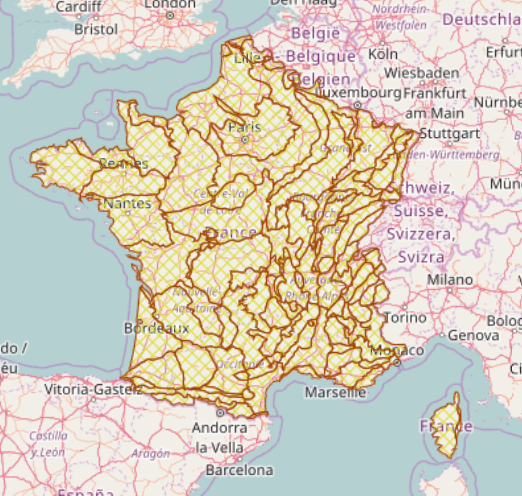
Entité spatiale homogène du point de vue des déterminants physiques qui contrôlent l’organisation et le fonctionnement global des écosystèmes aquatiques. A l'échelle du bassin, les déterminants primaires universellement reconnus du fonctionnement écologique des cours d'eau sont la géologie, le relief et le climat. Ce concept s'inspire des théories de contrôle hiérarchique des hydrosystèmes, et repose particulièrement sur l'emboîtement des échelles physiques, du bassin jusqu'au micro-habitat. L'IRSTEA (ex CEMAGREF) a défini les hydroécorégion pour la France métropolitaine. Il a développé le cadre conceptuel de la régionalisation par "hydroécorégion" et les aspects généraux de la méthode, l'objectif étant de définir et caractériser les Hydroécorégions pour la France métropolitaine. On distingue deux niveaux pour les hydroécorégions (HER) : le niveau 1 et le niveau 2. Le deuxième niveau de régionalisation est défini à partir du niveau 1, aboutissant à la description quantifiée d'une centaine d'hydro-écorégions de niveau 2 (HER-2). Ces HER-2 servent à préciser la variabilité interne des HER-1. La méthode et les résultats sont décris sur le site du Laboratoire d'Hydroécologie Quantitative (voir partie Source en ligne)