 Metadata catalogue
caribbean
Type of resources
Available actions
Topics
Keywords
Contact for the resource
Provided by
Years
Formats
status
-
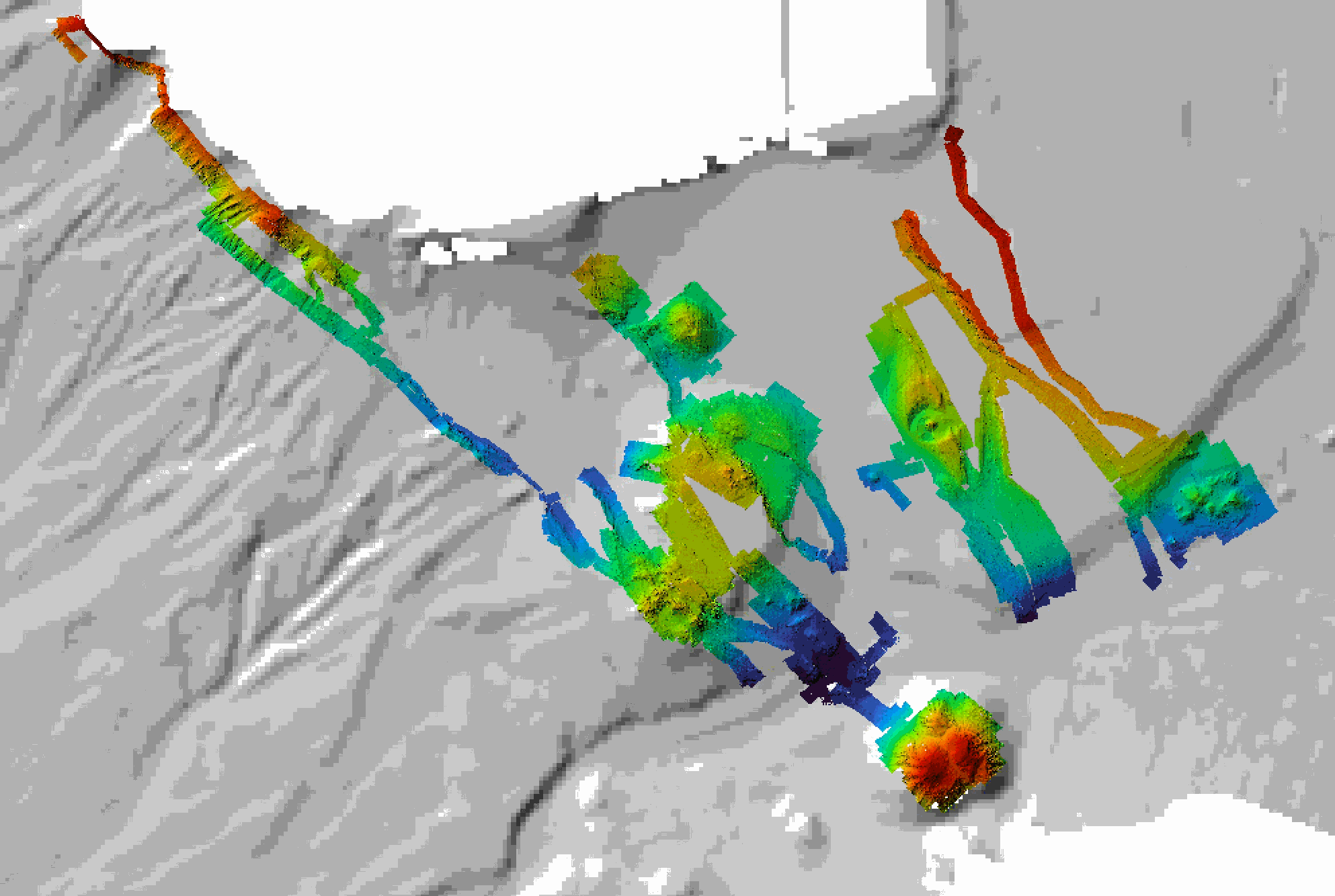
Near-bottom multibeam bathymetry acquired at the French Antilles volcanic arc between Les Saintes et Dominica islands. High-resolution bathymetry data (1 m/pixel) were acquired by the autonomous underwater vehicle (AUV) AsterX, deployed during the 2017 Subsaintes cruise (https://doi.org/10.17600/17001000. The dataset consists of dives #394 through #404, after renavigation of the veichile. This dataset includes both grids of individual dives (bathymetry and backscatter, in GRD format), and mosaics combining these dives in 3 larger grids (GEOTIFF). All grids are provided in WGS 84 projection.
-

SRID 900913 of two available coordinate systems. These data provide monthly average and annual average daily total solar resource averaged over surface cells of approximately 40 km by 40 km in size. The solar resource value is represented as watt-hours per square meter per day for each month. The data were developed from NREL's Climatological Solar Radiation (CSR) Model. This model uses information on cloud cover, atmospheric water vapor and trace gases, and the amount of aerosols in the atmosphere to calculate the monthly average daily total insolation (sun and sky) falling on a horizontal surface. Existing ground measurement stations are used to validate the data where possible. The modeled values are accurate to approximately 10% of a true measured value within the grid cell due to the uncertainties associated with meteorological input to the model. The local cloud cover can vary significantly even within a single grid cell as a result of terrain effects and other microclimate influences. Furthermore, the uncertainty of the modeled estimates increase with distance from reliable measurement sources and with the complexity of the terrain.