 Metadata catalogue
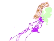
benthos
Type of resources
Topics
Keywords
Contact for the resource
Provided by
Years
Formats
Representation types
Update frequencies
status
Service types
-
Description: Spatial distribution of selected macrozoobenthic species in the German Bight. Data source: Data from environmental impact assessments (EIA) under the permit procedures of the Federal Maritime and Hydrographic Agency (BSH) in the North Sea EEZ and research data of the Alfred Wegener Institute (AWI), Helmholtz Centre for Polar and Marine Research; time period: 1997 to 2011, mainly spring and autumn data (EIA data), but also summer and winter data (AWI data) Sampling standards: Data of EIAs follow the standard investigation concept StUK 1-3 (BSH 2007), AWI data collected in accordance with the ICES sampling standard (Rumohr 1999). Sampling gears: mainly van Veen grabs (0.1 m², 30-95 kg), few stations by box corer (0.1 m², 160 kg), Nephrops norvegicus and Goneplax rhomboides sampled by beam trawl and dredge (1-3 m width) Sampling: 1-3 replicates per station, fixation in 4 % buffered formalin seawater solution, dredge and beam-trawl data recorded on board or subsamples frozen stored, abundance and biomass (g wet weight) per species Data analysis: science information system of benthic invertebrate data, examination of quality and plausibility, data harmonisation, product computation by AWI Product description: Grid: 5x5 km² for grab data, 10x10 km² for data on N. norvegicus and G. rhomboides from beam trawl and dredge hauls; available selectable parameter: number of stations, minimum, maximum, mean, median and standard deviation of density (m-²) per species; classification method: natural jenks (Jenks Caspall algorithm), Note: The products contain a different classification of species density! Note: Please regard different value ranges! Rumohr, H. (1999). "Soft bottom macrofauna: Collection, treatment, and quality assurance of samples." ICES Techniques in Environmental Sciences, No. 27: 1-19. BSH (2007): Standard ¿Investigation of the Impacts of Offshore Wind Turbines on the Marine Environment (StUK 3)¿, Hamburg.
-
Betreft monitoringsdata. Het Offshore Windpark Egmond aan Zee is het eerste offshore windpark dat in de Noordzee voor de Nederlandse kust is gebouwd. Het park bestaat uit 36 windmolens met ieder een vermogen van 3 MW. De locatie van het park ligt 10 tot 18 kilometer uit de kust bij Egmond aan Zee. Het is een demonstratiepark: De hier ontwikkelde kennis en opgedane ervaring is belangrijk voor de verdere ontwikkeling van windenergie op zee. Hierbij gaat het om techniek, ecologie, economische en maatschappelijke haalbaarheid. NoordzeeWind, een consortium van Nuon en Shell en eigenaar van OWEZ, won de tender voor OWEZ in combinatie met het zogenoemde MEP-NSW onderzoeksprogramma, een onderzoeksprogramma opgezet door de Rijksoverheid in 2006. Hierin staan leerdoelen voor de ontwikkeling van wind op zee. Het MEP-NSW heeft in belangrijke mate bijgedragen aan de leerdoelen van offshore windenergie. In het monitoring- en evaluatieprogramma staan de volgende ecologische vraagstukken centraal: •Vogels: vliegpatronen, aanwezigheid, intensiteit, seizoen, dag/nacht in verband met inschatting aanvaringsrisico’s: Vogels: verstoring leef-/foerageergebied, barrièrewerking. De invloed van onderwatergeluid op vissen en zeezoogdieren. De variatie en dichtheden van het onderwaterleven en het functioneren als refugium.
-
Betreft monitoringsdata. In de periode 2008-2013 heeft het Havenbedrijf Rotterdam de eerste fase van Maasvlakte 2 aangelegd. De nieuwe haven beslaat zo’n 2,5% van de totale Voordelta, een Natura2000 gebied. Zowel de aanleg als de aanwezigheid van de haven heeft volgens de Milieu Effect Rapportage (MER) effecten op aanwezige dier- en plantensoorten. De effecten van de aanleg en aanwezigheid van Maasvlakte 2 voor de natuur en leefomgeving zijn met verschillende maatregelen gecompenseerd en gemitigeerd. Zo is een bodembeschermingsgebied van 25.000 ha in de Voordelta ingesteld (10x de grootte van het oppervlak van de nieuwe haven) met daarbinnen rustgebieden voor vogels. Daarnaast is er in 2009 een nieuw duingebied gerealiseerd bij ‘s Gravezande (Spanjaardsduin) om de stikstofdepositie die na ingebruikname van de Tweede Maasvlakte toeneemt, te compenseren. Ook zijn diverse maatregelen genomen om de effecten van de aanleg te compenseren en mitigeren. Om de effectiviteit van deze genomen maatregelen te monitoren zijn drie Monitoring- en Evaluatieplannen (MEP) opgesteld en uitgevoerd.
-
Betreft monitoringsdata. Bij de start van de bouw van de eerste windparken op zee was nog veel onbekend over de ecologische effecten. Het Shortlist onderzoek richt zich op enerzijds de verspreiding van soorten (vogels, vissen en zeezoogdieren) en anderzijds de effecten op deze soorten in relatie tot de bouw en aanwezigheid van windparken. Het onderzoek is uitgevoerd in de periode 2010-2011. Rapporten zijn te vinden op www.informatiehuismarien.nl
-
Description: Spatial distribution of selected macrozoobenthic species in the German Bight. Data source: Data from environmental impact assessments (EIA) under the permit procedures of the Federal Maritime and Hydrographic Agency (BSH) in the North Sea EEZ and research data of the Alfred Wegener Institute (AWI), Helmholtz Centre for Polar and Marine Research; time period: 1997 to 2011, mainly spring and autumn data (EIA data), but also summer and winter data (AWI data) Sampling standards: Data of EIAs follow the standard investigation concept StUK 1-3 (BSH 2007), AWI data collected in accordance with the ICES sampling standard (Rumohr 1999). Sampling gears: mainly van Veen grabs (0.1 m², 30-95 kg), few stations by box corer (0.1 m², 160 kg), Nephrops norvegicus and Goneplax rhomboides sampled by beam trawl and dredge (1-3 m width) Sampling: 1-3 replicates per station, fixation in 4 % buffered formalin seawater solution, dredge and beam-trawl data recorded on board or subsamples frozen stored, abundance and biomass (g wet weight) per species Data analysis: science information system of benthic invertebrate data, examination of quality and plausibility, data harmonisation, product computation by AWI Product description: Grid: 5x5 km² for grab data, 10x10 km² for data on N. norvegicus and G. rhomboides from beam trawl and dredge hauls; available selectable parameter: number of stations, minimum, maximum, mean, median and standard deviation of density (m-²) per species; classification method: natural jenks (Jenks Caspall algorithm), Note: The products contain a different classification of species density! Note: Please regard different value ranges! Rumohr, H. (1999). "Soft bottom macrofauna: Collection, treatment, and quality assurance of samples." ICES Techniques in Environmental Sciences, No. 27: 1-19. BSH (2007): Standard ¿Investigation of the Impacts of Offshore Wind Turbines on the Marine Environment (StUK 3)¿, Hamburg.
-

Cartographie des herbiers à Zostera noltii de l'estuaire du Trieux, de l'anse de Paimpol (A), et de Saint-Jacut-de-la-Mer (B), sous-région Manche - Mer du Nord
-

Cartographie des herbiers à Zostera marina de l'Archipel de Molène (A) et de Chausey (B), sous-région Manche - Mer du Nord
-

Cette cartographie biomorphosédimentaire du golfe normano-breton est reproduite d'après la "carte biomorphosédimentaire de la zone intertidale au 1/25000, côte Ouest du Cotentin et Baie du Mont Saint-Michel" publiée en 1987 sous la forme de 7 cartes. Ces cartes résultent de la synthèse des travaux réalisés par le groupe "Estrans et Zones humides" dans le cadre de l'Etude Régionale Intégrée du Golfe Normano-breton. Ce travail a été réalisé sous l'égide de l'Ifremer, avec la collaboration du Laboratoire de Géomorphologie de l'Ecole Pratique des Hautes Etudes de Dinard et le Laboratoire Botanique de l'Université de Rennes I. Le principe de réalisation de la carte repose sur l'habillage d'un fond morphosédimentaire par les principales unités biosédimentaires observées sur l'ensemble de la zone de balancement des marées et s'appuie sur de nombreuses reconnaissances terrain. Cette carte a fait l'objet en 2005 d'une numérisation dans le cadre du Réseau de surveillance de la flore et de la faune benthique marine REBENT. Sous forme numérique, ces cartes ont été regroupées en un seul lot de données. La légende d'origine est reportée dans le champ attributaire "LEG_ORIG" et comporte les habitats suivants : - Enrochements ; - Platiers rocheux ; - Rochers dépourvus d'algues ; - Fucales ; - Rhodophycées ; - Laminaires ; - Cailloutis et blocs ; - Récifs d'Hermelles ; - Sédiments grossiers hétérogènes ; - Bancs coquilliers ; - Bancs hétérogènes ; - Bancs sableux ; - Sables moyens de basse plage ; - Eventails deltaïques des hâvres ; - Sables fins à moyens zoogènes de bas niveaux ; - Sables fins à moyens de haute plage ; - Sables fins à Macoma balthica : faciès à Haustoriidae ; - Sables fins à Macoma balthica ; - Sables fins vaseux ; - Crochons dunaires ; - Crochons sableux ; - Crochons végétalisés ; - Herbiers de Zostera marina ; - Zone humide supralittorale ; - Végétation du haut schorre ; - Végétation du bas-moyen schorre ; - Végétation du schorre de type 'haute slikke - bas schorre' ; - Végétation de la haute slikke bas schorre et secteurs de l'estran potentiellement colonisables ; - Chenaux ; - Mares. Trois couches complémentaires sont à associer à ce lot de données : une couche sur les coques et Corophium, une couche sur les espèces proliférantes (Crépidules, Lanices, Sargasses) et une couche sur les activités humaines (Mytiliculture, Ostréiculture, Pêcheries). Une harmonisation avec la typologie EUNIS est en cours dans le cadre des projets REBENT et Interreg-MESH.
