 Metadata catalogue
bathymetric LiDARs
Type of resources
Available actions
Topics
INSPIRE themes
Keywords
Contact for the resource
Provided by
Years
Formats
Representation types
Scale
Resolution
-

Lidar data taken on the Netherlands side of Sint Maarten, on land and shallow sea.
-

The DTM is produced with Teledyne multibeam echosounder survey, acquired in March 2023 by Marine Research Ltd. The resolution 5m x 5m. It is located at Sulina, Romania, on the coastal region of the Black Sea. Depths are referenced to the Local Sea Level - Marea Neagra 1975 (Mean Sea Level) and the coordinates are expressed into the WGS84 reference frame.
-
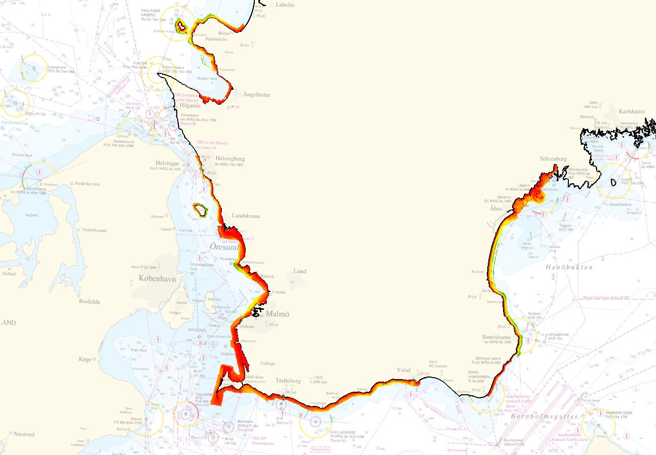
The dataset is provided by Geological Survey of Sweden (SGU) for EMODnet Bathymetry 2022. The dataset covers the areas of Skåne strand, in the Baltic Sea Region. The area was surveyed using LiDAR and multibeam sonar and merged into one composite grid. For the EMODnet project, the data was delivered in a resolution of 1 meter.
-
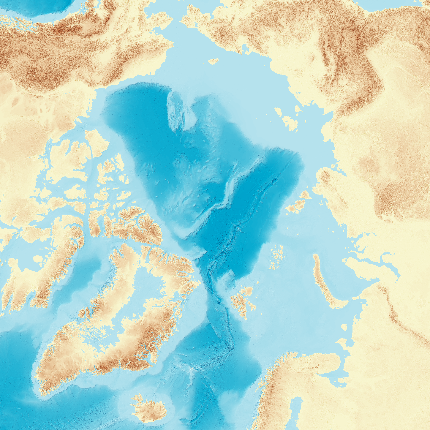
Knowledge about seafloor depth, or bathymetry, is crucial for various marine activities, including scientific research, offshore industry, navigation, and ocean exploration. Mapping the central Arctic Ocean is challenging due to the presence of perennial sea ice, which limits data collection to icebreakers, submarines, and drifting ice stations. The International Bathymetric Chart of the Arctic Ocean (IBCAO) was initiated in 1997 with the goal of updating the Arctic Ocean bathymetric portrayal. The project team has since released four versions, each improving resolution and accuracy. Here, we present IBCAO Version 5.0, which offers a resolution four times as high as Version 4.0, with 100 × 100 m grid cells compared to 200 × 200 m. Over 25 % of the Arctic Ocean is now mapped with individual depth soundings, based on a criteria for what is considered mapped that depends on water depth. Version 5.0 also represents significant advancements in data compilation and computing techniques. Despite these improvements, challenges such as sea-ice cover and political dynamics still hinder comprehensive mapping.