 Metadata catalogue
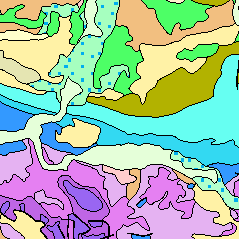
Tektonik
Type of resources
Available actions
Topics
INSPIRE themes
Keywords
Contact for the resource
Provided by
Years
Formats
Representation types
Update frequencies
status
Service types
Scale
-
Faults and tectonic boundaries in Belgium at various scales.
-
Tectonic lines in Europe, as they appear in the GeoERA HIKE fault data base. Fault geometry is based on national and regional information provided by the respective geological survey organisation.
-
Inventory of faults and tectonic boundaries in Brandenburg at regional scale (approx. 1:200.000 - 1:1.000.000)
-
Faults, shearzones and nappe boundaries in Austria as they appear in the GeoERA HIKE European fault data base
-
Inventory of faults and tectonic boundaries in Saxony-Anhalt at various regional scales
-
Inventory of generalized faults and tectonic boundaries such as associated structural regions in Germany, presented at following scales: 1.) German onshore (1: 2.500.000 - 1: 500000), 2.) Baltic Sea (1:1000000 - 1:250000), 3.) Central German North Sea (1:1000000 - 1:100000), 4.) Entenschnabel region - The northwestern German North Sea sector (1:1000000 - 1:50000).
-
Inventory of principal faults, shear zones, etc. in Bavaria (w/o Alpine domain)
-
.png)
The WMS GK1000 (INSPIRE) represents the surface geology of Germany and adjacent areas on a scale of 1:1,000,000. According to the Data Specification on Geology (D2.8.II.4_v3.0) the geological map provides INSPIRE-compliant data. The WMS GK1000 (INSPIRE) contains layers of the geologic units (GE.GeologicUnit), faults (GE.GeologicFault) and marginal position of the ice shield (GE. NaturalGeomorphologicFeature) displayed correspondingly to the INSPIRE portrayal rules. The geologic units are represented graphically by stratigraphy (GE.GeologicUnit.AgeOfRocks) and lithology (GE.GeologicUnit.Lithology). For different geochronologic minimum and maximum ages, e.g. Carboniferous - Permian, the portrayal is defined by the color of the geochronologic minimum age (olderNamedAge). The portrayal of the lithology is defined by the rock or rock group representing the main part of the lithological composition of the geologic unit. In case of the geologic units the user obtains detailed information via the getFeatureInfo request on the lithology, stratigraphy (age) and genesis (event environment and event process).
-
The GK1000 (INSPIRE) represents the surface geology of Germany and adjacent areas on a scale of 1:1,000,000. According to the Data Specification on Geology (D2.8.II.4_v3.0) the content of the geological map is stored in three INSPIRE-compliant GML files: GK1000_GeologicUnit.gml contains the geologic units, GK1000_GeologicStructure.gml comprises the faults and GK1000_NaturalGeomorphologicFeature.gml represents the marginal position of the ice shield. The GML files together with a Readme.txt file are provided in ZIP format (GK1000-INSPIRE.zip). The Readme.text file (German/English) contains detailed information on the GML files content. Data transformation was proceeded by using the INSPIRE Solution Pack for FME according to the INSPIRE requirements.
-
The Geological Map of Germany 1:1,000,000 (GK1000) represents the geology of Germany and adjacent areas. The Quaternary units of Northern Germany and the Alpine foreland are described by their genesis.The older sedimentary rocks are classified by age (stratigraphy); igneous and metamorphic rocks are classified by their composition (lithology).