 Metadata catalogue
Remote sensing
Type of resources
Available actions
Topics
INSPIRE themes
Keywords
Contact for the resource
Provided by
Years
Formats
Representation types
Update frequencies
Service types
Scale
Resolution
-

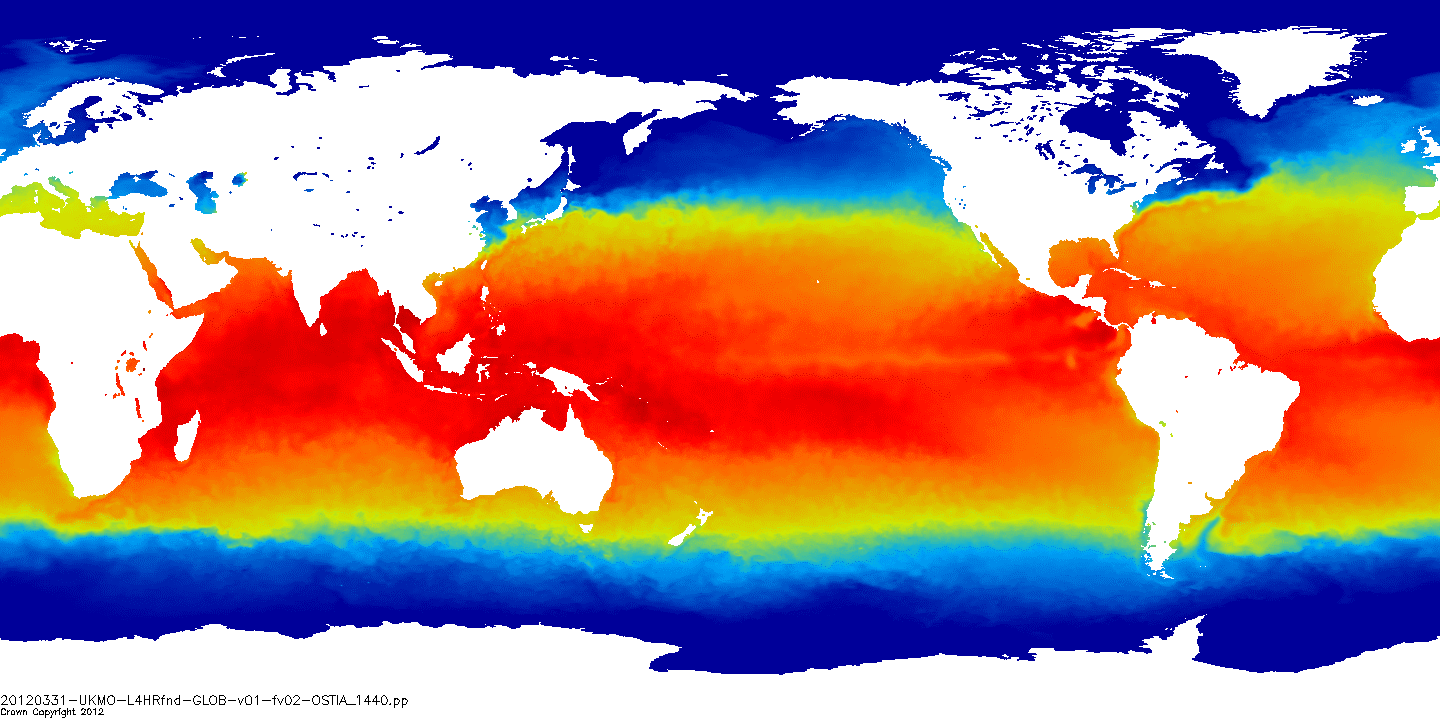
This product provides a gap free map of sea surface temperature at high resolution (UHR) on a 0.1 x 0.1 degree grid (approximately 10 x 10 km) for the Global Ocean, every 24 hours. It combines the nighttime observations of several infrared and microwave spaceborn instruments over a period of 24 hours.
-
Advanced Along-Track Scanning Radiometer multimission data have been reprocessed to provide update retrievals of Sea Surface Temperature (SST) to produce the AATSR Reprocessing for Climate (ARC) dataset.
-
The Scottish Remote Sensing Index (SRSI) is a collaboration between Scottish public sector organisations to public information about the remote sensing data they hold. For each remote sensed dataset, the spatial extent is captured, along with 12 attributes, including the sensor type, spatial resolution, and contact details of the data custodian. The licence status attribute can be used to filter the dataset to find openly available data.
-
This download service provides spatial data relating to orthoimagery held by the Scottish Government.
-
This download service provides spatial data relating to orthoimagery held by the Scottish Government.
-
This download service provides spatial data relating to orthoimagery held by the Scottish Government.
-
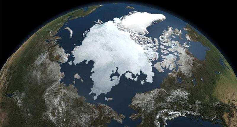
Sea Ice Arctic
-
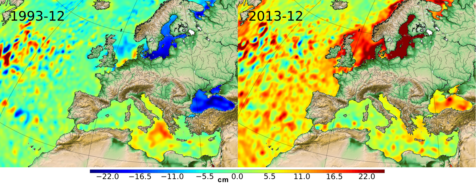
Ssalto/Duacs multimission gridded sea surface heights products. From January 1993 to the last extension of the Delayed-time products, the long delayed-time dataset allows to compute statistical means of Maps of Sea Level Anomalies (MSLA) over different periods of time. Computed with respect to a twenty-year mean profile [1993-2012], and including the seasonal variability (no annual cycle is removed).
-

The Ocean Heat Content ("OHC") is estimated from the measurement of the thermal expansion of the ocean based on differences between the total sea-level content derived from altimetry measurements and the mass content derived from gravimetry data, noted “altimetry-gravimetry”. The Earth Energy Imbalance ("EEI") indicator is derived from the temporal variations of the ocean heat content, i.e. by calculating its derivative (called the ocean heat uptake). A single NetCDF file provides all variables, including all data used to calculate the Ocean Heat Content and the Earth Energy Imbalance indicators, delivered transparently and allowing users to reconstruct their own Ocean Heat Content or Earth Energy Imbalance indicators. Users will therefore be able to find, among other things : - the regional map of the Ocean Heat Content trends (3°x3°) (see image associated with this metadata sheet) - global ocean heat content time series (representative of the globe within the extent of data availability) - earth energy imbalance time series (from global OHC filtered-out from signals lower than 3 years)
-

Monomission Sentinel-3A altimetry product, LR-RMC mode (Low-Resolution with Range Migration Correction) with along-track level-2 estimations at 20Hz rate in LR-RMC mode. LR-RMC associated waveforms are also included, as well with the geophysical corrections applied to the altimeter range (SGDR files).