 Metadata catalogue
Operational oceanography
Type of resources
Available actions
Topics
Keywords
Provided by
Representation types
-
Significant Wave Height (SWH) monomission along-track altimeter satellite product available for Sentinel-3A and Sentinel-3B missions in Near-Real-Time. SWH values are computed from the High Resolution Mode, also known as Synthetic Aperture Radar mode (SAR) and are calibrated relative to buoys. A validity flag and the applied correction are also provided. Since April 2021, a new variable is included in the files : wind speed, computed by Gourrion (2002) algorithm using Collard (2005) table with PLRM sigma0 and SWH. Moreover, the values are cross-calibrated with Jason-3 standard F wind speed.
-
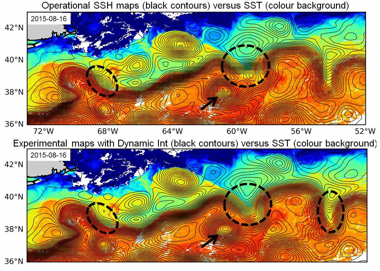
Multimission altimeter products "Experimental" with a finer resolution in preparation to the SWOT Era with sea surface heights computed with respect to a twenty-year mean and Geostrophic velocities, resulting from specific processes, available in delayed time. Use: regional studies, ocean variability (mesoscale circulation,...),