 Metadata catalogue
October
Type of resources
Available actions
Topics
INSPIRE themes
Keywords
Contact for the resource
Provided by
Years
Formats
Representation types
Update frequencies
status
-
INFOMAR backscatter data is measured primarily by multibeam (MBES) and also singlebeam (SBES) echosounder devices. MBES transducers transmit multiple a high frequency pulses of sound from beneath a vessel in a fan shape down to the seabed. The amount of energy reflected back to the vessel for each pulse of sound is termed the backscatter. The amount of energy returned will depend on the seabed type, for example a softer bottom such as mud will return a weaker signal than a harder bottom, like rock. Backscatter therefore can be used to infer seabed type.
-
This network includes ground-based measurements for approximately 50 stations in the Renewable Resource Monitoring and Mapping (RRMM) Solar Radiation Monitoring Network. The current stations provide one-minute resolution data for three solar components, along with temperature, humidity, wind speed and direction, and barometric pressure. The network began with three stations in January 2013, and additional stations were added in May and June of that year. Additional stations of the same design are being added, and a group of higher tier research quality stations will be added in the second half of 2013 and in early 2014. Solar data is collected at various temporal resolutions: 1-minute, hourly, daily, monthly, and annual averages of 3-second samples for all solar and meteorological components are collected at each station. IRENA has access to monthly data only. Other resolutions are available for purchase directly from K.A.CARE.
-
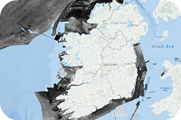
The National Marine Planning Framework (NMPF) Area is the geographic area management and reporting unit for Ireland's NMPF reporting. The NMPF sits at the top of the hierarchy of plans and sectoral policies for the marine area of Ireland. Marine planning brings together multiple users of the ocean to make informed and coordinated decisions on the sustainable use of marine resources. EU Directive 2014/89/EU, establishing a framework for maritime spatial planning, was adopted in July 2014. The European Union (Framework for Maritime Spatial Planning) Regulations 2016 were signed into law on 29th June 2016. The NMPF is managed by the Department of Housing Planning and Local Government (DHPLG) with monitoring support provided by the Marine Institute. The area applies from the High Water Mark in Ireland’s coastal waters, territorial seas, exclusive economic zone and in designated parts of the continental shelf. Ireland’s marine area totals over 488,000 Km2.
-
The station design includes a 100-m tall wind monitoring mast which takes measurements of multiple wind and meteorological parameters at heights of 100, 98, 80, 60, and 40 meters along the mast. Wind data is collected at various temporal resolutions; 10-minute, hourly, daily, monthly, and annual average of 10-m samples and maximum gusts for all wind and meteorological components are collected at each monitor. IRENA has access to monthly data only. Other resolutions are available for purchase directly from K.A.CARE.
-
This network includes ground-based measurements for approximately 50 stations in the Renewable Resource Monitoring and Mapping (RRMM) Solar Radiation Monitoring Network. The current stations provide one-minute resolution data for three solar components, along with temperature, humidity, wind speed and direction, and barometric pressure. The network began with three stations in January 2013, and additional stations were added in May and June of that year. Additional stations of the same design are being added, and a group of higher tier research quality stations will be added in the second half of 2013 and in early 2014. Solar data is collected at various temporal resolutions: 1-minute, hourly, daily, monthly, and annual averages of 3-second samples for all solar and meteorological components are collected at each station. IRENA has access to monthly data only. Other resolutions are available for purchase directly from K.A.CARE.
-
This data describes the distribution of specific habitats identified in the EU Directive on the Conservation of Habitats, Flora and Fauna, also known as the Habitats Directive. The data is presented in the Habitats Directive Article 17 2019 report called The Status of EU Protected Habitats and Species in Ireland, available here https://www.npws.ie/publications/article-17-reports. This distribution of estuaries, salt marshes, sand dunes, sea cliffs and subtidal sandbanks were mapped over a time period inclusive of 1983 to 2018 by the National Parks and Wildlife Service and its associated entities. A detailed desk study was carried out to catalogue all sea cliff sites in Ireland using 2005 OSI aerial photographs and images of the Irish coastline captured in 2003. A conservation assessment and survey technique were developed (based on the pilot survey completed in 2009) and field surveys and assessments were carried out at 32 cliff sites around Ireland. This work was completed by January 21 2011. The saltmarsh data is used as part of the monitoring of four Annex I saltmarsh habitats Article 17 reporting under the Habitats Directive. A field survey was carried out visiting 86 sites, of which 85 were assessed using data collected in the field from January 1982 to September 2018. The subtidal sandbanks data was prepared as part of Ireland's third 6-yearly report to the EU, for the period 2013 to 2018, on the conservation status of all habitats and species referred to in Article 2 of the Council Directive 92/43/EEC of 21 May 1992 on the conservation of natural habitats and of wild fauna and flora (the Habitats Directive). The Distribution for the habitat was generated by intersecting the full 10km grid of 2000 grid cells with all known polygon locations for the Annex I Habitat Sandbanks (1110). see NPWS, 2019*, Section 5.15, p.7 for details. Further information: https://www.npws.ie/maps-and-data/habitat-and-species-data/article-17/2019/habitats/coastal-habitats The data represent the best-known distribution of these Annex habitats based on available mapped data, and these annexe habitat distributions may be a subset of Sea Cliffs or Sandbanks or Saltmarsh nationally, other features not meeting the criteria of the given Annex habitat – https://ec.europa.eu/environment/nature/legislation/habitatsdirective/docs/Int_Manual_EU28.pdf and https://www.npws.ie/sites/default/files/publications/pdf/A%20Guide%20to%20Habitats%20in%20Ireland%20-%20Fossitt.pdf Vegetated sea cliffs of the Atlantic and Baltic coasts (EU Code 1230) https://www.npws.ie/sites/default/files/article-17/2019/habitats/1230/1230VegetatedSeaCliffs.zip Sandbanks which are slightly covered by seawater all the time (EU Code 1110) https://www.npws.ie/sites/default/files/article-17/2019/habitats/1110/1110Sandbanks.zip For ‘Saltmarsh’ there are 4 Annex 1 saltmarsh habitats, namely; • Salicornia and other annuals colonizing mud and sand (1310) • Atlantic salt meadows (Glauco-Puccinellietalia maritimae) (1330) • Mediterranean salt meadows (Juncetalia maritimi) (1410) • Mediterranean & thermo-Atlantic halophilous scrubs (Sarcocornetea fruticosi) (1420) The metadata link from the Atlas metadata acknowledges the 4 annexe habitats, but it is not clear if the single-layer represents all four (ie if MI have created a composite version). However, to note there are actually multiple points and poly files for each of the 4 saltmarsh Annex habitats – see downloads https://www.npws.ie/sites/default/files/article-17/2019/habitats/1310/1310Salicorniamud.zip https://www.npws.ie/sites/default/files/article-17/2019/habitats/1330/1330AtlanticSaltMeadows.zip https://www.npws.ie/sites/default/files/article-17/2019/habitats/1410/1410MediterraneanSaltMeadows.zip https://www.npws.ie/sites/default/files/article-17/2019/habitats/1420/1420HalophilousScrub.zip
-
This Illustrates the existence or planned presence of marine renewable energy sites (wind farm authorisations) in Irish waters, as catalogued and displayed by 4C Offshore and DP Energy. The features were digitized manually from visualisations of windfarm authorisations viewable on https://www.4coffshore.com/offshorewind/ while the location for Inis Ealga was supplied in a shapefile provided by DP Energy. The research was undertaken by the MaREI Centre for Marine and Renewable Energy and published in 2019.
-
The location of seabed gas pipeline infrastructure from Cork to the Kinsale platform, Mayo to the Corrib platform and the international connector routes between Ireland and Scotland.
-
This dataset shows spawning and nursery grounds of commercially important species, in particular: Hake, Mackerel, Horse Mackerel, Atlantic Cod, Herring, Haddock, Megrim, Blue Whiting, Black Belly Angler Monkfish, White Belly Angler Monkfish and Whiting. Spawning area, spawning grounds and spawning beds are considered the locations where commercially important species of fish leave their eggs for fertilisation. Spawn consists of the reproductive cells (gametes) of fish, some of which will become fertilised and produce offspring. The process of spawning typically involves females releasing ova (unfertilized eggs) into the water, often in large quantities, while males simultaneously or sequentially release spermatozoa (milt) to fertilise the eggs. Spawning grounds help understand the species distribution of a particular commerically important fish. Marine nursery areas are habitats that promote the survival of young commercially important fish species. Many of these creatures are important to humans in fisheries and seafood. These habitats are essential for the reproduction and understanding of the geographical species distribution. Take them away or degrade them, and the production of commercially harvested species will decline or cease altogether. Spawning and Nursery grounds are areas where both spawning and nursery grounds overlap.