MSFD
Type of resources
Available actions
Topics
INSPIRE themes
Keywords
Contact for the resource
Provided by
Years
Formats
Representation types
Update frequencies
Scale
-

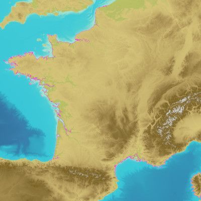
The land-sea limit corresponds to the Highest Astronomical Tide (HAT) in the case of a tide of coefficient 120 and under normal meteorological conditions (no offshore wind and mean atmospheric pressure of 1013 hPa). This geometric line is naturally defined as the intersection of a HAT model (extended to the coast and the top end of the upper estuary) based on the available Bathyelli surfaces, and a high-resolution digital terrain model of the coastal area. It corresponds to the highest limit of the intertidal area and takes into account, when they exist, the 3 administrative maritime limits which are: the transversal limit of the sea (LTM), the salt water limit (LSE) and the limit of maritime jurisdiction (LAM). This limit is measured (quoted) in relation to the local hydrographic chart datum and to the levels of reference for France (IGN69 and IGN78 for Corsica). Relations to other levels of reference (mean sea level and ellipsoid) are known. The land-sea limit product, mainly results from the exploitation of the two products Litto3D®/RGEALTI® and Bathyelli, and represents, with a metric resolution (1 to 5 metres), this theoretical entity by a set of 2D polylines describing the nature of the coast (artificial or natural, rocky or sandy, steep or flat, etc.). The method used for calculating the land-sea limit makes it possible to produce a continuous, homogeneous and spatially coherent limit on the entire French metropolitan coastal area.
-
Dataset delle aree marine italiane di diviosne del Mare Adriatico oggetto del reporting per la Strategia Marina ai sensi dell'art. 4 MSFD; si compone delle 4 aree.
-
Dataset delle sotto-regioni marine italiane oggetto del reporting per la Strategia Marina ai sensi dell'art. 4 MSFD; si compone delle 3 aree: Tirreno, Ionio e Adriatico.
-
Dataset della regione marina italiana oggetto del reporting per la Strategia Marina ai sensi dell'art. 4 MSFD.
-

EMODnet (European Marine Observation and Data Network) is the long term marine data initiative supported by the European Commission since 2009 to ensure that European marine data will become easily accessible, interoperable, and free on restrictions on use. EMODnet Chemistry provides access to standardized, harmonized and validated chemical data collections for water quality evaluation at a regional scale, as defined by the Marine Strategy Framework Directive (MSFD). The data portal has adopted and adapted SeaDataNet standards and services, establishing interoperability between the data sets from the many different providers (more than 60 in EMODnet Chemistry network). Concentration maps of nutrients, chlorophyll-a and dissolved oxygen are computed on a standard grid, providing information at a regular time interval, per season and over several vertical layers, including the deepest one. Dedicated OGC standard services for browsing, viewing and downloading chemistry observation, data and data products for the European waters have been developed, and are actively maintained and monitored.
 Metadata catalogue