 Metadata catalogue
Lowest Astronomical Tide
Type of resources
Available actions
Topics
INSPIRE themes
Keywords
Contact for the resource
Provided by
Years
Formats
Representation types
Scale
Resolution
-
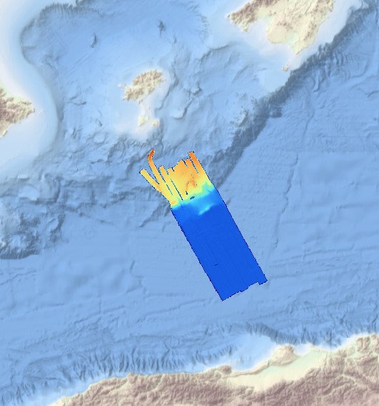
Gridded data for the ESS-ULYX-PP-2023-2 cruise.
-

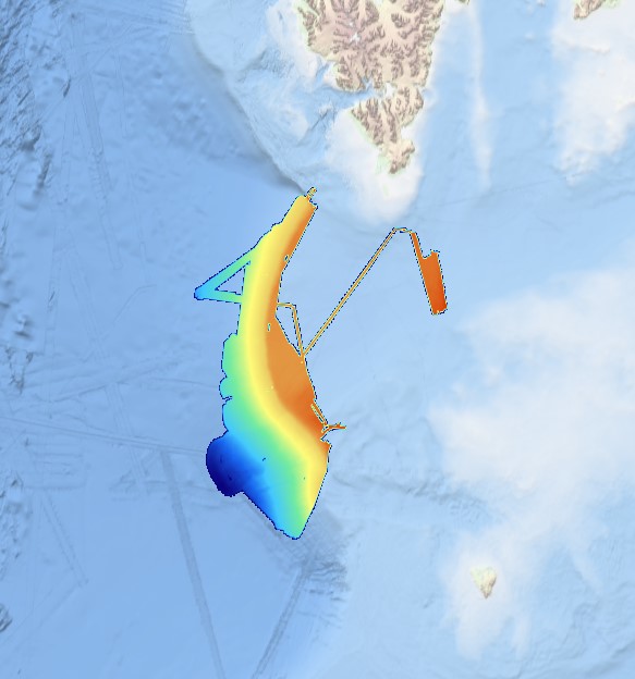
Lidar data taken on the Netherlands side of Sint Maarten, on land and shallow sea.
-
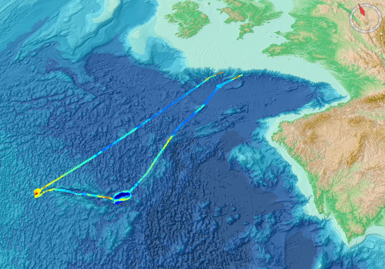
This composite Digital Terrain Model (cDTM) is a high resolution bathymetry dataset that covers CASCADES-I, CASCADES-II, COSTEM-1, COSTEM-2, COSTEM-3, COSTEM-4, FORMED-2, FORMED-4 and FORMED-6 cruises. Multibeam data acquired in 2008, 2009, 2010, 2011, 2013, 2014 and 2015 on board the R/V Sarmiento de Gamboa and the R/V García del Cid with an Atlas Hydrosweep DS-3 and an Elac Seabeam 1050D echo-sounder.
-
This composite Digital Terrain Model (cDTM) is a high resolution bathymetry dataset that covers SALTFLU cruise. Multibeam data acquired in 2012 on board the R/V OGS Explora with a Reason 8150 echo-sounder
-
Multibeam data acquired in 2007 during the SVAIS cruise on board the R/VHespérides with a Simrad EM12 echo-sounder
-
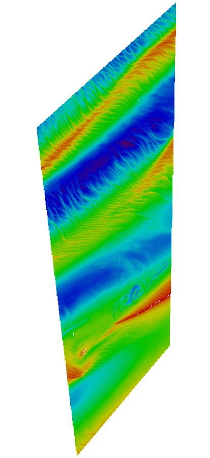
Maas West Outer Vlissingen, South part. There are sand waves. Surveyed by one of the Hydrographic Survey Vessels of the Royal Netherlands Navy.
-

Bathymetric data resulting from hydrographic surveys for cartographic purposes and/or port management. Surveys carried out in accordance with the IHO S-44 standard.
-
Bathymetric data resulting from hydrographic surveys for cartographic purposes and/or port management. Surveys carried out in accordance with the IHO S-44 standard.
-

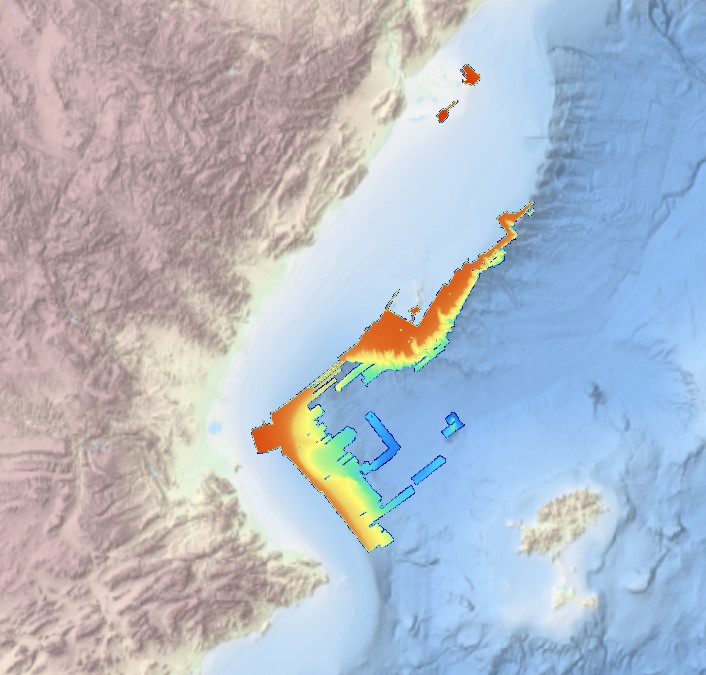
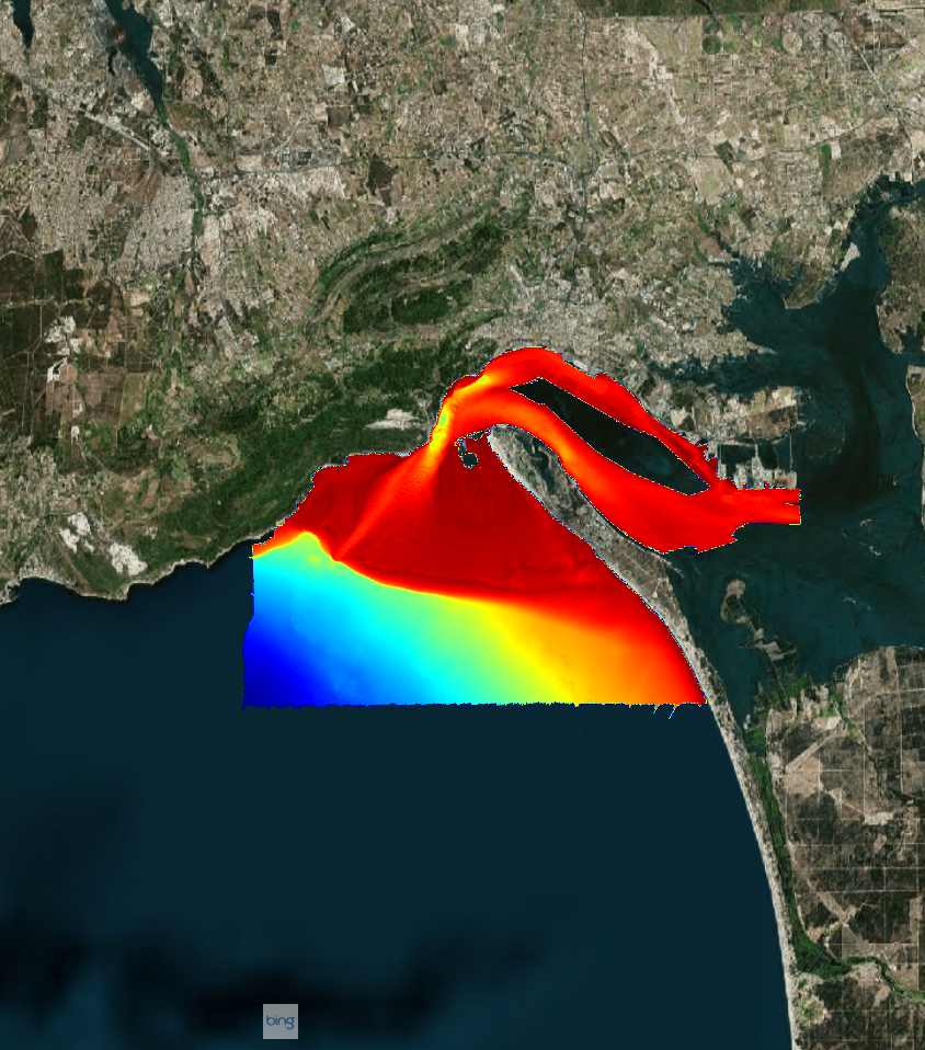
Multibeam bathymetry of Haifa Bay. Description of processed data sources: the data come from the IOLR's R/V Etziona www.ocean.org) with a Kongsberg-Simrad EM1002 (90 kHz, 111 beams). The data is the property of the Israeli Government, Ministry of National Infrastructures, which was renamed to the Ministry of Energy and Water. The original data is classified. The navigation is all with real-time corrections and is <1 m. The appropriate oceanographic measurements were made with my AML CTD as well as a Valeport SV. The analysis was all done with CARIS HIPS/SIPS. The data include another survey in deeper water with an ELAC Nautik Gmbh. SeaBeam 3050 50 kHz system, a year ago aboard the R/V Mediterranean Explorer (www.ecoocean.com) . It covered some 7,000 sq. km. from depths of ~500 to 1600 m.
-

Systematic survey performed by IDROSPED with Singlebeam EchoSounder