 Metadata catalogue
Land Use
Type of resources
Available actions
Topics
INSPIRE themes
Keywords
Contact for the resource
Provided by
Years
Formats
Representation types
Update frequencies
status
Scale
-
The Perth and Kinross Employment Land Audit is prepared annually to provide up to date and accurate information on the supply and availability of employment land for business and industrial use within the Perth and Kinross Council area. This audit has been prepared from information provided in the Local Development Plan and through the monitoring of planning application approvals.
-
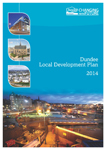
The Local Development Plan for Dundee contains the spatial strategy that will guide future development up to 2024 and shows which land is being allocated to meet the City's development needs and where new development should and should not happen. The Plan contains policies and proposals covering the principal land use issues in the City and will provide the context in which decisions on planning applications will be made. The Local Development Plan will be reviewed at five yearly intervals to ensure that an up to date plan is in pl ace at all times to guide future development in the City.
-
Perth Green Belt from the 2019 Perth & Kinross Council Adopted Local Development Plan 2
-
The Scottish Vacant and Derelict Land Survey (SVDLS) is a survey undertaken to establish the extent and state of vacant and derelict land in Scotland. The survey has been operating since 1988 and is managed by the Scottish Government Communities Analytical Services. Most Councils submit data annually with the Survey base date of 31st March. The data collected provides an invaluable source of information relating to vacant and derelict sites and assists in reinforcing and justifying national policy established to bring about the re-use and regeneration of these land resources. Dundee City Council conduct an annual survey where potential sites, identified in the preceding 6 months by Dundee City Council, are assessed for possible inclusion on the Scottish Vacant & Derelict Land register for that year. During the survey any site that has been redeveloped or regenerated are removed from the register and reported to Scottish Government. Scottish Government also provide Vacant & Derelict Land Funding (VDLF) to qualifying local authorities to facilitate the regeneration of land.
-
O Loteamento Industrial insere-se de acordo com o Plano de Pormenor da Zona Industrial da Calvela em área urbanizada de indústria e armazéns. Tem como finalidade. disciplinar a ocupação e uso do solo da área abrangida pela operação de loteamento da Calvela, em Vale de Cambra, inserido, no Plano de Pormenor da Zona Industrial da Calvela.
-

This dataset consists of the Maltese Islands coastal boundary, which represents the terrestrial limit of the coverage of the Strategic Plan for the Environment and Development (SPED).
-

This dataset consists of part of the Strategic Proposals and Marine Objectives as published in the Strategic Plan for the Environment and Development (SPED). It shows the locations of Business hubs, fuel storage sites, park and ride car parks, power station, priority areas for social and community facilities, reverse osmosis plants, sewage treatment plants, waste management facilities, country parks, enterprise hubs, integrated harbour management sites, Aviation hub, national recreational centre, ports for fisheries, sports complexes.
-

This dataset consists of part of the Strategic Proposals and Marine Objectives as published in the Strategic Plan for the Environment and Development (SPED). It shows the location of a Strategic Open Gap which should be kept free from further urban development.
-

This dataset consists of part of the Strategic Proposals and Marine Objectives as published in the Strategic Plan for the Environment and Development (SPED). It shows the classification of the urban areas into Principal Urban Area, Regional Urban Settlements and Small Urban Settlements.
-

This dataset consists of part of the Strategic Proposals and Marine Objectives as published in the Strategic Plan for the Environment and Development (SPED). It shows the locations of Spoil Ground, Bunkering areas and Aquaculture zones.