 Metadata catalogue
Kattegat
Type of resources
Available actions
Topics
INSPIRE themes
Keywords
Contact for the resource
Provided by
Years
Formats
Representation types
Update frequencies
Scale
Resolution
-
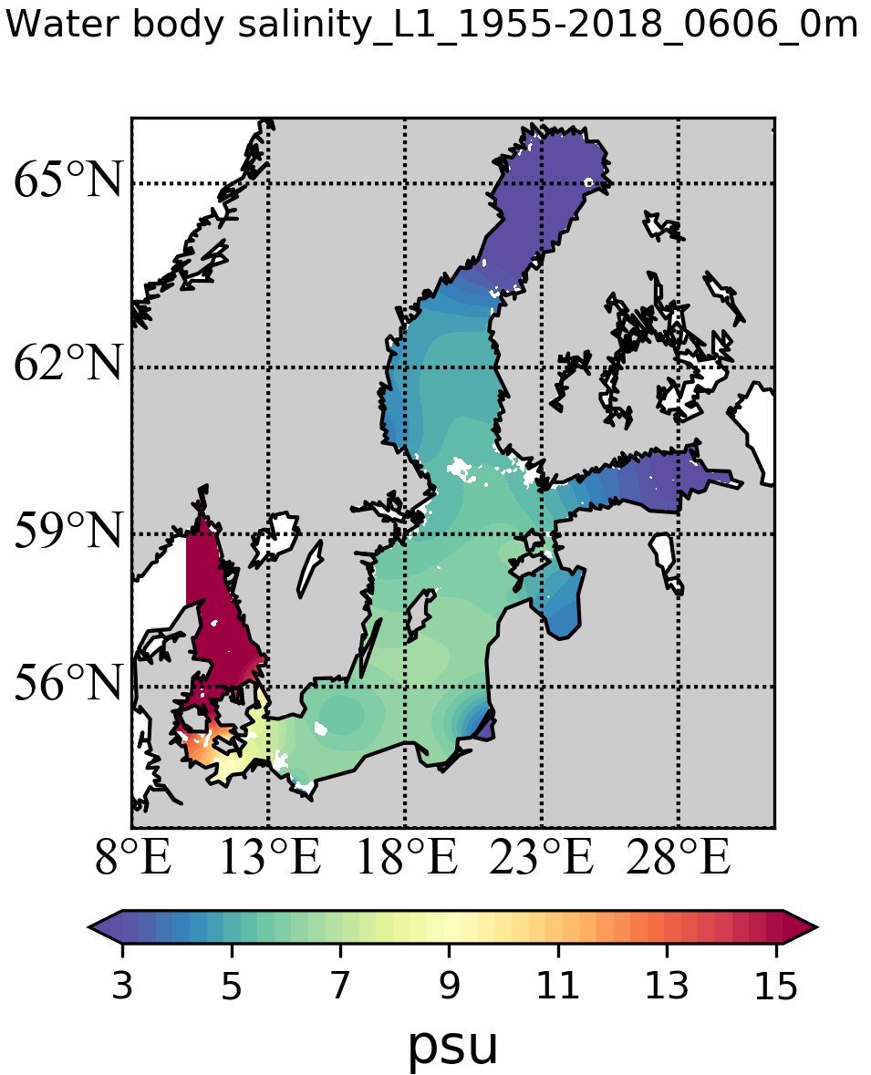
The SDC_BAL_CLIM_TS_V2 product contains temperature and salinity climatologies for the Baltic Sea, including seasonal and monthly fields for the period 1955-2018 and seasonal and monthly fields for 6 decades starting from 1955 to 2018. The climatological fields were computed from a merged Baltic Sea data set that combines data extracted from two major sources: 1) SeaDataNet infrastructure and 2) Coriolis Ocean Dataset for Reanalysis. The computation was done with the DIVAnd (Data-Interpolating Variational Analysis in n dimensions), version 2.6.3.
-
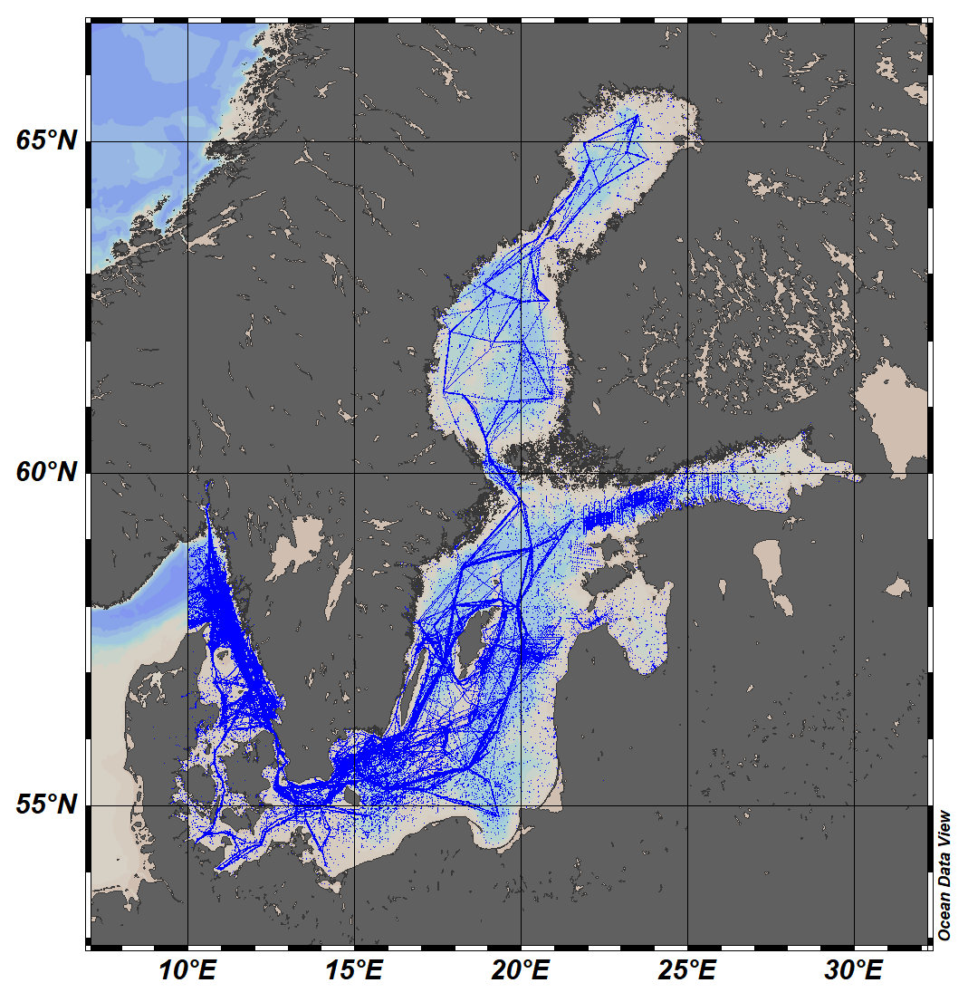
The SeaDataCloud Temperature and Salinity historical data collection for the Baltic Sea V2 includes open access in situ data on temperature and salinity of water column. The data were retrieved from the SeaDataNet infrastructure during summer 2019. Data have been quality controlled according to the SeaDataNet2 project QC procedures in conjunction with the visual expert check using the ODV software. The final number of stations in the collection is 481695, containing around 14.4 million values for both temperature and salinity. The dataset format is ODV binary collection which you can read, analyse and export from with the ODV application provided by the Alfred Wegener institute at http://odv.awi.de/. For data access please register at http://www.marine-id.org/.
-
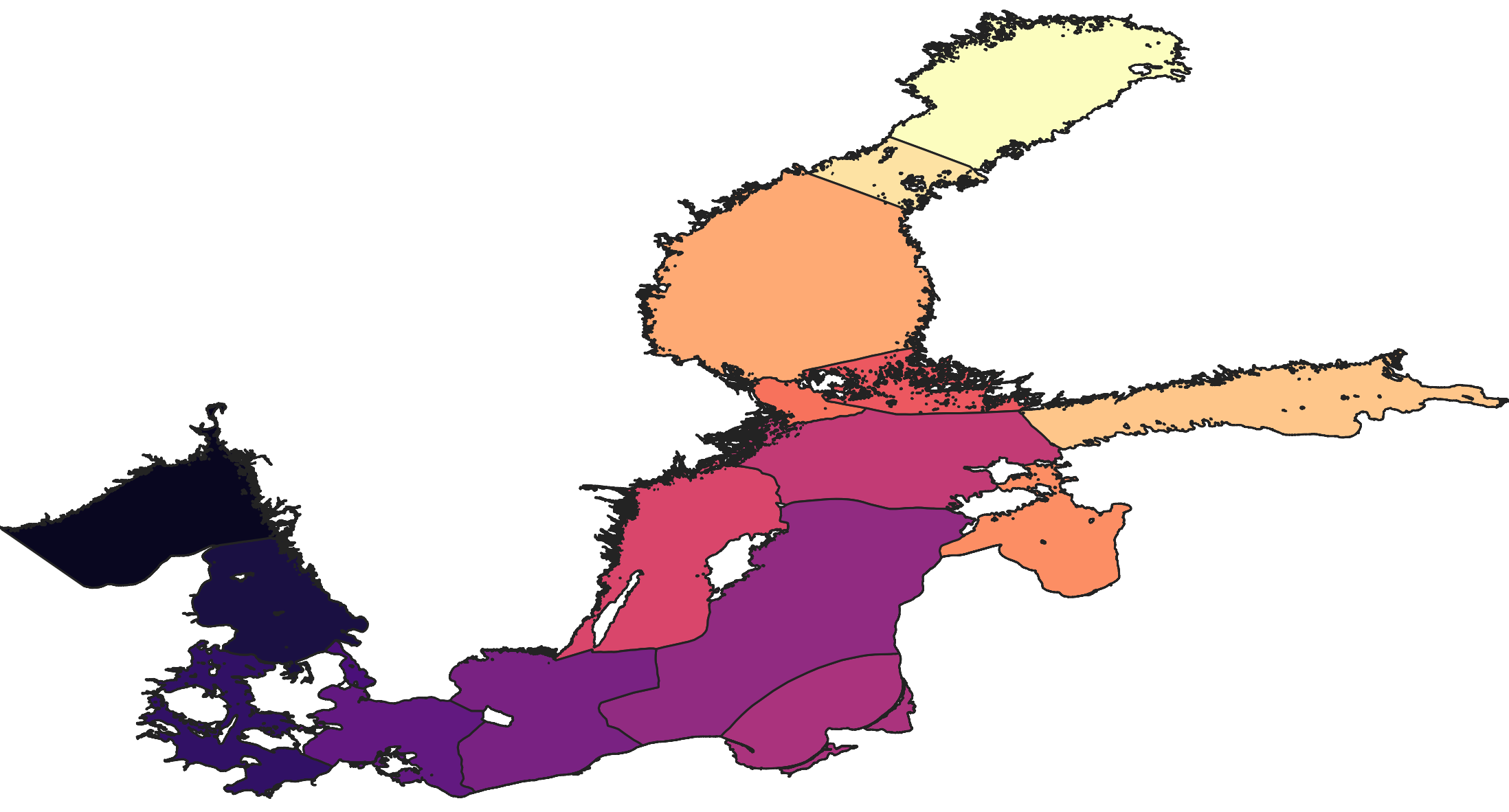
The SDC_BAL_TS_statistics_DP1 contains temperature and salinity means and standard deviation at different depths in basins in the Baltic Sea for every month. Based on the SeaDataCloud historical dataset SDC_BAL_DATA_TS_V2 covering the period 1900 – 2019 and merged with the Coriolis ocean dataset for reanalysis (CORA) dataset (https://www.seanoe.org/data/00351/46219/).
-

This vector dataset represents the benthic broad habitat types in Europe Seas potentially affected by the ship wakes. When navigating, the propellers of ships generate a turbulent mixing of the water that can produce sediment re-suspension in soft bottoms of shallow areas. This can increase the turbidity in those areas, affecting the seafloor organisms (especially those that are directly dependent on light, such as aquatic plants). It may also contribute to an increase of the the eutrophication level of the ecosystem (since the turbid waters may become warmer, which may turn into a reduction of dissolved oxygen in water). Finally, turbidity can produce an increase in the inputs of contaminants and microbial pathogens, since those can become attached to the suspended solids. The dataset has been prepared in the context of the development of the first European Maritime Transport Environmental Report (https://www.eea.europa.eu/publications/maritime-transport).
-
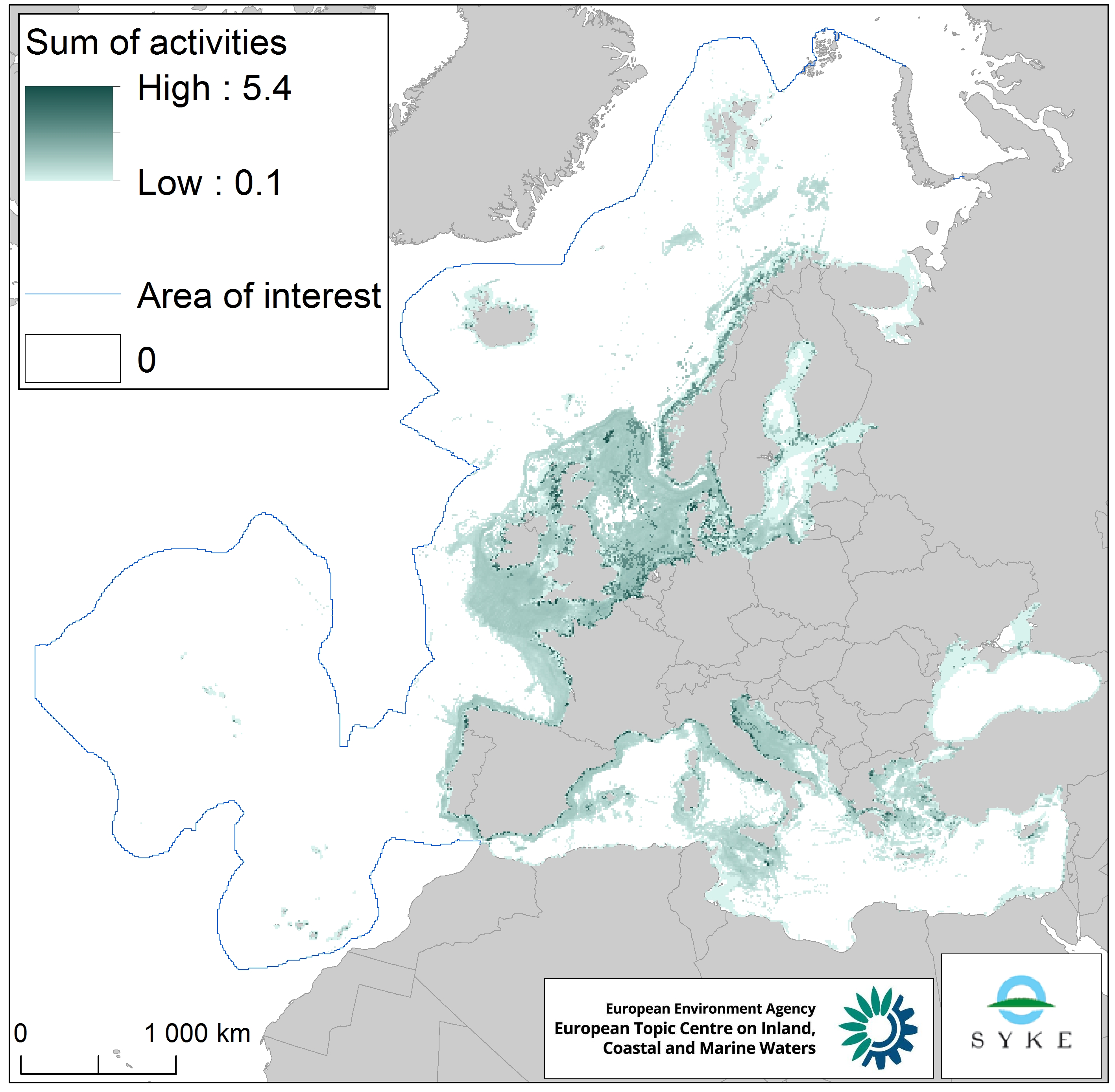
This raster dataset represents physical disturbance to the seabed in the European seas. Several human activities disturb the seabed either directly or indirectly. Alteration of benthic living conditions as a result of increased sedimentation or attenuation of light penetration, abrasion of the seabed and exploitation of benthic biota, temporarily disturb the benthic habitat quality. The dataset is an aggregation of several different human activities that cause physical disturbance to the seabed: aquaculture, demersal fishing, dredging and dumping of dredged material, oil and gas rigs, offshore installations, ports, sand and gravel extraction, shellfish mariculture, shipping in shallow waters and windfarms. The resulting dataset is a raster (10km grid cell) derived from EMODnet, MED-IAMER, JRC-STECF, OSPAR, HELCOM and 4C Offshore datasets, and with reference temporal coverage from 2012 to 2017. This dataset has been prepared for the calculation of the combined effect index, produced for the ETC/ICM Report 4/2019 "Multiple pressures and their combined effects in Europe's seas" available on: https://www.eionet.europa.eu/etcs/etc-icm/etc-icm-report-4-2019-multiple-pressures-and-their-combined-effects-in-europes-seas-1.
-
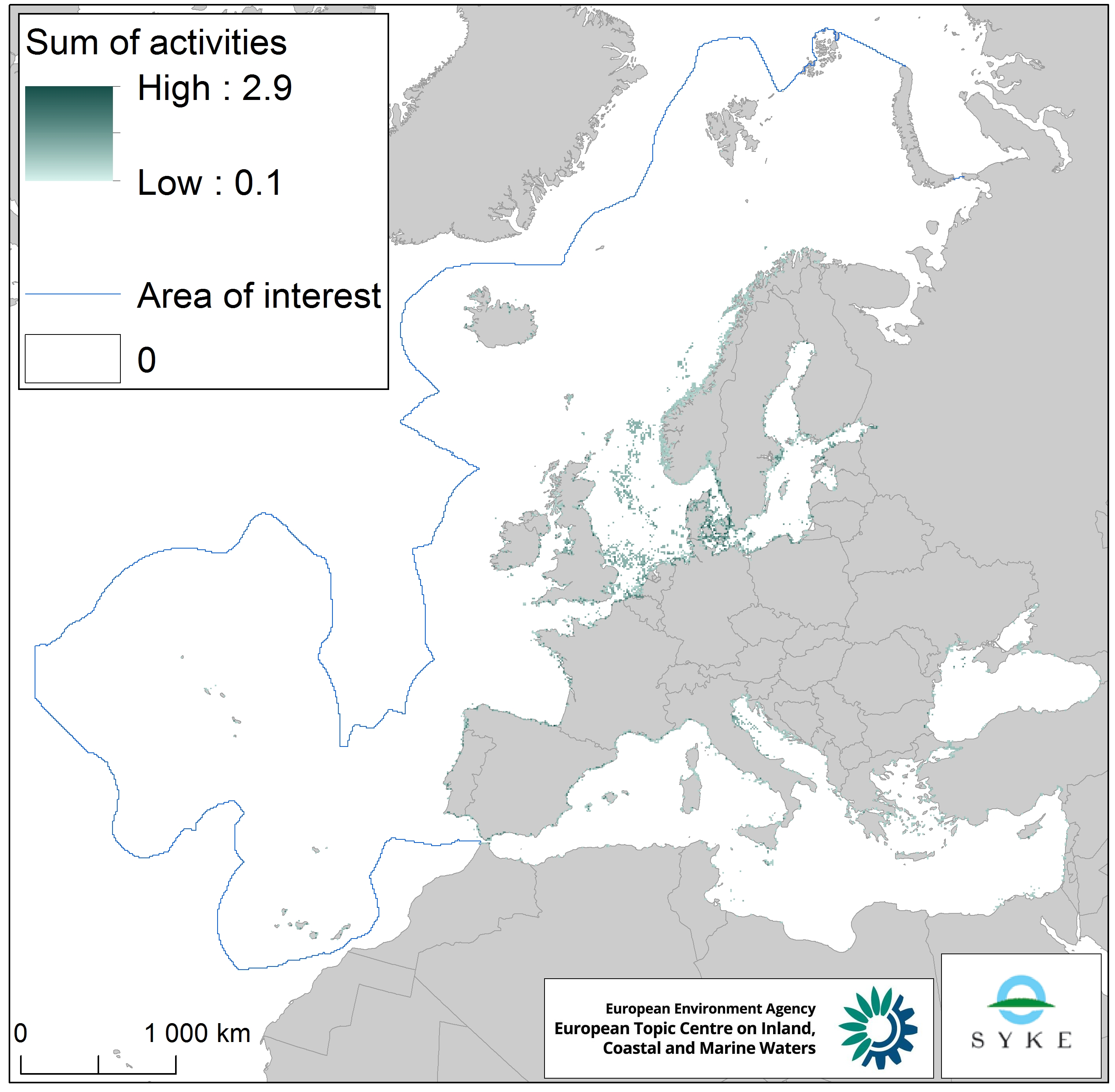
This raster dataset represents the physical loss of the seabed in the European seas. Physical habitat loss is an extreme pressure on the marine ecosystem which was defined to include all impacts on the seabed which take more than 12 years to recover, a time span influencing even long living marine mammals and seabirds. Habitat is lost if its substrate, morphology or topography is permanently altered. The dataset is an aggregation of several different human activities that cause physical loss in the seabed: dredging and dumping of dredged material, oil and gas rigs, offshore installations, ports, sand and gravel extraction and windfarms. The resulting dataset is a raster (10km grid cell) derived from EMODnet, MED-IAMER and 4C Offshore datasets and with temporal reference from 2012 to 2017. Higher values mean more loss causing activity in the area. Due to its resolution, loss causing activity in a cell does not usually mean that all the seabed habitat in the area is lost. This dataset has been prepared for the calculation of the combined effect index, produced for the ETC/ICM Report 4/2019 "Multiple pressures and their combined effects in Europe's seas" available on: https://www.eionet.europa.eu/etcs/etc-icm/etc-icm-report-4-2019-multiple-pressures-and-their-combined-effects-in-europes-seas-1.
-
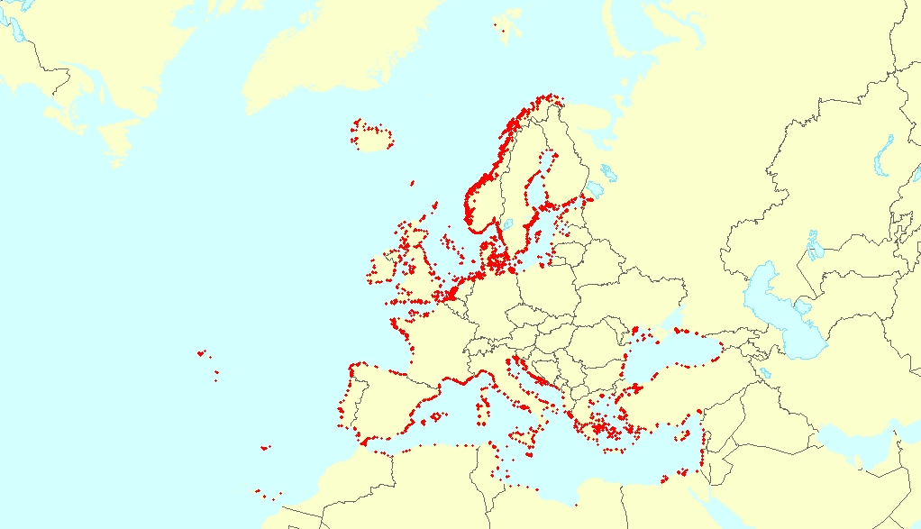
This vector dataset represents the benthic broad habitat types in Europe seas potentially affected by anchoring. The anchoring of vessels can produce damages to the seafloor and the loss of the habitat where it happens. It takes place in shallow waters, close to ports, where vessels have to wait for a spot in the port so they can load or offload (since ports have a limited amount of dockage). The anchoring areas allow vessels to safely anchor in protection from bad weather or other circumstances. The type of alterations to the habitats resulting from anchoring depend mainly on the dimensions and type of the anchor, as well as its movement resulting from the movement of the vessel due to currents or waves, which can increase the adverse effects. The dataset has been prepared in the context of the development of the first European Maritime Transport Environmental Report (to be published as an EMSA-EEA report in 2021).