 Metadata catalogue
Italy
Type of resources
Available actions
Topics
INSPIRE themes
Keywords
Contact for the resource
Provided by
Years
Formats
Representation types
Update frequencies
status
Scale
-

Source: RSE S.p.A. Website: www.rse-web.it Description: Annual mean wind speed and specific production maps at four levels (25, 50, 75 and 100 m) above ground and sea, with 1 km spatial resolution, are available in a WebGIS for navigation and free download. The maps have been calculated by means of the WINDS model of Genoa University. The onshore maps have been calibrated with more than 200 met stations data, the offshore maps with satellite data and few available direct measurements. Constraints maps can be overlapped. A “Performance Calculation” tool allows the user to perform a technical-economical evaluation of hypothesis of wind farms based on the dataset of the Wind Atlas. Detailed description: http://irena.masdar.ac.ae/docs/OWEMES_Italian_wind_atlas_english_version_paper.pdf Original website: http://atlanteeolico.rse-web.it/viewer.htm Please access he data quality information for this dataset at: http://globalatlas.irena.org/dqif/publishdata.aspx?datasetid=3034. Also for additional information please download the data quality framework report at: goo.gl/T2wMaq
-
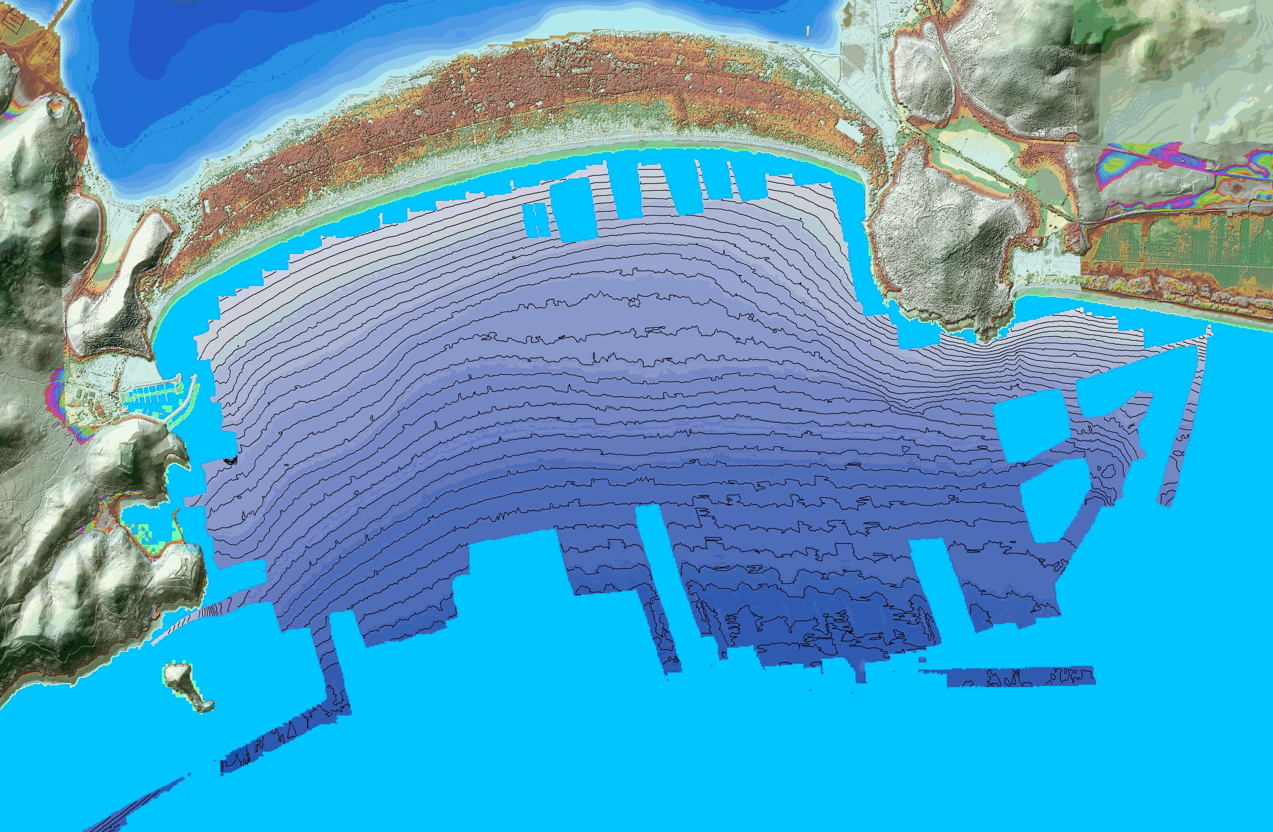
These bathymetric data were produced using the interferometric side-scan sonar onboard the Haliotis Research Vessel, Operated by Genavir, for the French Oceanographic Fleet, in October 2022, during the oceanographic campaign HISOPE (l'Haliotis pour l’Imagerie Sismique d’Orbetello et Pyrgi Etrusques). The investigated area is located in front of the tombolo di Feniglia, in the Gulf of Porto Ercole. The goal of the campaign was to image the sedimentary architecture of the Tombolo di Feniglia Acquisition took place from October 1st to October 6th 2022. Data were acquired by eng. Quentin Layahe, Genavir, onboard the Haliotis, piloted by Serge Garcia, and post-processed using the software Globe, developed by the IFREMER, by Dr.Gilles Brocard (Archéorient, University of Lyon 2, France) and Alessandro Conforti, research engineer at the CNR (Italian national center for research) at Orosi, Sardinia.
-
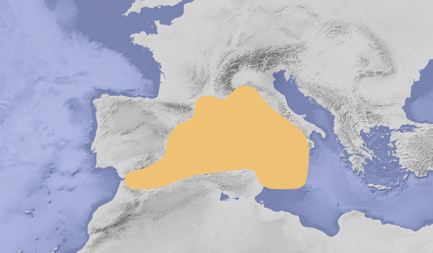
Study area of SIMWESTMED Project composed by FAO sub-area 37 including Malta waters
-
Le gravità osservate sono riferite alla IGSN71 e le Anomalie di Bouguer sono state calcolate a densità 2.67 g/cm3 Sono state realizzate 39 mappe delle Anomalie di Bouguer (secondo il taglio cartografico della carta "Jog -1501 Il Mondo serie 250/G") alla scala 1:250.000, disponibili in formato digitale. Il progetto di cartografia digitale è frutto di una collaborazione scientifica tra il Servizio Geofisica del Dipartimento di Difesa del Suolo di ISPRA, Gruppo Cartografia e Telerilevamento del Dipartimento di Geofisica della Litosfera di OGS e Exploration & Production Division di ENI.