 Metadata catalogue
IR-FOF
Type of resources
Available actions
Topics
Keywords
Contact for the resource
Provided by
Years
Formats
-
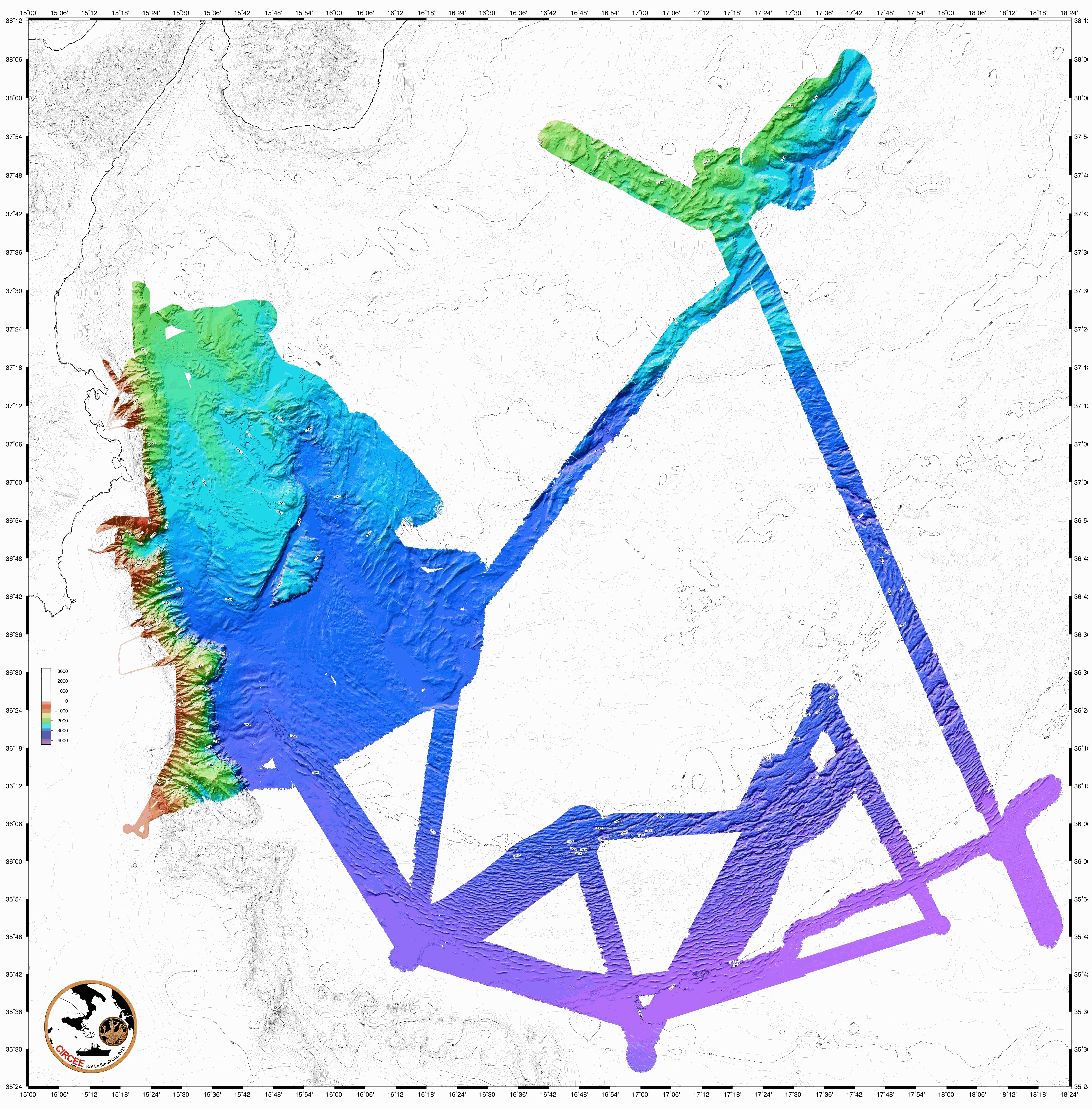
The following data were acquired in 2013 by the french research vessel N/O Suroit during the CIRCEE cruise (see the cruise report): - High-resolution 72-trace seismic data. The files are available in the segy format. A map is provided to locate the 1500 km of seismic profile acquired. - Gridded bathymetry data (resolution : 90m) available in GRD format (software GMT Generic Mapping Software de Wessel & Smith based on NetCDF libraries). A map is available. - Bathymetry data from multibeam echo sounder Kongsberg-Simrad EM302. The data are available in the raw data mbg and include the travel time and amplitude (reflectivity). - Highfrequency chirp-sonar data. The files are available in the segy format. A map is available in the cruise report.
-
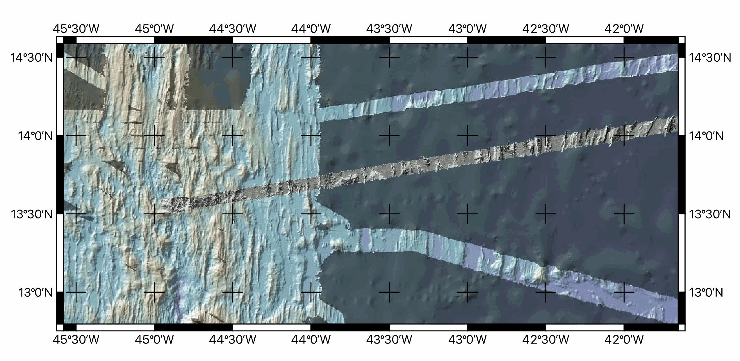
Multibeam bathymetry data, gridded at ~100m, acquired around during the transit towards the Mid-Atlantic ridge axis (13°20'N and 13°30'N oceanic detachments area) during the ODEMAR cruise (2013). Bathymetric data was acquired by the PourQUoi Pas? multibeam system (RESON SEABAT 7150). Data is provided as geotiffs (WGS84) ODM_transit_16Nov.tif Extent -27.8375538800000015,16.3530121699999995 : -26.3755538800000018,16.6860121699999979 Width 1463 Height 334 Data type Float32 - Thirty two bit floating point GDAL Driver Description GTiff GDAL Driver Metadata GeoTIFF Dataset Description /Users/jescartin/WORK/Proyectos/ODEMAR/DATA/Bathygrids/Transit/ODM_transit_16Nov.tif Compression PACKBITS Band 1 STATISTICS_MAXIMUM=-4139.5639648438 STATISTICS_MEAN=-4612.4823849892 STATISTICS_MINIMUM=-4866.7373046875 STATISTICS_STDDEV=121.40234041923 STATISTICS_VALID_PERCENT=29.85 Scale: 1 Offset: 0 More information AREA_OR_POINT=Area TIFFTAG_SOFTWARE=MATLAB 9.14, Mapping Toolbox 5.5 Dimensions X: 1463 Y: 334 Bands: 1 Origin -27.8375538800000015,16.6860121699999979 Pixel Size 0.0009993164730006834189,-0.0009970059880239474058 ODM_transit_17Nov.tif Extent -32.4955601099999996,15.5934151199999995 : -27.8195601099999976,16.4454151199999998 Width 4677 Height 853 Data type Float32 - Thirty two bit floating point GDAL Driver Description GTiff GDAL Driver Metadata GeoTIFF Dataset Description /Users/jescartin/WORK/Proyectos/ODEMAR/DATA/Bathygrids/Transit/ODM_transit_17Nov.tif Compression PACKBITS Band 1 STATISTICS_APPROXIMATE=YES STATISTICS_MAXIMUM=-4458.8168945312 STATISTICS_MEAN=-5144.8000932272 STATISTICS_MINIMUM=-5562.1850585938 STATISTICS_STDDEV=164.55246561258 STATISTICS_VALID_PERCENT=50.04 Scale: 1 Offset: 0 More information AREA_OR_POINT=Area TIFFTAG_SOFTWARE=MATLAB 9.14, Mapping Toolbox 5.5 Dimensions X: 4677 Y: 853 Bands: 1 Origin -32.4955601099999996,16.4454151199999998 Pixel Size 0.0009997861877271759391,-0.0009988276670574447458 ODM_transit_18Nov.tif Extent -36.9279732571747630,14.8264479347363469 : -32.4729732571747647,15.7054479347363465 Width 4456 Height 880 Data type Float32 - Thirty two bit floating point GDAL Driver Description GTiff GDAL Driver Metadata GeoTIFF Dataset Description /Users/jescartin/WORK/Proyectos/ODEMAR/DATA/Bathygrids/Transit/ODM_transit_18Nov.tif Compression PACKBITS Band 1 STATISTICS_APPROXIMATE=YES STATISTICS_MAXIMUM=-5171.58203125 STATISTICS_MEAN=-5712.1738558372 STATISTICS_MINIMUM=-5946.1611328125 STATISTICS_STDDEV=139.45706418798 STATISTICS_VALID_PERCENT=7.565 Scale: 1 Offset: 0 More information AREA_OR_POINT=Area TIFFTAG_SOFTWARE=MATLAB 9.14, Mapping Toolbox 5.5 Dimensions X: 4456 Y: 880 Bands: 1 Origin -36.9279732571747630,15.7054479347363465 Pixel Size 0.0009997755834829438748,-0.0009988636363636358394 ODM_transit_19Nov.tif Extent -41.3188024399999989,14.0843680599999992 : -36.8828024399999990,14.9493680599999994 Width 4437 Height 866 Data type Float32 - Thirty two bit floating point GDAL Driver Description GTiff GDAL Driver Metadata GeoTIFF Dataset Description /Users/jescartin/WORK/Proyectos/ODEMAR/DATA/Bathygrids/Transit/ODM_transit_19Nov.tif Compression PACKBITS Band 1 STATISTICS_APPROXIMATE=YES STATISTICS_MAXIMUM=-4540.5317382812 STATISTICS_MEAN=-5176.2961468757 STATISTICS_MINIMUM=-5426.123046875 STATISTICS_STDDEV=183.14492125461 STATISTICS_VALID_PERCENT=7.674 Scale: 1 Offset: 0 More information AREA_OR_POINT=Area TIFFTAG_SOFTWARE=MATLAB 9.14, Mapping Toolbox 5.5 Dimensions X: 4437 Y: 866 Bands: 1 Origin -41.3188024399999989,14.9493680599999994 Pixel Size 0.0009997746224926751767,-0.0009988452655889147342 ODM_transit_20Nov.tif Extent -44.9630377200000027,13.5018919999999998 : -41.3030377200000061,14.1828919999999989 Width 3661 Height 682 Data type Float32 - Thirty two bit floating point GDAL Driver Description GTiff GDAL Driver Metadata GeoTIFF Dataset Description /Users/jescartin/WORK/Proyectos/ODEMAR/DATA/Bathygrids/Transit/ODM_transit_20Nov.tif Compression PACKBITS Band 1 STATISTICS_APPROXIMATE=YES STATISTICS_MAXIMUM=-3173.7924804688 STATISTICS_MEAN=-4347.3027374804 STATISTICS_MINIMUM=-4821.65625 STATISTICS_STDDEV=276.6463937856 STATISTICS_VALID_PERCENT=42.31 Scale: 1 Offset: 0 More information AREA_OR_POINT=Area TIFFTAG_SOFTWARE=MATLAB 9.14, Mapping Toolbox 5.5 Dimensions X: 3661 Y: 682 Bands: 1 Origin -44.9630377200000027,14.1828919999999989 Pixel Size 0.0009997268505872703662,-0.000998533724340174662
-
ODEMAR cruise: ROV Victor photomosaics - French Antilles - GEOTIFFS (blended & renavigated, UTM 20N)
Photomosaics acquired by ROV Victor during ODEMAR cruise, Dive #563, with OTUS camera (B&W) vertically mounted. Track follows the Roseau Fault (French Antilles, off Les Saintes islands). GEOTIFFS projected in WGS84 UTM Zone 20N.
-
Multibeam bathymetry acquired during SWIFT cruise with the Marion Dufresne. Processed data gridded at 100 m and provided in NETCDF GMT format (.grd extension).
-
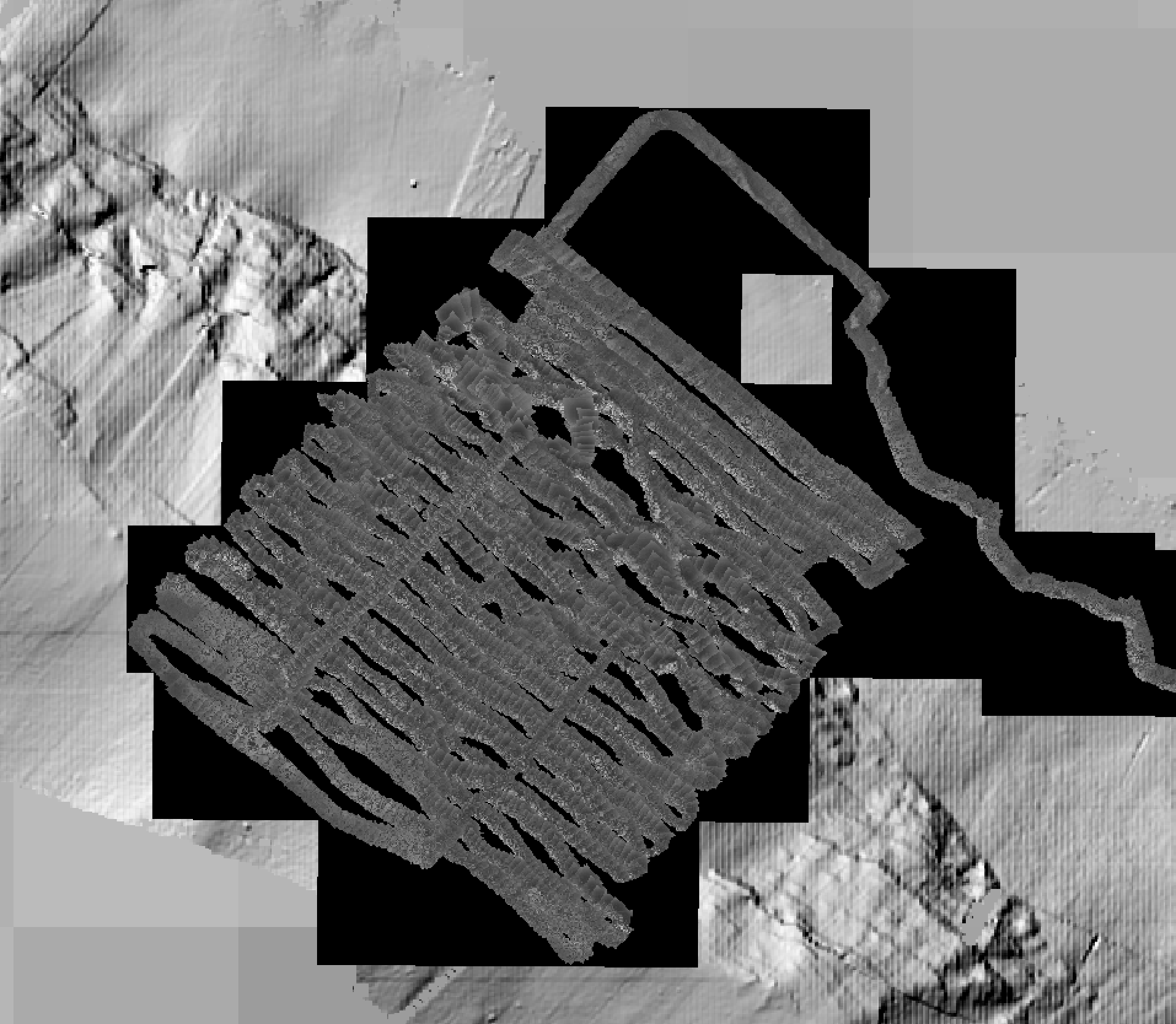
Multibeam bathymetry acquired by AUV Abyss (GEOMAR), during the ODEMAR Cruise off Les Saintes ilsnads (French Antilles). Data is processed and gridded at 2 m resolution.
-
Photomosaics acquired by ROV Victor during dives #653, #654, #655, and #658, along the Roseau Fault (French Antilles). The images, acquired with the ROV vertical camera, were positioned and scales using ROV navigation only (no feature matching, renavigation and reprojection). Images are corrected for uneven illumination. Photomosaics are presented in folders for each dive, and include a Geotiff (.tif) and a location file (.tfw). All photomosaics are in projection WGS84 UTM 20N.
-
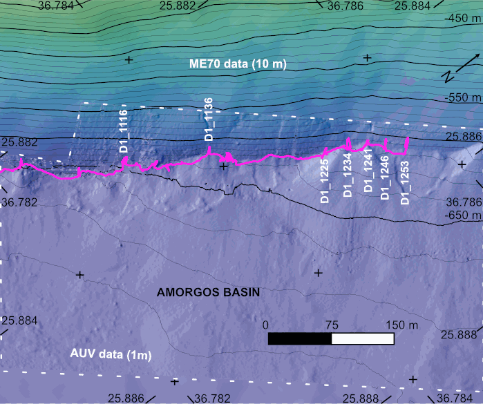
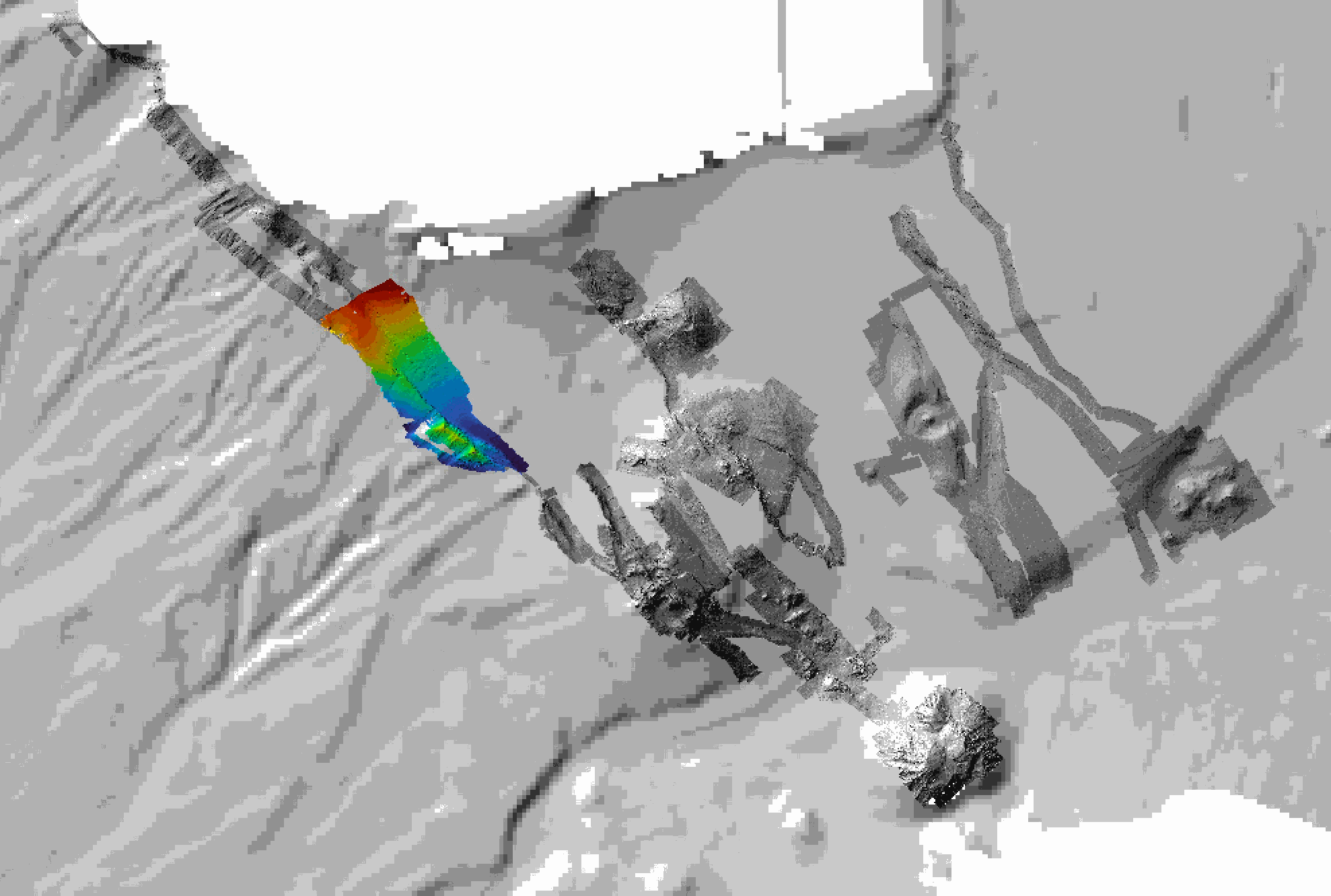
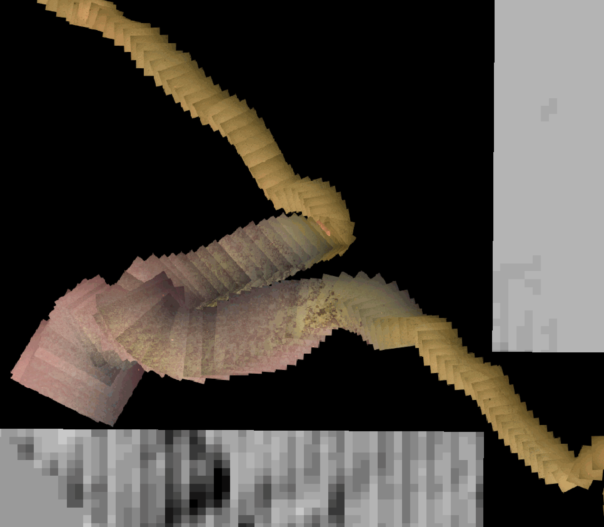
The AMORGOS-23 cruise (https://doi.org/10.17600/18003211) was conducted onboard R/V Europe from April 26th 2023 to May 9th 2023. Using HROV Ariane equipped with 4K cameras, we surveyed the main active faults between Amorgos and Anafi islands in order to identify and quantify recent deformation of the seafloor linked to the 1956 Amorgos earthquake. During dive 244-1, we surveyed the steepest scarp of the Amorgos fault, along its central segment. We provide here seven scaled Digital Outcrop Models (in .obj format) calculated from the HROV videos with MATISSE 3D software. There location (model origin) is also provided in a table, together with information about the portions of the videos used to produce the models. Due to incomplete navigation data, the models are not properly oriented.
-
Data of parameters presented as figures in the manuscript: Biogenic silica (BSi: µmol.L-1), Lithogenic silicon (LSi: µmol.L-1), Total Chlorophyll a (TChla: mg.m-3) and Fucoxanthin (Fuco: mg.m-3). Note that: - Total fraction for BSi and LSi is available from Niskin bottles (> 0.8 µm) and in situ pumps (> 0.45 µm); - Size-fractions for BSi and LSi is available from in situ pumps only (5-53 µm; > 53 µm); - Total fraction for TChla and Fuco is available from Niskin bottles (> 0.7 µm). - Integrated data (0-200 m) is available from Niskin Bottles. Acronym explanations: - Sampling type: ISP = In Situ Pump; ISP-SF = In Situ Pump with Size-Fraction; NSK = Niskin. - Method used for BSi and LSi computation: NOC = No Correction applied; RAG = Correction using the method used from the protocol established by Ragueneau et al. (2005); ACR = Average Crustal Ratio method used when one of the criterion from the protocol established by Ragueneau et al. (2005) is not respected. - bdl = Below Detection Limit For further explanations in the method, should you please refer to the Material and Methods section in the manuscript (revised version submitted in Marine Chemistry).
-
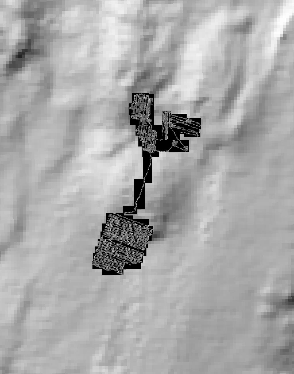
Black and white seafloor photomosaic of the Lucky Strike hydrothermal field and the ridge axis to the South, acquired with VICTOR6000 during the Bathyluck 2009. Individual still images were matched, corrected for uneven illumination, renavigated and blended for a seamless photomosaic. This data release includes partial geotiffs covering the whole surveyed area. To be cited: Gini et al. (submitted); Barreyre et al. (2012); Escartin et al. (2013); Escartín et al. (2015).
-
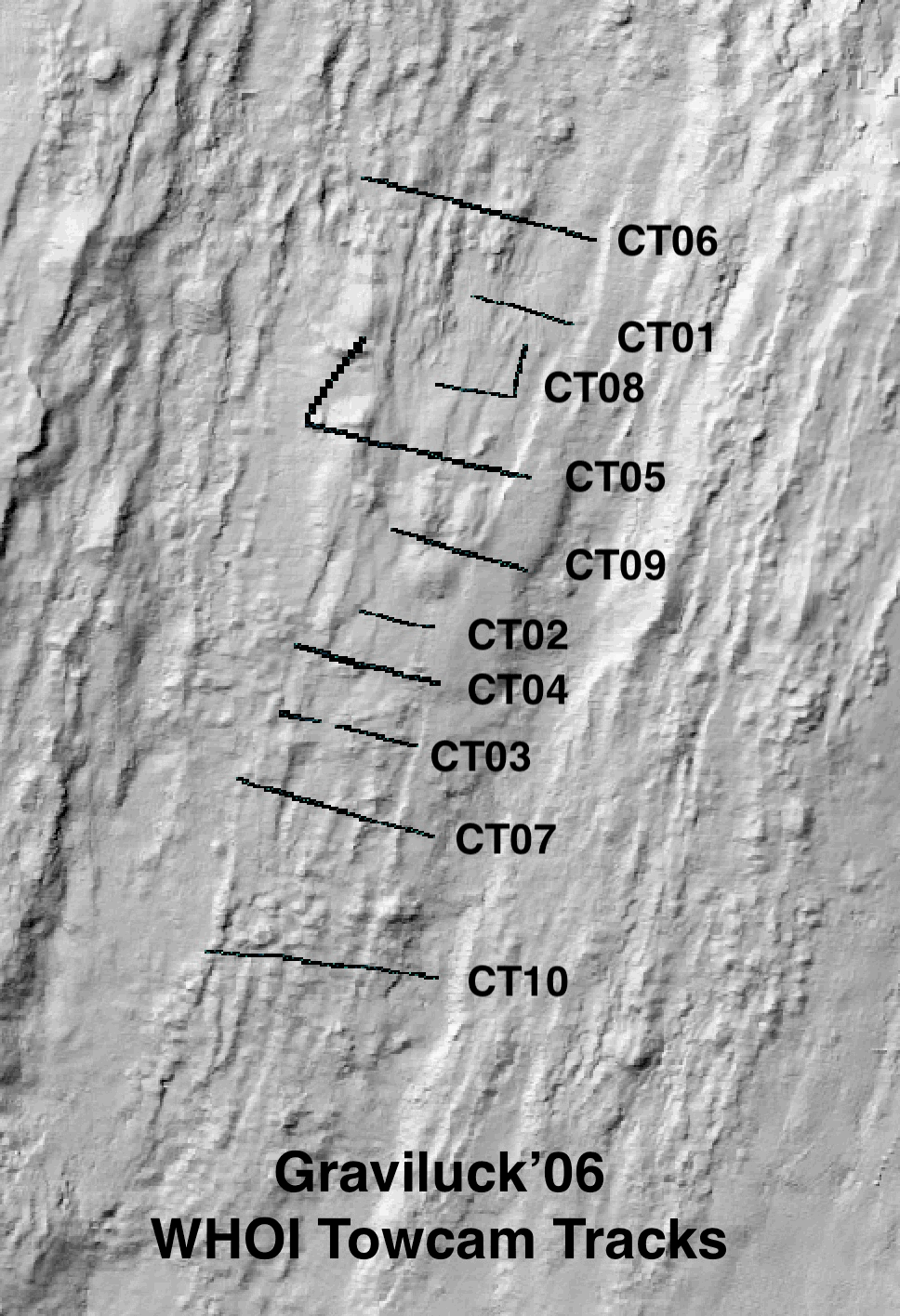
Colour seafloor photomosaics along towed camera tracks crossing the axis of the Lucky Strike ridge segment (Mid Altantic Ridge). Images were acquired with the WHOI TowCam system (https://www.whoi.edu/what-we-do/explore/underwater-vehicles/towed-vehicles/towcam/), during the Graviluck 2016 cruise. Images are process for colour and illumination correction. Images are placed and photomosaiced based on USBL navigation of the TowCam, altitude, and orientation. The datasets include geotiffs for each of the tracks. To be cited: cited: Gini et al. (submitted); Escartin et al. (2008; 2014).