 Metadata catalogue
Hauts-de-France
Type of resources
Available actions
Topics
INSPIRE themes
Keywords
Contact for the resource
Provided by
Years
Formats
Representation types
Update frequencies
status
Service types
Scale
Resolution
-
Ce service CSW permet la découverte des données géographiques et services web référencés par GéoPicardie, y compris les données et services moissonnés sur des catalogues externes. Ce service n'a pas été conçu pour être moissonné par d'autres catalogues. Nous vous remercions de ne pas le moissonner. Un autre service CSW (plus restreint) a été mis en place à cet effet.
-
Storymap présentant le Modèle Numérique de Terrain Unifié réalisé dans le cadre du PAPI Bresle Somme Authie
-

Cartographie dynamique représentant surface (MNT bathymétriques) et linéaire (isobathes) de la bathymétrie en Manche Mer du Nord
-
This dataset was created within the framework of the S3-EUROHAB project. It contains the vulnerability index of scallop fishing vessels exposed to the risk of harvest closures due to HABs toxins and the potential contamination in scallops, as well as the sensitivity, exposure and adaptive capacity indicators used to calculate the vulnerability composite index. These data cover the French coasts of the eastern English Channel and the period of the scallop fishing season between 2012-2013 and 2018-2019. The indicators are calculated per fishing fleet category which corresponds to a segmentation based on the intersection between vessel lenghth and fishing technique. The identification of indicators describing the vulnerability components (exposure, sensitivity and adaptive capacity) is based on characteristics of the (1) French scallop fishery in the eastern English Channel and (2) the HABs impacts in this area. The exposure indicator is represented by the ratio of the closure duration compared to the total authorised fishing duration for each season. The sensitivity of fishermen is characterised by the dependency of fishing vessels on scallop production and on fishing areas likely to be closed during scallop toxicity periods. Adaptive capacity is defined as the strategies of fishermen to avoid the impacts of closures. It is composed of two indicators: the capacity to change fishing areas and the capacity to change target species (scallops). All the variables in this dataset are described in the dictionary of the attribute table associated to this metadata descrition.
-

Classification des points SOL issus de la campagne topographique 2020 du ROL par LIDAR IR
-

Profil topographique PZ3 à Zuydcoote
-

Profil topographique PB5 à Bray-Dunes
-
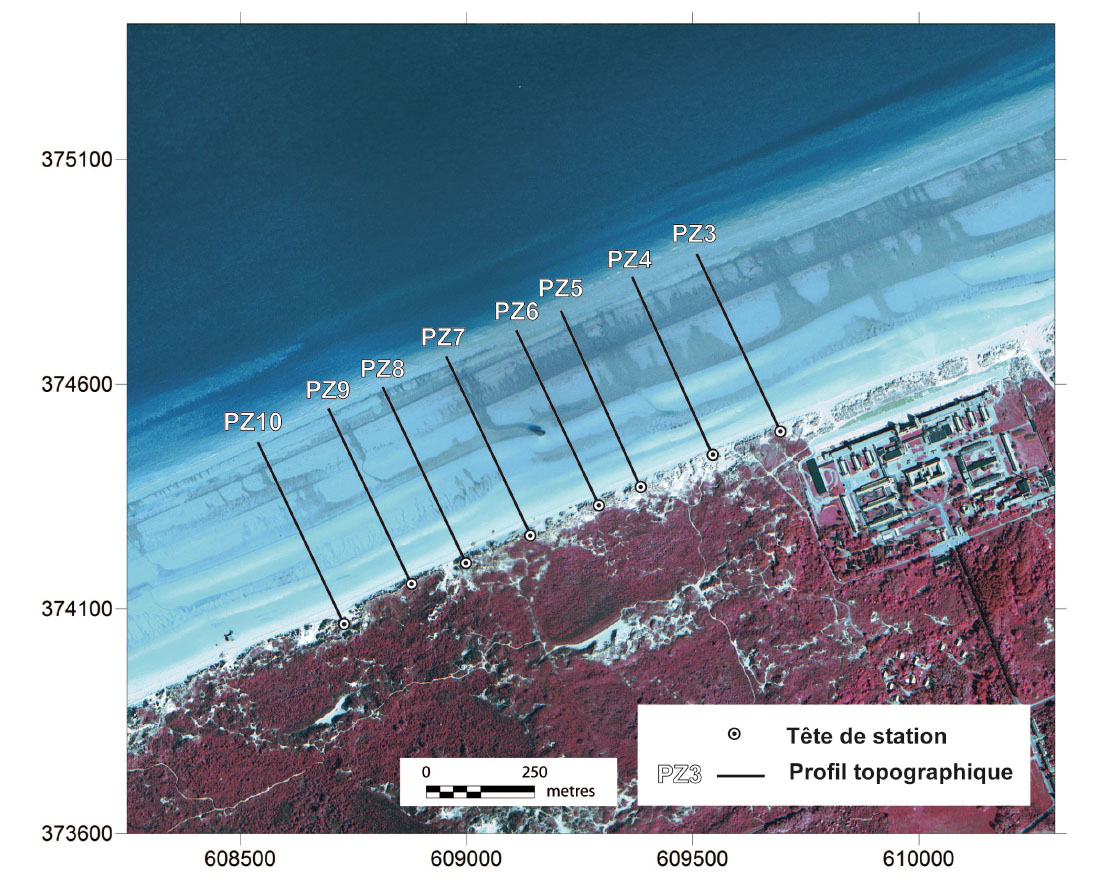
Profil topographique PZ10 à Zuydcoote
-

Isobathes de référence : 0, 3, 5, 7, 10m, de la Normandie et des Hauts-de-France
-

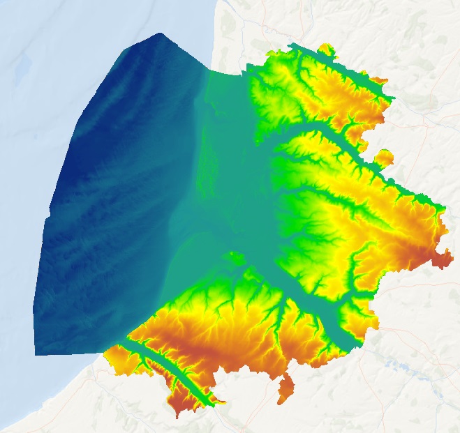
Ce modèle numérique de terrain est une représentation de la topographie selon un maillage défini à un pas de 1 m, par dalle de 1 km de côté, sur le littoral de la Normandie et des Hauts-de-France en 2020.