 Metadata catalogue
GEOSERVER
Type of resources
Available actions
INSPIRE themes
Keywords
Contact for the resource
Provided by
Years
Formats
status
Service types
-
A compliant implementation of WMS plus most of the SLD extension (dynamic styling). Can also generate PDF, SVG, KML, GeoRSS
-
Le service permet de consulter les données de la ZABRI représentées sur des cartes.
-

Le service permet de télécharger les données de diffusion du Conservatoire botanique National de Brest selon différents formats SIG.
-

INSPIRE View Service Service displaying the GeoCR500 dataset that has been created for the OneGeology-Europe project, updated for the EGDI project in 2016.
-
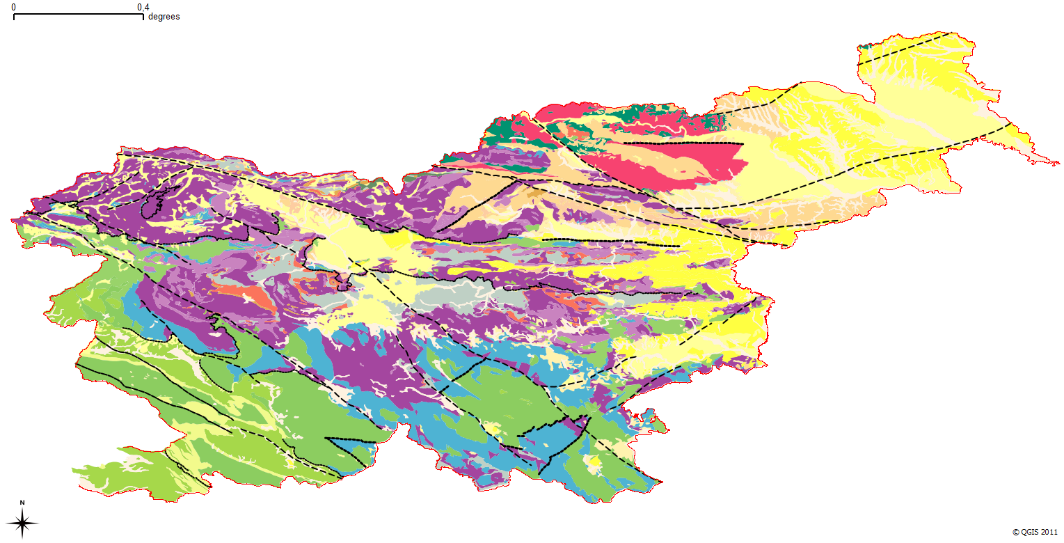
The harmonized geological map of Slovenia is a simplified version of the 1:250 000 scale Geological Map of Slovenia (Buser, 2009), which was compiled using the Basic Geological Map of Slovenia at a scale of 1: 100.000 (compiled by various authors during the 1960's to 1980's) with the addition of new information by Buser. It is primarily a lithostratigraphic map.The faults were selected for portrayal using two criteria; regional extent and tectonic importance. The map presented here was edited specifically for the purpose of the OneGeology-Europe project by M. Bavec, M. Novak, M. Poljak, M. Trajanova and D. Skaberne.
-
The harmonized geological map of Slovenia is a simplified version of the 1:250 000 scale Geological Map of Slovenia (Buser, 2009), which was compiled using the Basic Geological Map of Slovenia at a scale of 1: 100.000 (compiled by various authors during the 1960's to 1980's) with the addition of new information by Buser. It is primarily a lithostratigraphic map.The faults were selected for portrayal using two criteria; regional extent and tectonic importance. The map presented here was edited specifically for the purpose of the OneGeology-Europe project by M. Bavec, M. Novak, M. Poljak, M. Trajanova and D. Skaberne.