 Metadata catalogue
Ethiopia
Type of resources
Available actions
Topics
Keywords
Contact for the resource
Provided by
Years
Formats
Representation types
Update frequencies
status
Scale
Resolution
-

SRID 900913 of two available coordinate systems. These data are results from the KAMM/WASP studies. Version 2 is an updated version of the earlier release and includes an adjustment to Weibull A and k to bring the Atlas values into better agreement with observations. The KAMM/WAsP methodology uses a set of wind classes to represent wind conditions for the mapped region. A mesoscale simulation for each wind class, using KAMM (Karlsruhe Mesoscale Model), is performed and statistics performed on the model output. The result is i. a wind resource map, a summary of the simulated wind climate, and ii. a wind atlas, a summary of the wind climate standardized to flat, uniform roughness terrain. (Purpose): The product is intended to be used to estimate the wind resource potential in the country including the the spatial variability. This map covers regions where long term measurements are not available. In a sense this is the point of the mapping exercise, but it also means that verification of results has not been as complete would be ideal. There is some concern that the results may underestimate the resource. However, new measurement data is coming and revisions to the map may be made if necessary as verification is carried out.
-

One mosaic of 11 map sheets: 1. V : Soils map : Lower valley : Burkur : map N° 1 = Carte des sols : Basse vallée : carte N° 1. Scale of 1:50 000. Date of publication: 1973. 2. V : Soils map : Lower valley : Gode : map N° 6 = Carte des sols : Basse vallée : carte N° 6. Scale of 1:50 000. Date of publication: 1973. 3. V : Soils map : Lower valley : Gode East : map N° 5 = Carte des sols : Basse vallée : carte N° 5. Scale of 1:50 000. Date of publication: 1973. 4. V : Soils map : Lower valley : Gode West : map N° 7 = Carte des sols : Basse vallée : carte N° 7. Scale of 1:50 000. Date of publication: 1973. 5. V : Soils map : Lower valley : Imi : map N° 10 = Carte des sols : Basse vallée : carte N° 10. Scale of 1:50 000. Date of publication: 1973. 6. V : Soils map : Lower valley : Imi East : map N° 9 = Carte des sols : Basse vallée : carte N° 9. Scale of 1:50 000. Date of publication: 1973. 7. V : Soils map : Lower valley : Imi West : map N° 11 = Carte des sols : Basse vallée : carte N° 11. Scale of 1:50 000. Date of publication: 1973. 8. V : Soils map : Lower valley : Kelafo : map N° 4 = Carte des sols : Basse vallée : carte N° 4. Scale of 1:50 000. Date of publication: 1973. 9. V : Soils map : Lower valley : Madiso : map N° 8 = Carte des sols : Basse vallée : carte N° 8. Scale of 1:50 000. Date of publication: 1973. 10. V : Soils map : Lower valley : Mustahil : map N° 2 = Carte des sols : Basse vallée : carte N° 2. Scale of 1:50 000. Date of publication: 1973. 11. V : Soils map : Lower valley : Mustahil West : map N° 3 = Carte des sols : Basse vallée : carte N° 3. Scale of 1:50 000. Date of publication: 1973.
-

The map sheet: 1. V : Soils map = Carte des sols : Wabi Shebelle Basin. Scale of 1:1 000 000. Date of publication: 1973.
-

The map sheet: 1. IV - Geological map of Wabi Shebelle basin. Scale of 1:1 000 000. Date of publication: 1973.
-
Geological map of Ogaden. One mosaic of 7 map sheets. Scale of 1:250 000. Date of publication: 1974.

One mosaic of 7 map sheets: 1. IV - Geological map of Ogaden : Degahbour. Scale of 1:250 000. Date of publication: 1974. 2. IV - Geological map of Ogaden : Duhun. Scale of 1:250 000. Date of publication: 1974. 3. IV - Geological map of Ogaden : Gode. Scale of 1:250 000. Date of publication: 1974. 4. IV - Geological map of Ogaden : Godere. Scale of 1:250 000. Date of publication: 1974. 5. IV - Geological map of Ogaden : Imi. Scale of 1:250 000. Date of publication: 1974. 6. IV - Geological map of Ogaden : Kebri-Dahar. Scale of 1:250 000. Date of publication: 1974. 7. IV - Geological map of Ogaden : Mustahil. Scale of 1:250 000. Date of publication: 1974.
-
This database contains botanical records either relating to material present in one of the Naturalis collections, or to material that has been or is being used in research projects. The records usually relate to herbarium specimens, but it also contains data on silica-gel samples, wood samples, spirit collections, carpological collections, etc.; rarely to observations only. The Naturalis collections have their strong points in The Netherlands and surrounding countries, Southeast Asia and New Guinea, West- and Central-Africa, Ethiopia and the Guyanas.
-

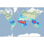
The map sheet: 1. Répartition géographique de Dipetalonema streptocerca et répartition africaine de Dipetalonema perstans. Scale of 1:10 000 000. Date of publication: 1958.
-

The map sheet: 1. Carte des sols d'Afrique. unknown. Date of publication: unknown.