 Metadata catalogue
EMODnet HRSM
Type of resources
Available actions
Topics
INSPIRE themes
Keywords
Contact for the resource
Provided by
Years
Formats
Representation types
Scale
Resolution
-
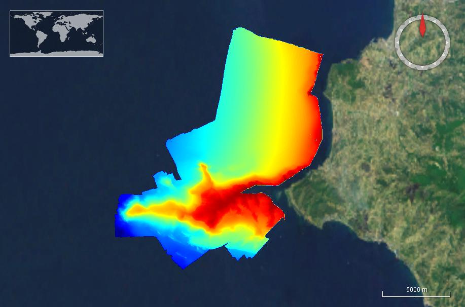
This dataset was collected during a survey within GEOSED Project by means of the MBES system Reson SeaBat8111 in the area named Punta Licosa in the Tyrrhenian Sea, Central Mediterranean. The dataset was acquired on the continental shelf in the depth range 10-150 meters.The Multibeam has 101 beams 1°x1° and an operational frequency of 100 kHz. A LandStar 12 channel DGPS system was used for ship positioning and a motion sensor TSS-DMS02-05 was used to provide corrections for attitude data. A Sound Velocity Sensor was installed near the transducers thus providing realtime sound speed for beam steering. A sound velocity profiler Reson SVP20 was lowered through the water column every 6–8 h to get the velocity profile required for the depth computation. The bathymetric data were processed using the PDS2000 software. Data de-spiking was carried out without the application of automatic filters in order to preserve data accuracy and resolution
-

Source data for the EMODNet DTM for the Belgium Coastal Waters is compiled by the Vlaamse Hydrografie (http://www.afdelingkust.be/en/bathymetric-database) at a resolution of 1/512 arc minute. The data set covers the waters along the Belgian coast.
-
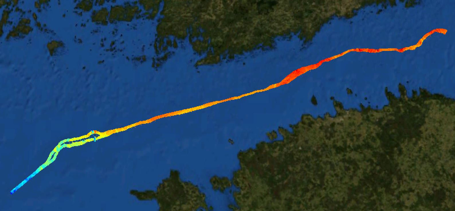
The Nord Stream 2 dataset covers a narrow zone of the pipeline. The pupose is reconnaissance surveys.
-
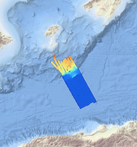
This composite Digital Terrain Model (cDTM) is a high resolution bathymetry dataset that covers SALTFLU cruise. Multibeam data acquired in 2012 on board the R/V OGS Explora with a Reason 8150 echo-sounder
-
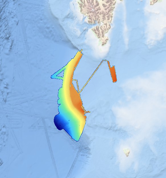
Multibeam data acquired in 2007 during the SVAIS cruise on board the R/VHespérides with a Simrad EM12 echo-sounder
-
Systematic survey performed by Italian Navy Hydrographic vessels with Multibeam EchoSounder
-
Joint composite of SI Survey Bathymetry dataset (composite of 3 surveying years within 2007-2009).
-
Systematic survey performed by Italian Navy Hydrpgraphic vessels with Multibeam EchoSounder
-
Maas West Outer Vlissingen, South part. There are sand waves. Surveyed by one of the Hydrographic Survey Vessels of the Royal Netherlands Navy.
-

The composite Digital Terrain Model of the Central Bulgarian Black Sea Slope is a result of processing and compilation of multibeam echosounder data gathered under several projects: the Caucasus on-line cable route survey (2007); The South Stream pipeline route survey (2009-2012); CBC Programme “MARINEGEOHAZARD” (2012). The DTM at a source resolution of approximately 55 meters was compiled for inclusion into the EMODnet HRSM dataset. The area embraces 2675 square kilometers from the shelf break to the abyssal plain in the center of the Bulgarian EEZ of the Black Sea.