 Metadata catalogue
EMODNet Bathymetry
Type of resources
Available actions
Topics
INSPIRE themes
Keywords
Contact for the resource
Provided by
Years
Formats
Representation types
Scale
Resolution
-

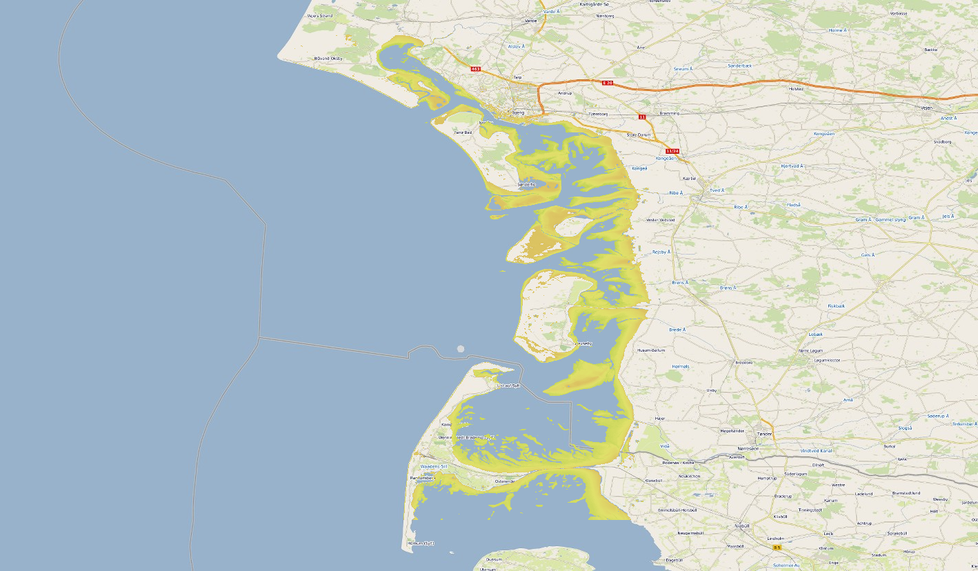
Satellite-derived intertidal bathymetry for the Danish Wadden on the West coast of Denmark
-

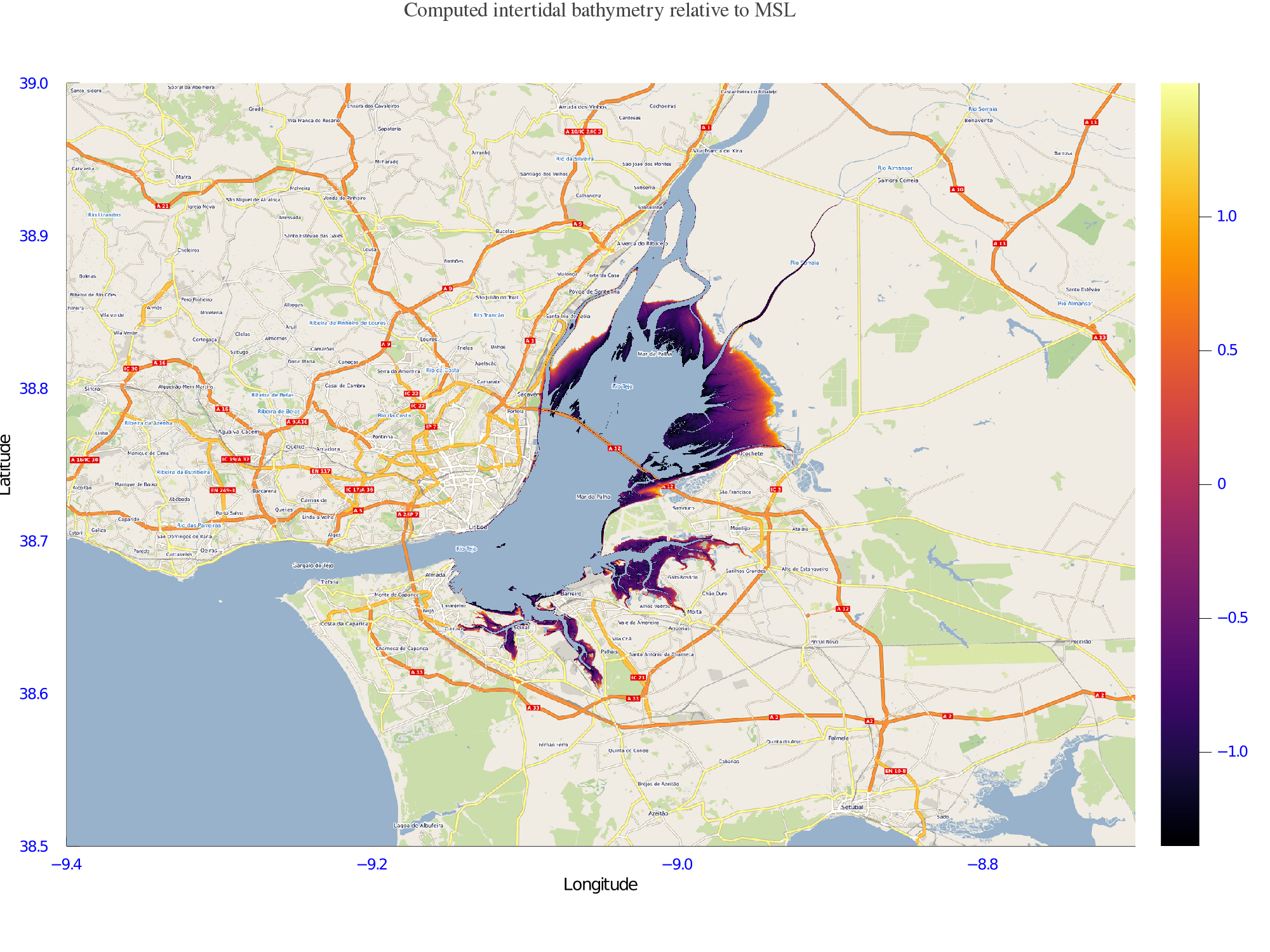
Satellite-derived intertidal bathymetry for the Tagus estuary near Lisbon Portugal
-
Satellite-derived intertidal bathymetry for the Danish Wadden on the West coast of Denmark
-
Satellite-derived intertidal bathymetry for the Tagus estuary near Lisbon Portugal
-

Gridded multibeam data acquired during scientific surveys and transits of French research vessels from 1992 to 2017 off the French Caribbean Islands.
-
This composite Digital Terrain Model (cDTM) is a high resolution bathymetry dataset highlighting measurement of depth of water in the ocean. This cDTM covers the Celtic Sea Basin off the coast of Co. Cork in Ireland. The EMODnet high resolution DTM covers bathymetry surveys completed between during 2022. Bathymetric data collected on board research vessels using multi-beam and single-beam echosounder instrumentation. Raw bathymetry processed within CARIS software to produce bathymetry products subsequently converted to NetCDF cDTM for EMODnet. Acquisition, processing and product delivery follows IHO standard s44 Edition 5. cDTM is composed of three (3) images “merged simply” using GLOBE software. INFOMAR (Integrated Mapping for the Sustainable Development of Ireland's Marine Resource) is a twenty year program to map the physical, chemical and biological features of Ireland's seabed established in 2006. INFOMAR is funded by the Department of Communications, Climate Action and Environment (DCCAE), and delivered by joint management partners Geological Survey Ireland and the Marine Institute. The program is the successor to the Irish National Seabed Survey (INSS) which ran between 1999 and 2005. INFOMAR concentrates on creating integrated mapping products related to the seabed.
-
This composite Digital Terrain Model (cDTM) is a high resolution bathymetry dataset highlighting measurement of depth of water in the ocean. This cDTM covers Galway Bay and Aran Islands off the coast of Co. Galway in Ireland. The EMODnet high resolution DTM covers bathymetry surveys completed between during 2022. Bathymetric data collected on board research vessels using multi-beam and single-beam echosounder instrumentation. Raw bathymetry processed within CARIS software to produce bathymetry products subsequently converted to NetCDF cDTM for EMODnet. Acquisition, processing and product delivery follows IHO standard s44 Edition 5. cDTM is composed of two (2) images “merged simply” using GLOBE software. INFOMAR (Integrated Mapping for the Sustainable Development of Ireland's Marine Resource) is a twenty year program to map the physical, chemical and biological features of Ireland's seabed established in 2006. INFOMAR is funded by the Department of Communications, Climate Action and Environment (DCCAE), and delivered by joint management partners Geological Survey Ireland and the Marine Institute. The program is the successor to the Irish National Seabed Survey (INSS) which ran between 1999 and 2005. INFOMAR concentrates on creating integrated mapping products related to the seabed.
-
9496-25-DTM - Site Survey of Dogger Bank Tranche C Offshore Wind Farm Area by Gardline Geosurvey Ltd
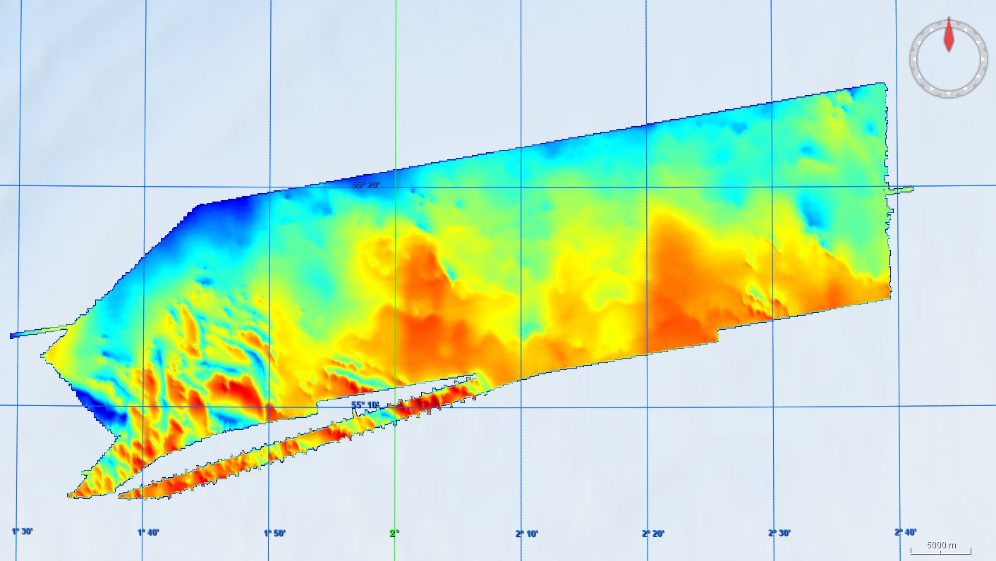
Gardline Geosurvey Limited was contracted to survey the Dogger Bank Offshore Wind Farm (OWF) Area between 04-Apr-2013 and 02-Aug-2013, comprising the Tranche C zonal surveys. The aim of the surveys was to carry out a geophysical investigation that would broadly assess the entire developable area of the zone. Seabed information was required to inform the site selection process and enable preliminary foundation design to be undertaken. The geological data acquisition programme was carried out on M.V. Sea Surveyor, which sailed from Hull and returned to Blyth, and M.V. Vigilant which sailed from, and returned to, Great Yarmouth upon completion of survey operations. The Crown Estate is the data owner and copyright holder.
-
GEMS Survey Ltd. (GEMS) were contracted by Forewind Limited to undertake a bathymetric and geophysical survey of the Tranche A development area and two met mast locations (which were later revised) within the Dogger Bank Zone, in addition to a cable reconnaissance from Tranche A to the Yorkshire coastline. The primary objectives of the survey were to produce sufficiently high resolution bathymetric and geophysical data and interpretations to allow regional interpretation for planning and modelling purposes; for met mast design to commence and to provide high quality data to inform further benthic and environmental surveys. This survey was carried out between 8 July 2010 and 26 December 2010. The vertical datum for this project is LAT using predicted tides. This metadata relates to the bathymetric datasets. The surveys were undertaken onboard the MV Aquarius and MV Kommandor Jack.
-
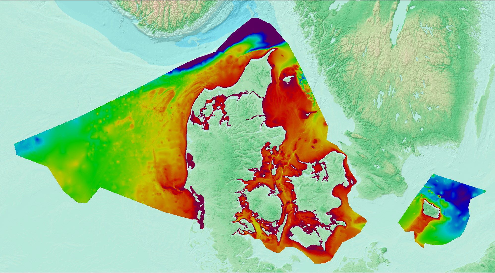
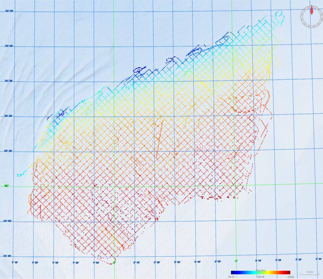
Denmark’s Depth Model (DDM) is a depth-averaged digital bathymetric model, covering Denmark’s Exclusive Economic Zone (EEZ). The model has a grid resolution of 50 meters and is based on a collection of hydrographic survey datasets and other sources.